
Santiago to Polvaredas (over Paso Cristo Redentor/Los Libertadores)
 Share:


After leaving Santiago, my plan was to finally start with the "real" Andean passes. The first one on my list is Paso Cristo Redentor (sometimes called Los Libertadores) which is a main connection between Santiago and Mendoza. This means a lot of traffic. Fortunately, all the traffic disappears to the tunnel at about 3200m and the last 600 elevation meters are thus traffic free on the Chilean side. Argentinian side has a bit of a touristy traffic as the top of the pass -- with the elevation of about 3830 metes -- is featuring a big monument of Christ.
March 22
Before I can climb the pass, I first need to get out of Santiago. This is (unsurprisingly) a complicated thing to do without encountering lots of traffic. Because of my starting location within Santiago -- Los Condes -- I am opting for a road to Colina over a small pass. This turns out to be a decent selection. While the traffic in the town is pretty busy, as soon as I get out of the city the traffic dies.
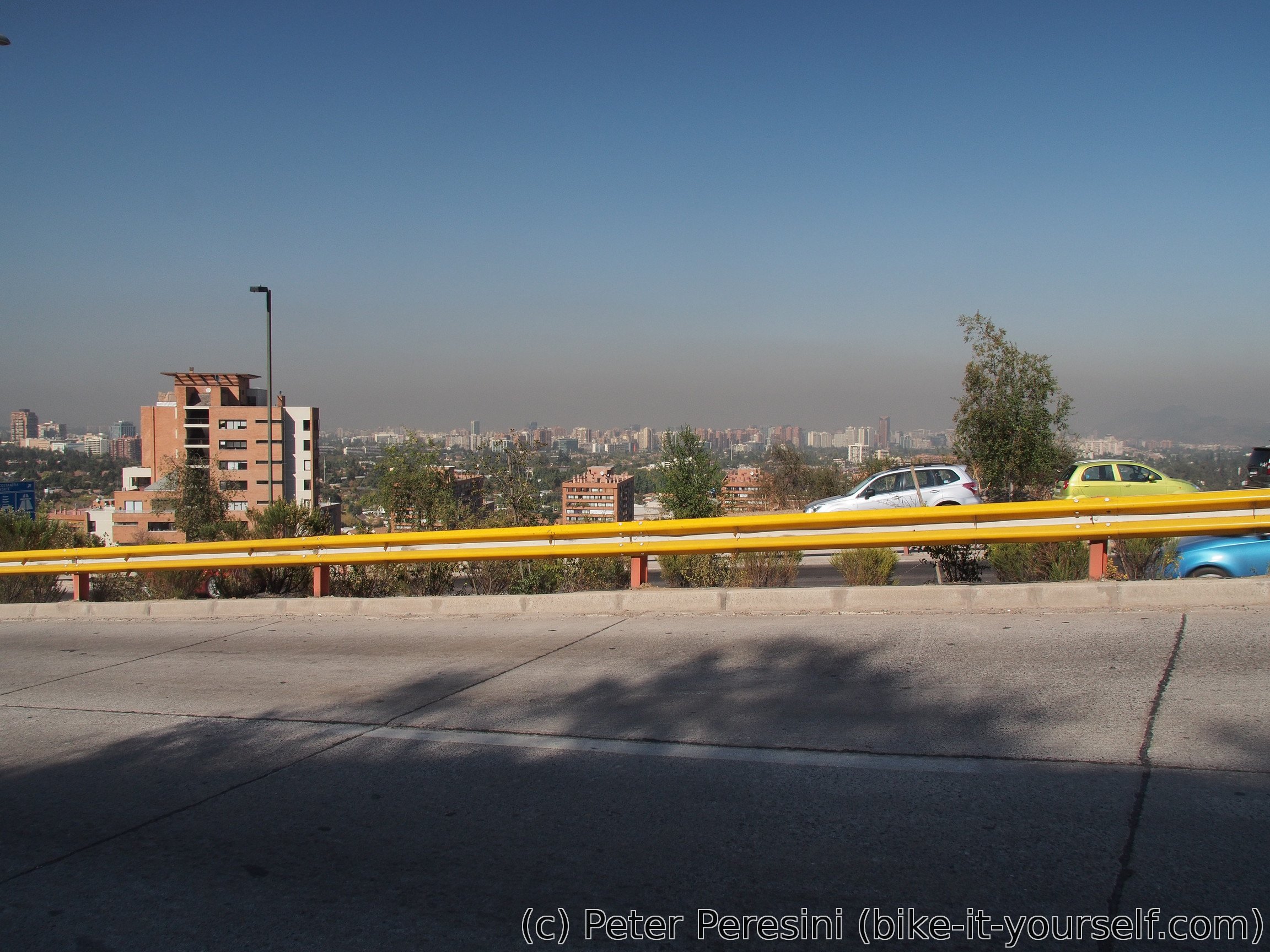
In Colina I am learning that the road I wanted to take further is another autopista and I cannot really cheat my way around it because there seems to be no parallel roads (not even ripio). As such, I need to take a detour to the west and then again back to the east.
Because I was rather good at buying new stuff in Santiago (both kit and food), the bike feels unusually heavy. I guess I just need to get accustomed to the new load.
In Colina, the scenery changes from the big agglomeration into a heavily populated kind-of-a-farmland. I have a lunch there and I am ready to go to my next destination, a village called Lampa. From there I continue to the north.
At my evening shopping stop, I am making a grave mistake -- I forget my water bottle before the kiosco and I realize it too late. Fortunately, I am securing a replacement bottle relatively quickly. And as a bonus, I have 100ml of additional capacity as the bottle isn't usual 1.5L but for some reason 1.6L.
But the surprise of the evening is just going to happen. Just as I am finding a camping spot, I notice that there is something funny about my back tire. Sure enough, I have a flat. A quick inspection reveals a thorn sticking out of the tire. After 5000 kilometers of puncture-free ride on Schwalbe the Maxxis tire did not do the best job at self-marketing when it failed on the first day I ride it. (OK, technically this is a third day because I did some riding in Santiago). The rest of the evening is spent by fixing the flat, cooking the dinner and making it inside the tent just in time for the night to creep on me.
March 23
Of course, my wild camping place selection was rather terrible. The road was quite busy overnight with trucks and so it wasn't the best sleep ever. In a rather grumpy mood the clear morning sky invites me to another day of hot cycling. I need to climb from around 700 to 1300 just so that I can descent it later down to Los Andes. But first I am stopping by a guard of some industrial complex and getting water. While there are lots of "streams" around, these are all a part of big watering system for all the orchard and anything green around. As such, the water is rather muddy and I could bet it contains elevated doses of fertilizers.
Then the pass starts. Fortunately it is totally quiet because all the traffic goes through a tunnel on an autopista. The climb is decently steep (around 5-6%) but even this makes me sweat a lot in the hot sun. My climb is interrupted by a dog. It doesn't look exactly great and decides to stalk me with a rather short distance. As I have a fresh memory of a dog trying to bite me I am just standing with a bike and hoping that the dog will lose interest in me. Fortunately, I am saved by a truck driver who figures out that the shabby looking dog is hungry and gives it cheese. I am using this opportunity to quickly put as much distance from the dog as possible and it works, nobody is following me this time.
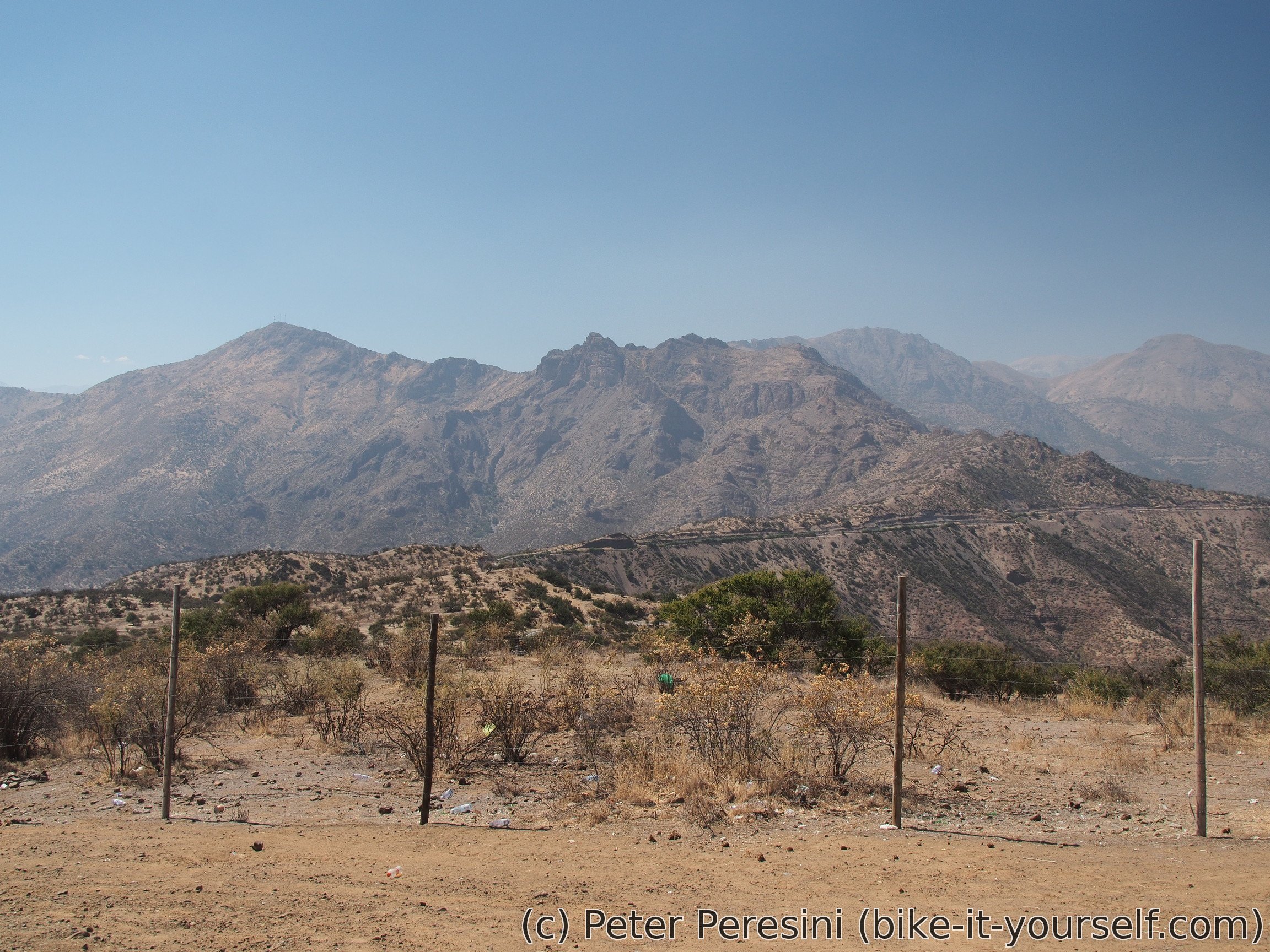
The views around can be described only as dry. There is no green grass, only lots of golden colors. Which is why I am surprised to see some green trees and bushes. All in all, in the whole 600 meters of a climb I did not see any source of water. That is, except a human-made waterway which leads water from god-only-knows where to a water dam not-so-nearby.
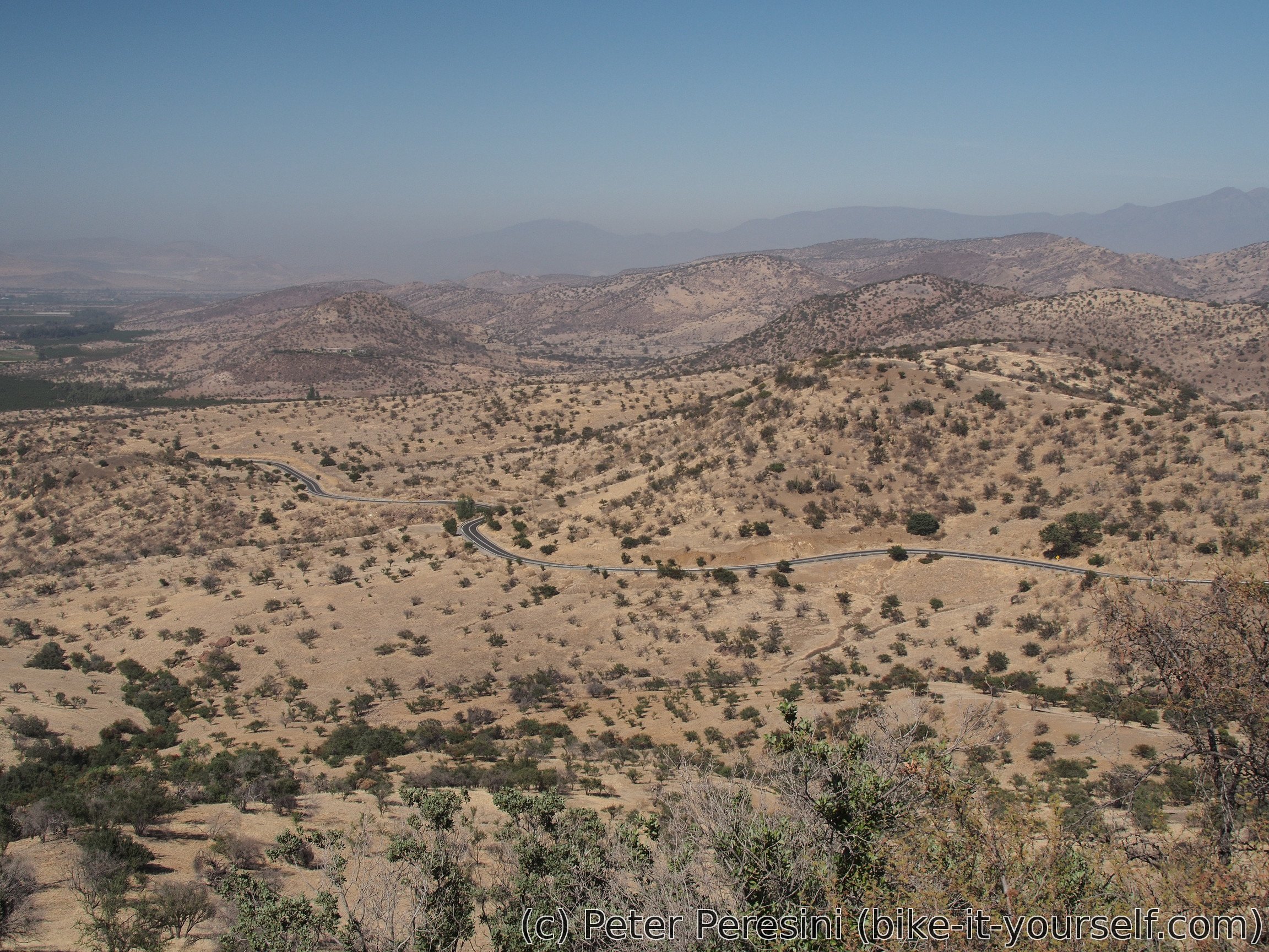
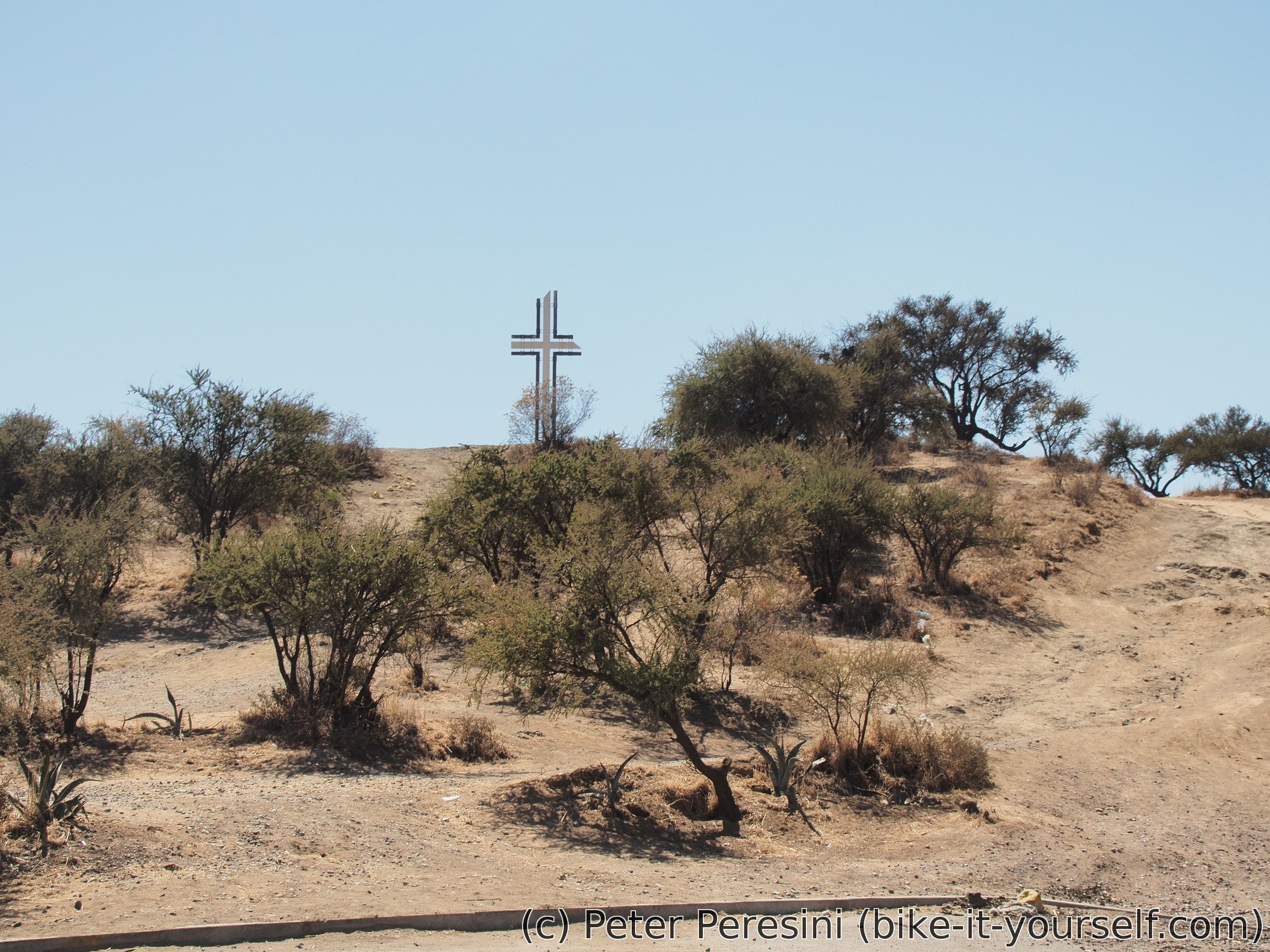
The top of the pass welcomes me with a big cross. I do a quick hike to a viewpoint but the distant views are too hazy. Afterwards I enjoy a rather quick descent. I need to join the autopista for a while as there is no alternative but kilometers are quickly passing by and soon I get down of it.
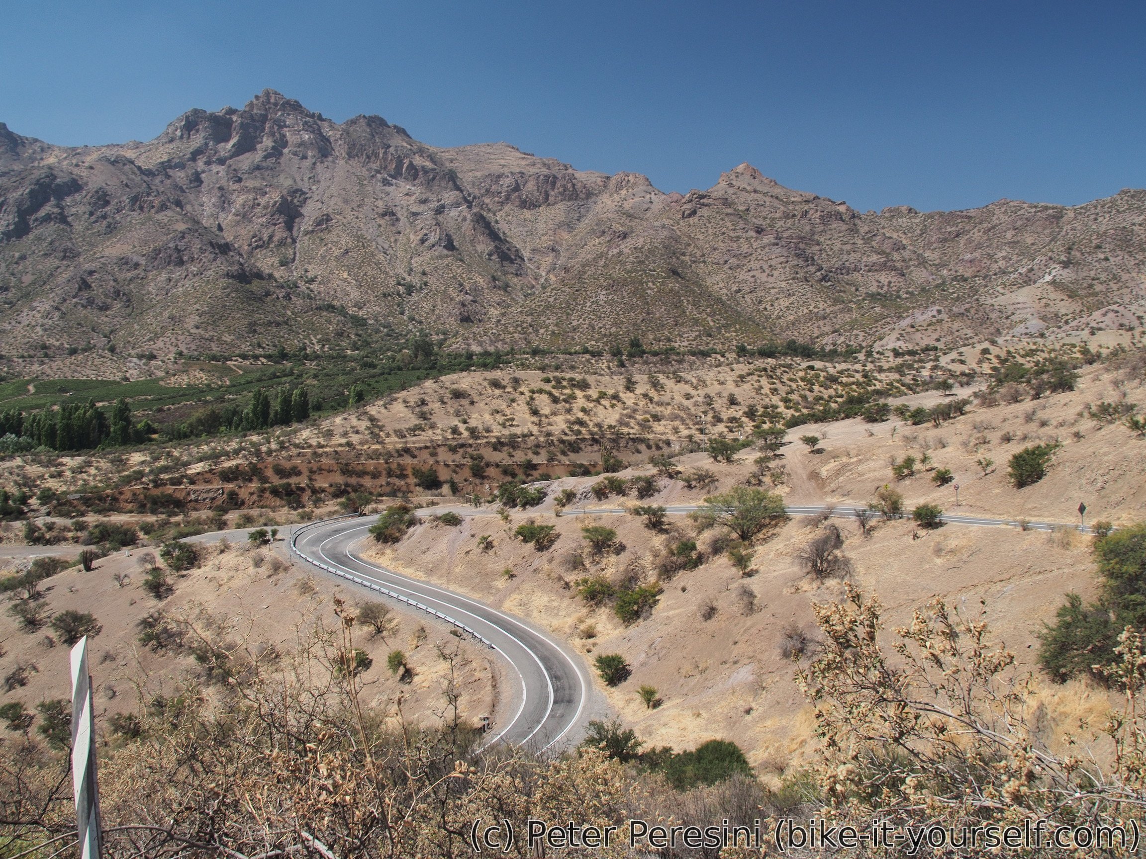
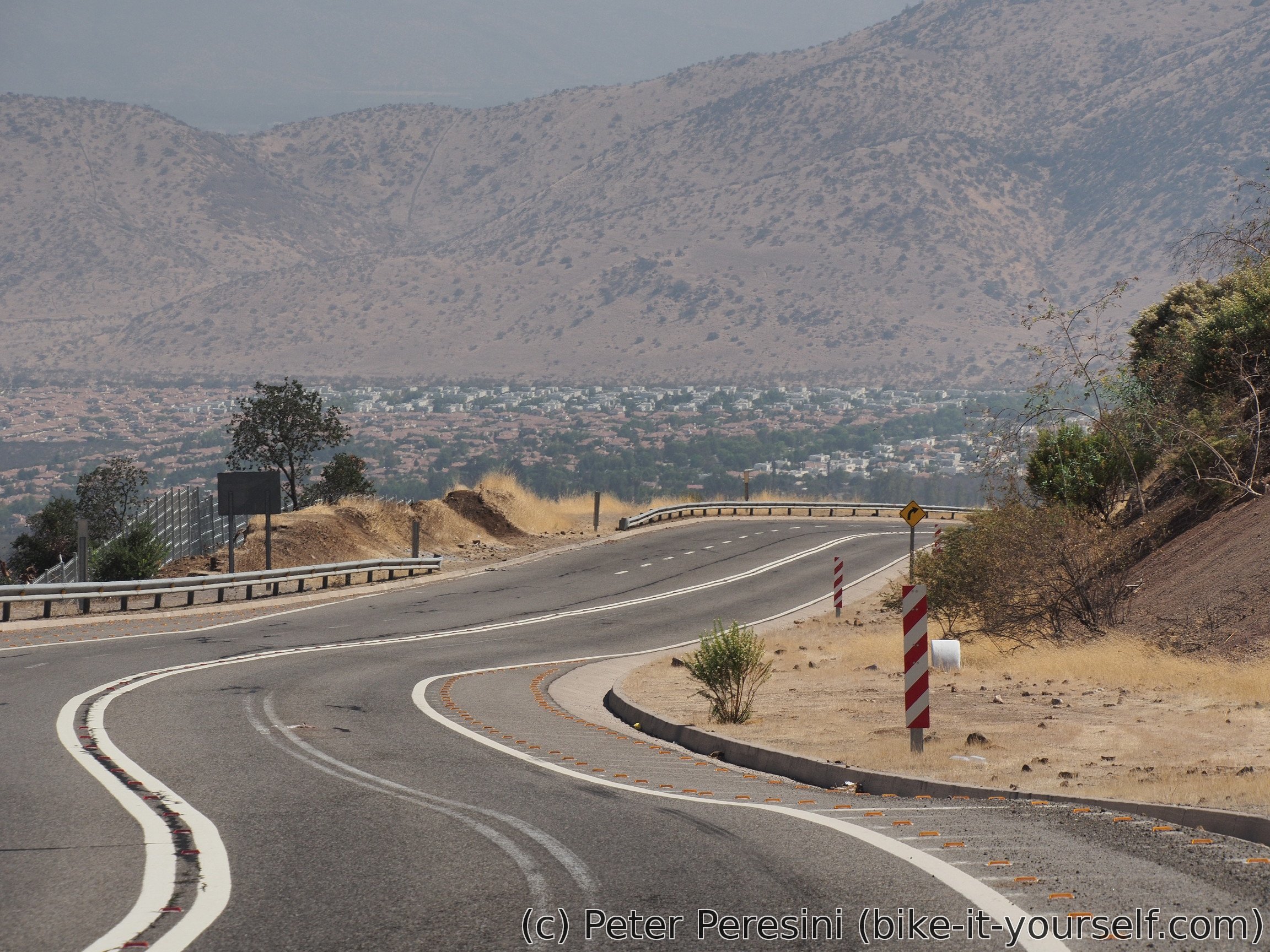
By now the heat is just like a furnace. I am again resupplying with water, passing through Los Andes and hooray to the pass. The road is quite busy with cars and trucks but fortunately there is wide shoulder. To my surprise, the valley I am going through is basically homogeniously habitated. But then, I am still only at about 1000 meters above the sea.
To my surprise, I am coming across a cyclist going down from the pass. This is a first bike tourer after a rather long period without meeting anybody. So we talk for a while. The cyclist is a guy from Brazil, 4 months on the road but his plan is 3-4 years trip around the world.
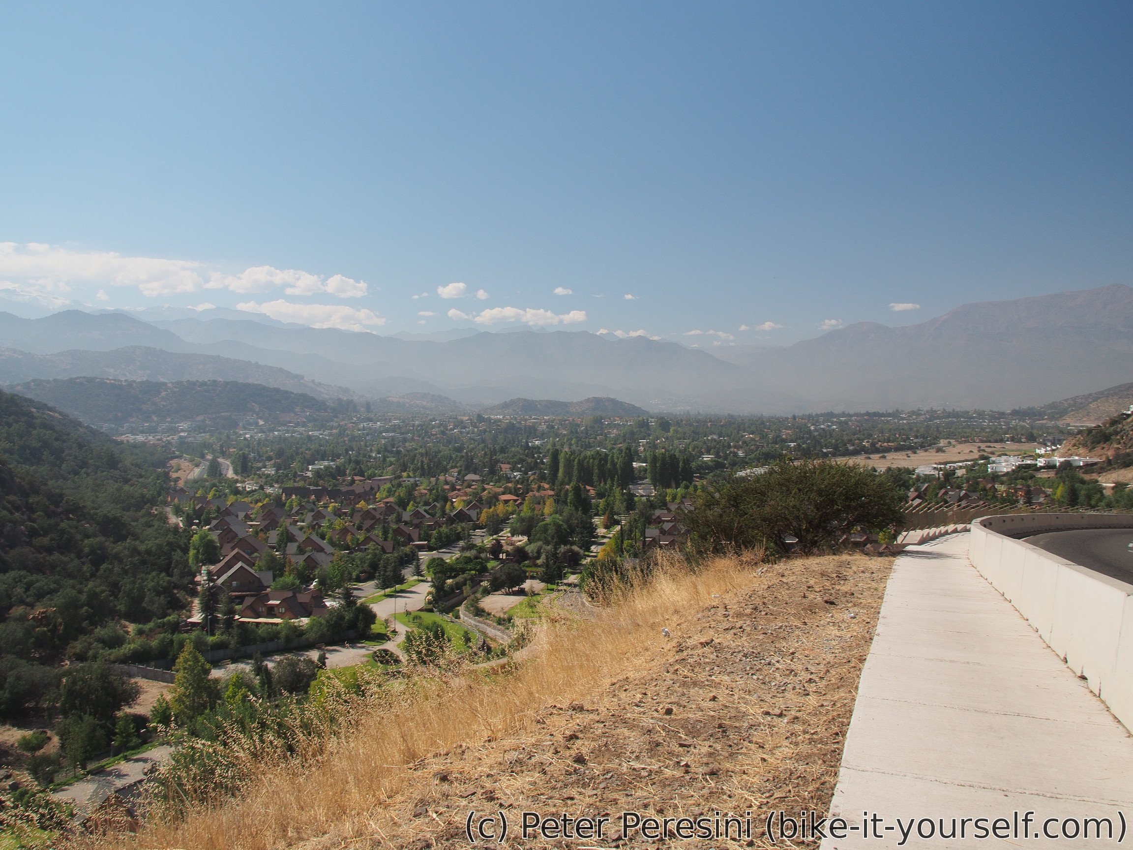
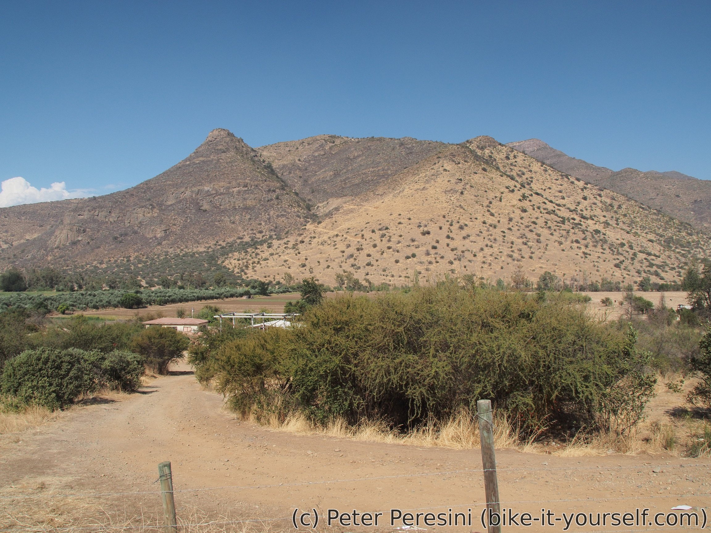
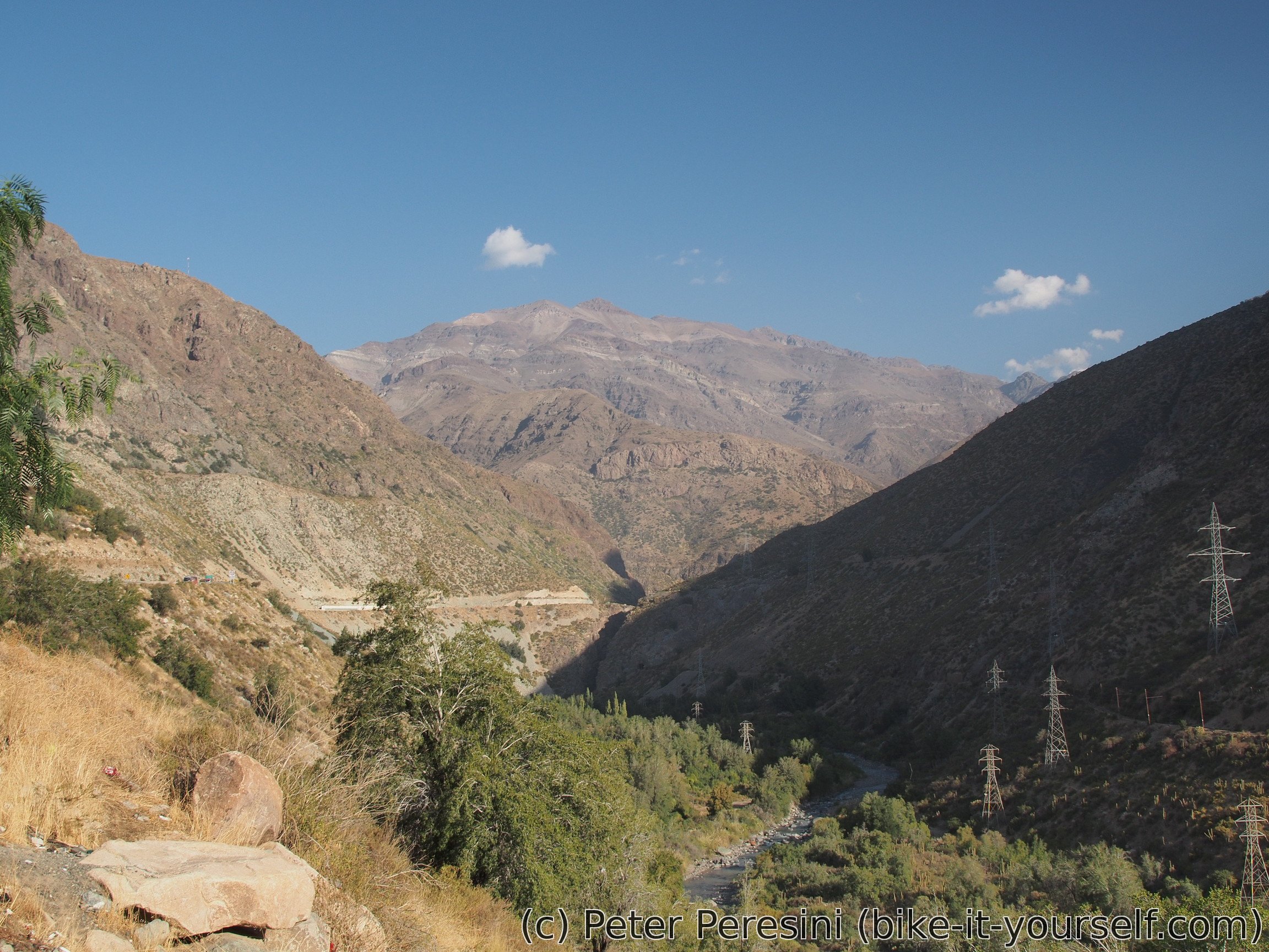
As the evening closes on me the views are getting better. I am going in a narrow valley with steep sides and in the distance I can already see some nice mountains. Of course, this implies a rather problematic campsite finding -- I am not really inclined to camp anywhere near the road because the pass is open 24 hours and the trucks make loud noises (especially the ones going down and making a machine-gun firing sound when using their engines to break).

But I am quite fortunate in finding a decently quiet place. In one sharp turn I can see a track going uphill. A quick inspection reveals a nice and quiet (decently shielded from the road noises) flat camping place around a water viaduct. The only problem is getting there. I spend next 30 minutes moving all my bags and bike to the place because I am going three times there -- the road is super-steep and it is impossible to push even a half-loaded bike up.
The last surprise of the day concerns my dinner. With a dismay I am finding out that I have no soup. I am wondering what happened and the best explanation is that I mistakenly thrown them away with my trash.
March 24
The night was surprisingly warm. As I am cooking breakfast I can see the first rays of the Sun on the hills at the opposite side of the valley. The plan for today is hard. I need to get to 2800-3000 meters of elevation so that tomorrow I will be able to finish the pass and get down from it.

As a part of my unusual morning routine I am letting gas out of my gas cylinder. It was almost empty and I need to trash it (and obviously trashing a canister containing even a bit of propane-butane isn't exactly a great idea).
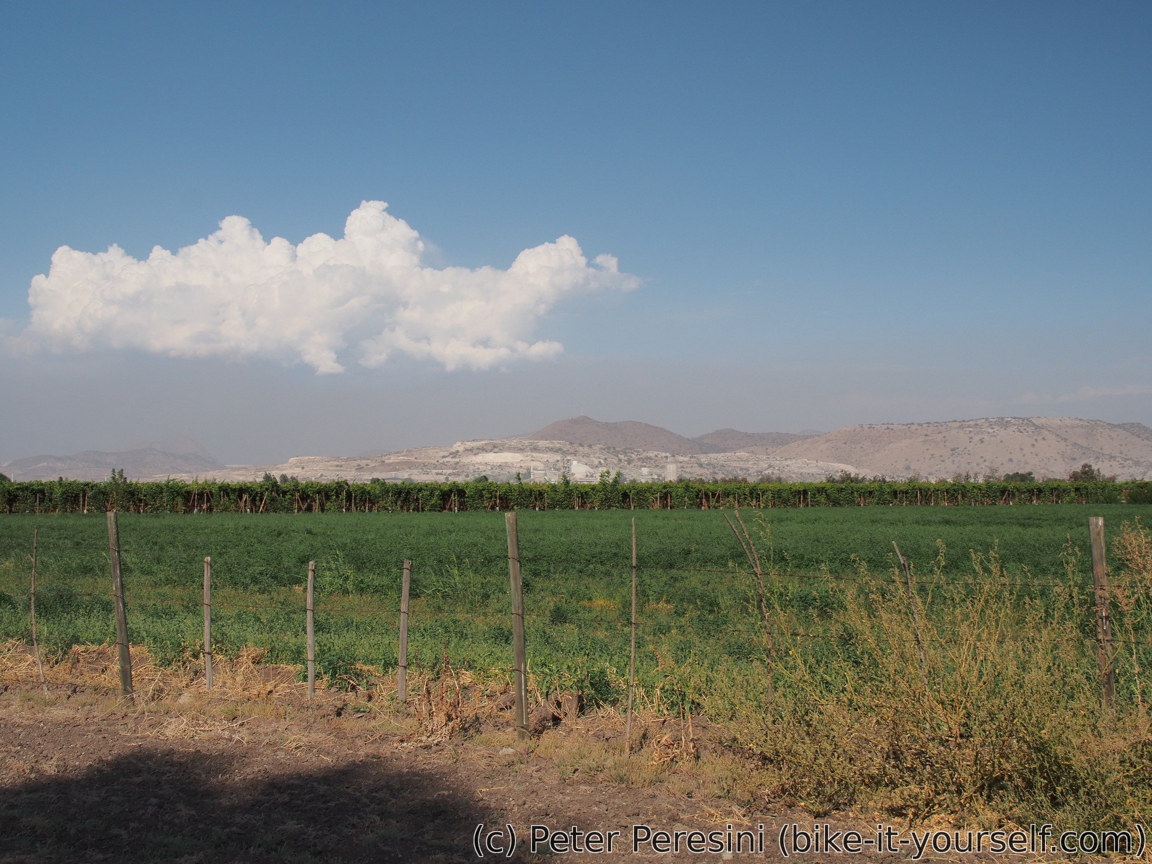
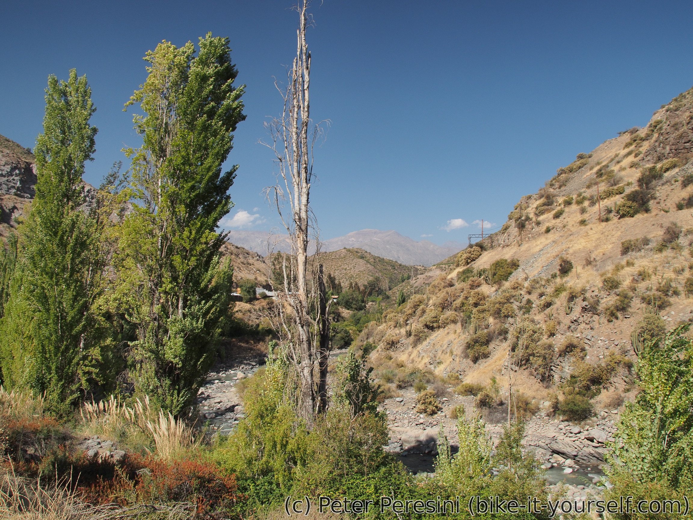
Then I am ready to go. I am restocking with water in the next "village" on my way. The whole valley I am passing by is criss-crossed by hydroelectric power plants, large tubes and other waterways. This adds it a bit of an industrial feel and mostly it basically removes any possibility of getting water from the river passing through the valley.
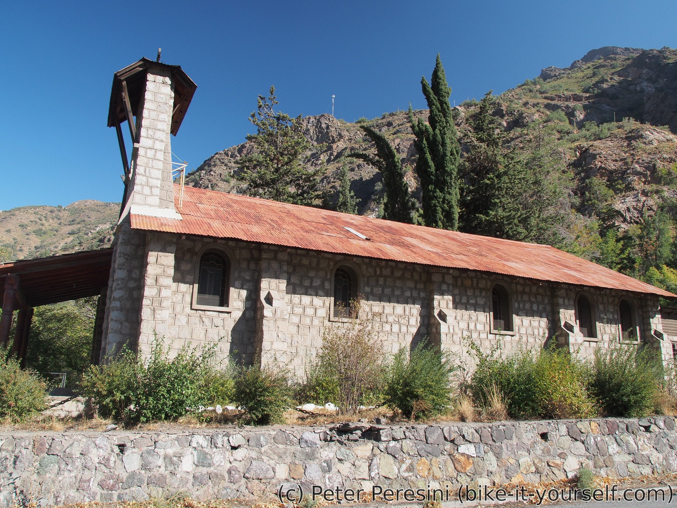
I am stopping in Rio Blanco to get rid of waste and for a final resupply of food before the pass. Around here the river also changes from muddy to crystal clear.
After few more kilometers I am passing by a toll. Every transiting vehicle needs to pay a fee here but fortunately they don't have bicycle on a list. So I am happily cycling through the place, smiling at the guy in a booth and ... causing an alarm. Apparently the damn thing has some sensor.
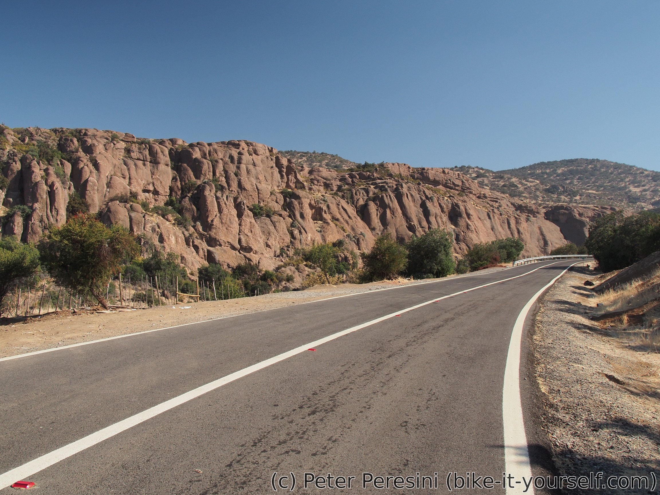
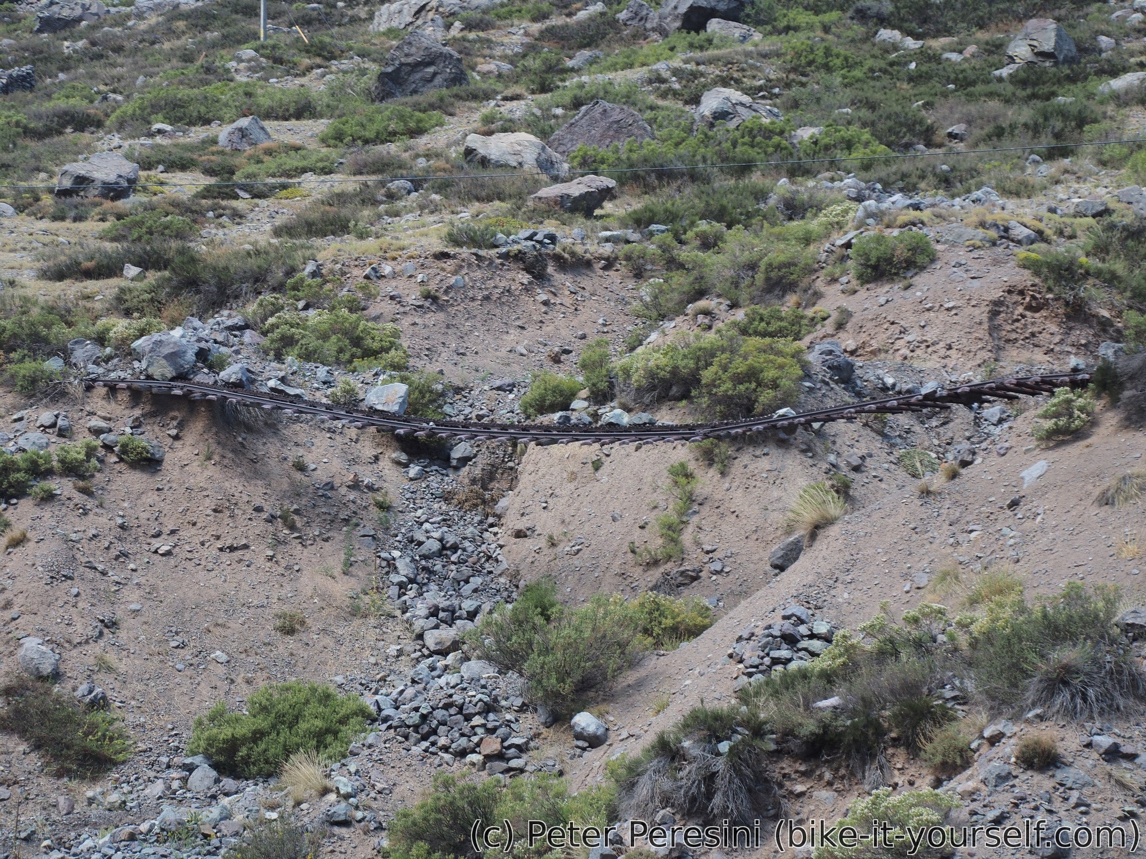
The road is getting progressively steeper and I am having a lunch at 1800m around a road gallery. Apart from the road, there is also a railway here. It would make some scenic ride, that is, if you like Indiana Jones style of riding because the railway is disused and quickly deteriorating.

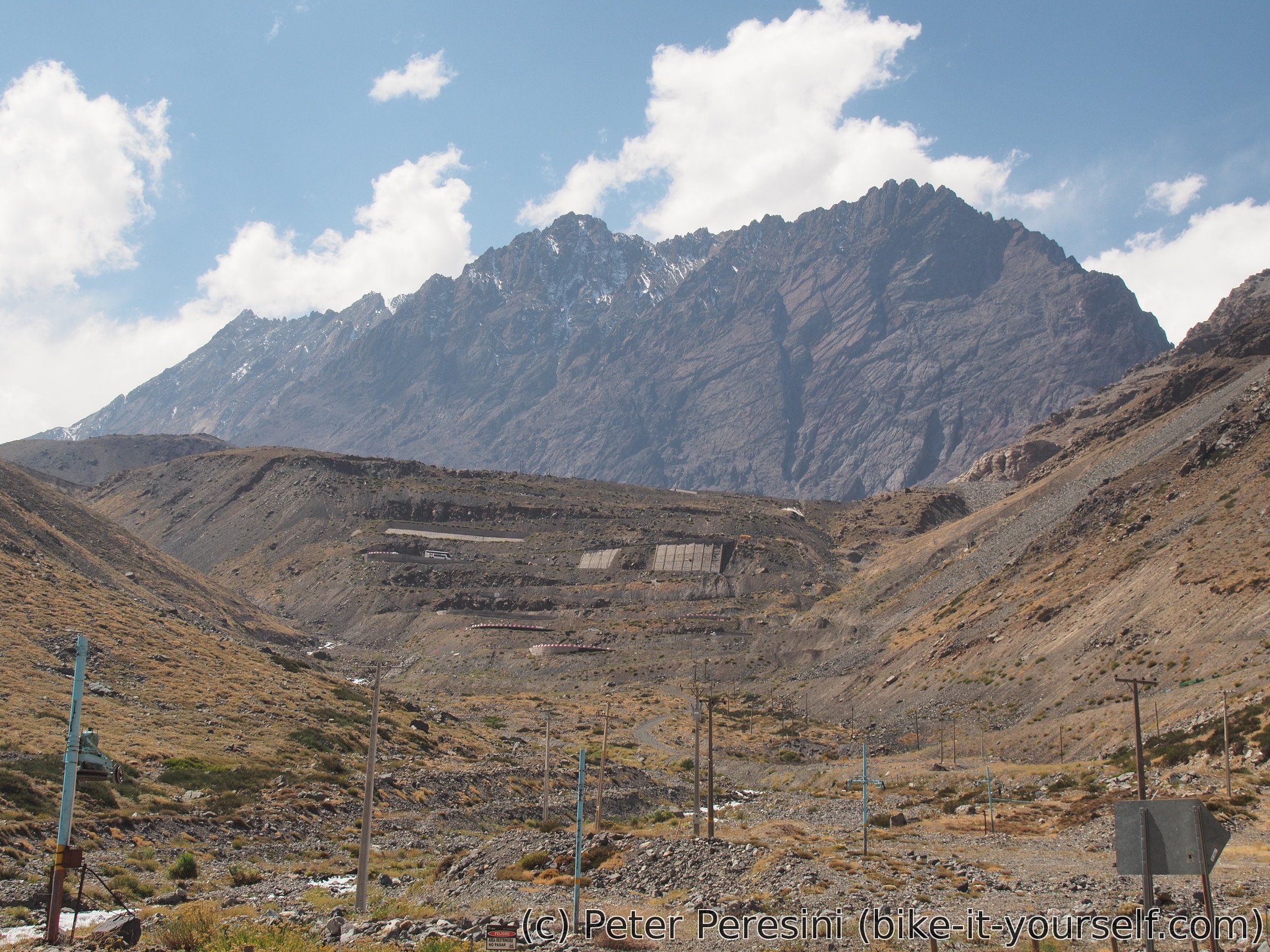
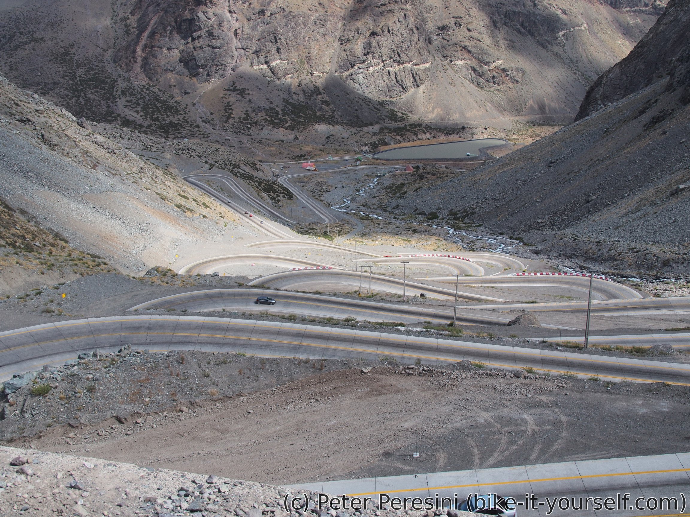
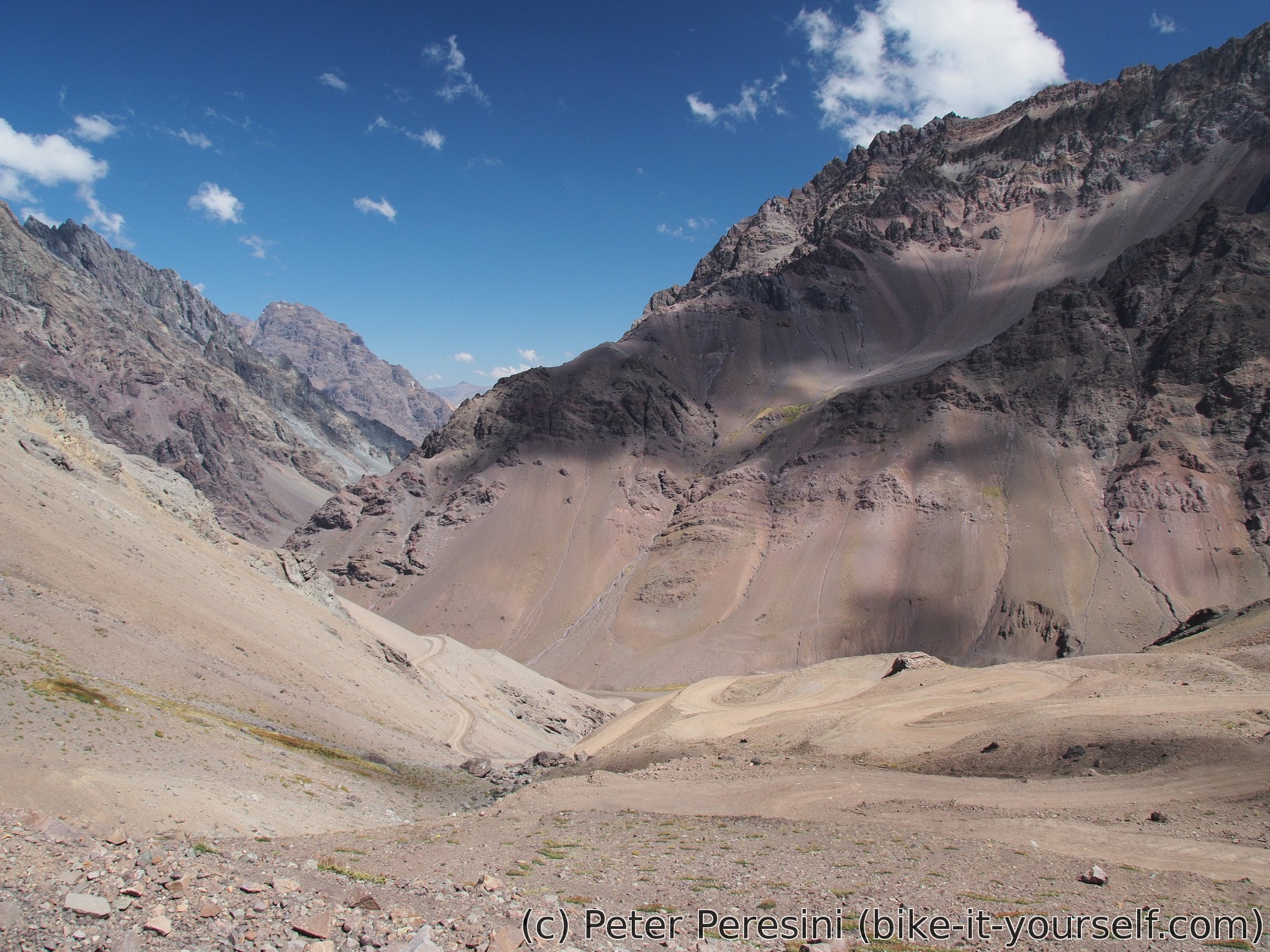
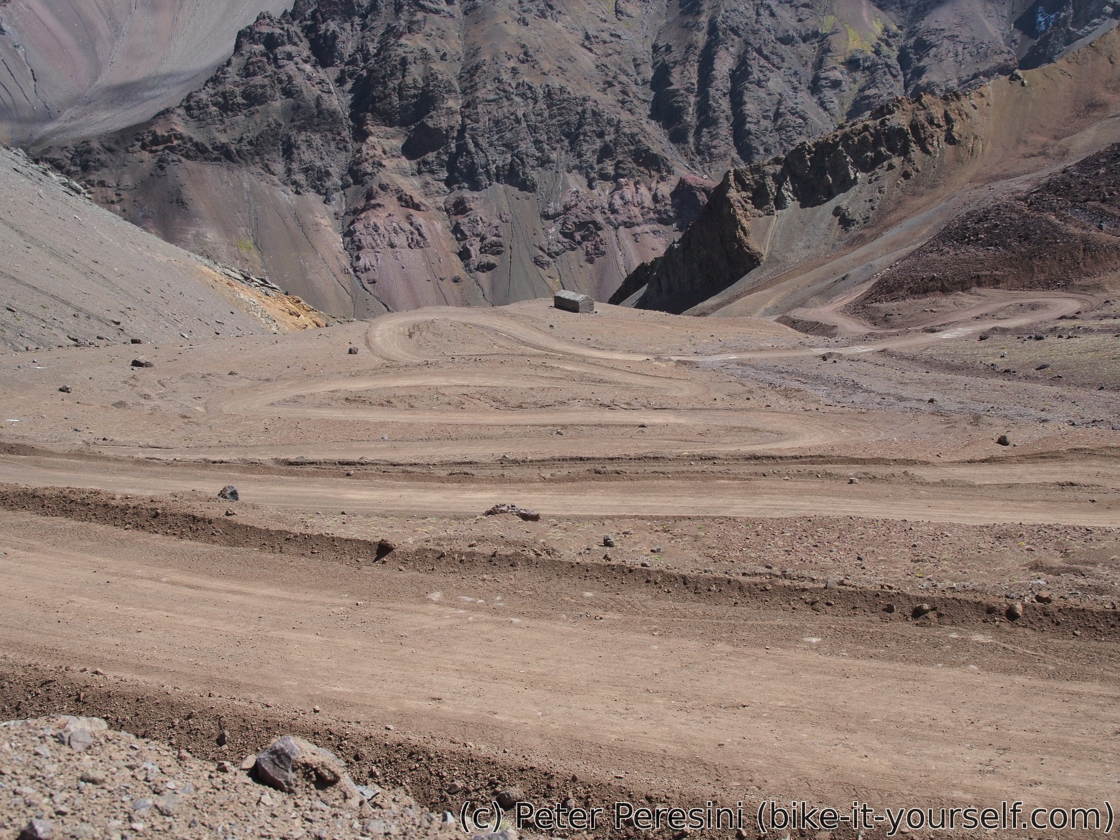
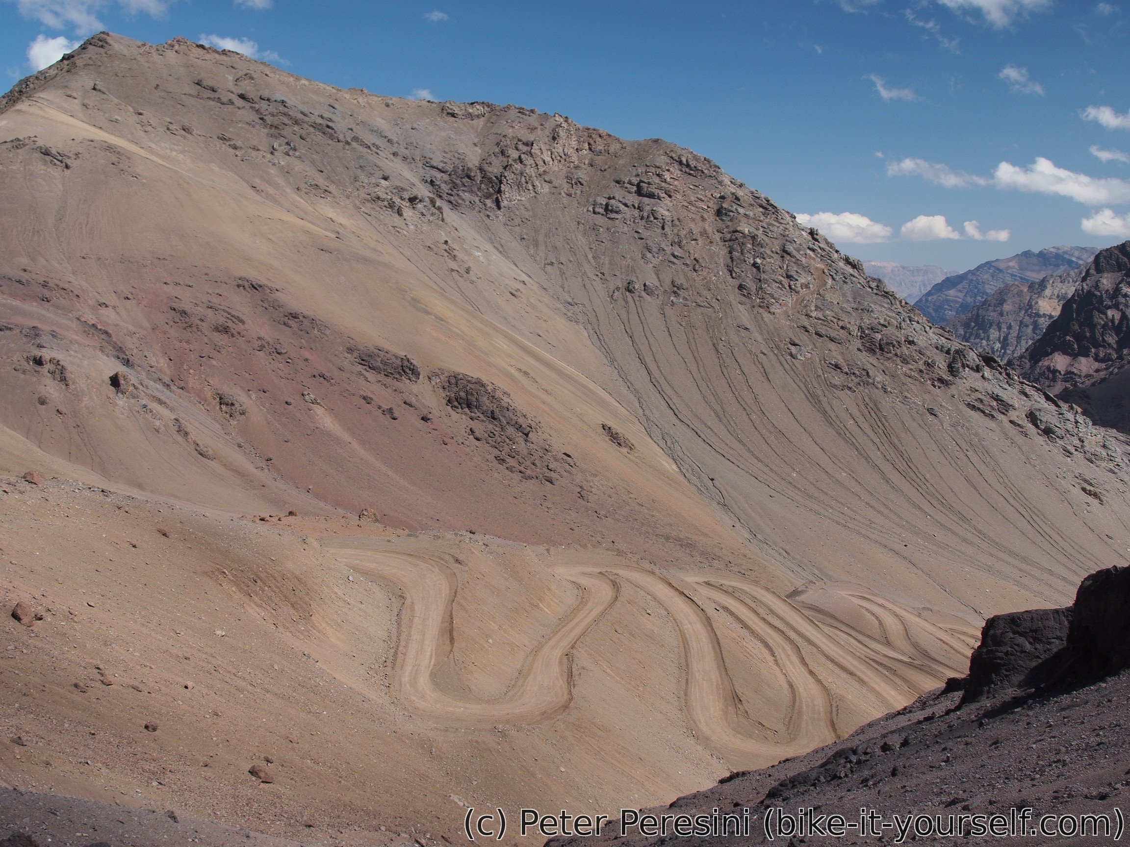
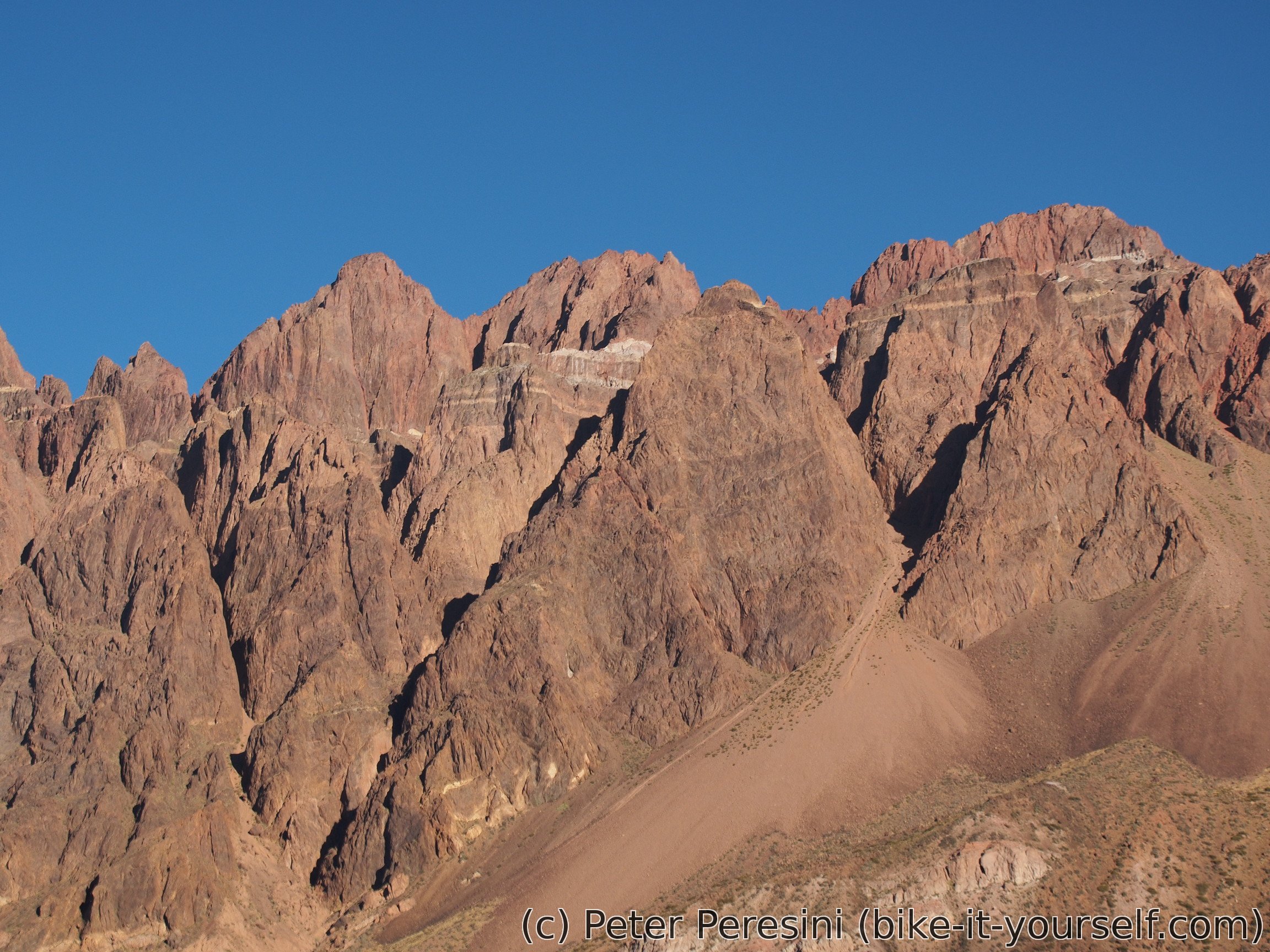
Around military refugio Juncal the steep part of the climb starts. It consists of an almost infinite number of switchbacks which are all numbered. Fortunately, the road is really wide here and the trucks aren't exactly fast climbing 8% grade so I feel quite safe.
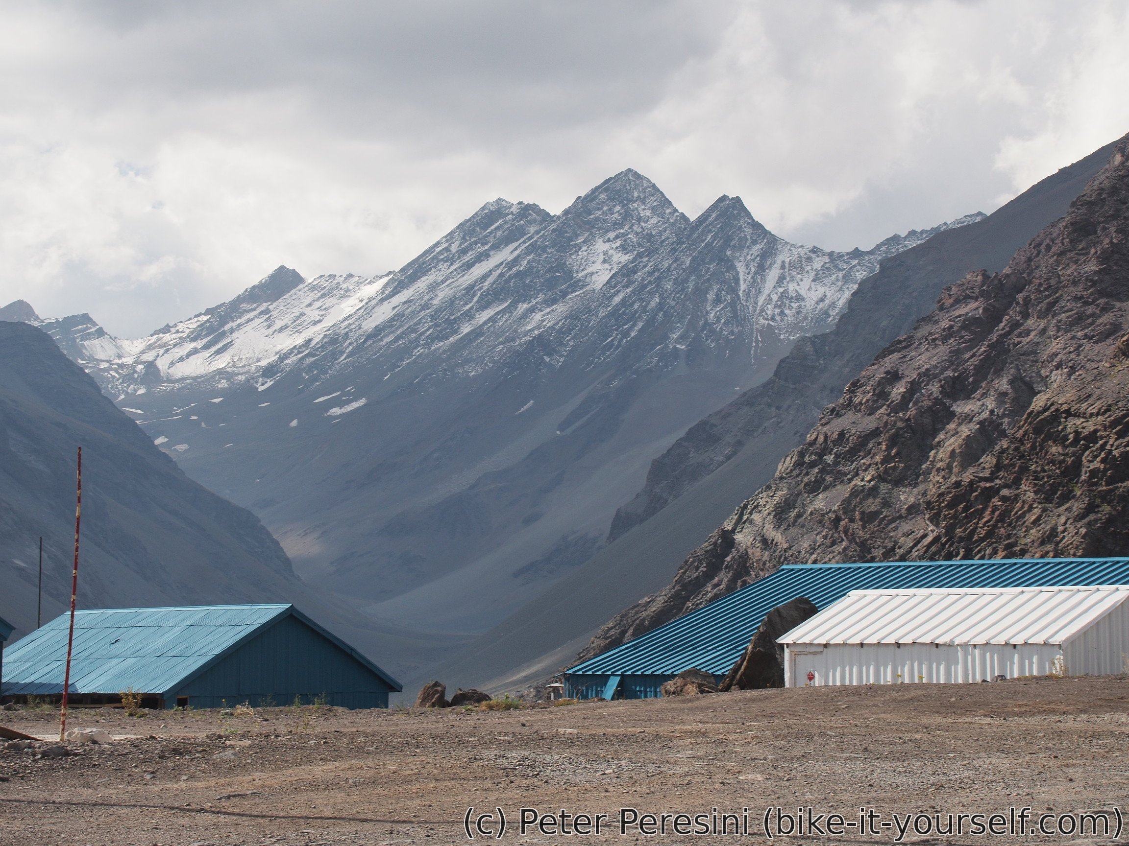
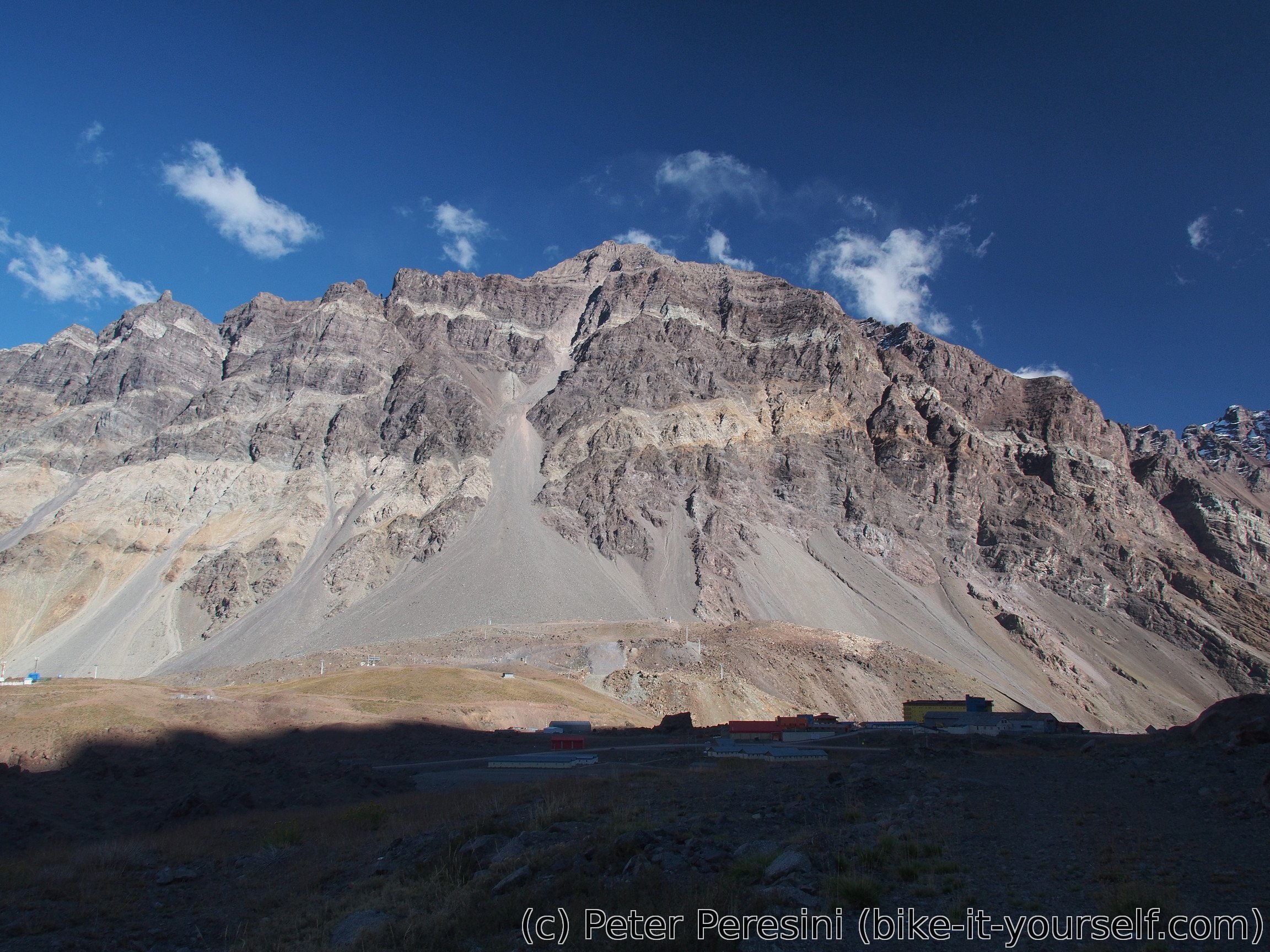
At around 2800m I am checking out a hotel. A room for 80 dollars per night isn't exactly coinciding with my ideas of spending money. Unfortunately, in a few kilometers there will be aduana and I don't want to camp too close to it. As a result, I am pushing a bit more and camping early on a not so good place and not too far from the road.
March 25
To my surprise it wasn't freezing in the night. But that does not mean I am not freezing when I get out of the tent. Before I manage to pack the camp I am meeting another cyclist. This time it is a rather old Australian uncle who is on the road already for 15 months. He is generally going in the same direction as me (i.e., to the north) but his plan is much less ambitious in terms of Andes crossings. Still, I am surprised he managed to climb even this.
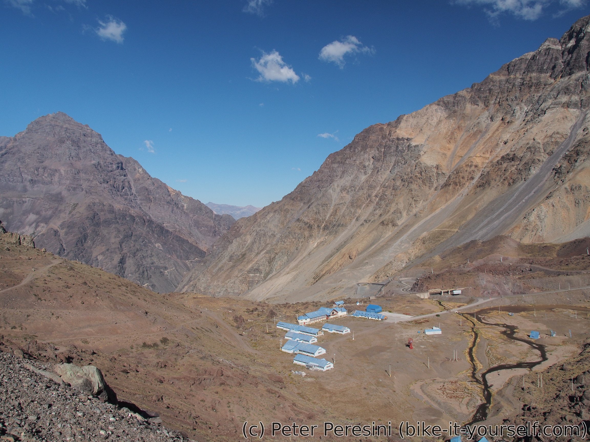
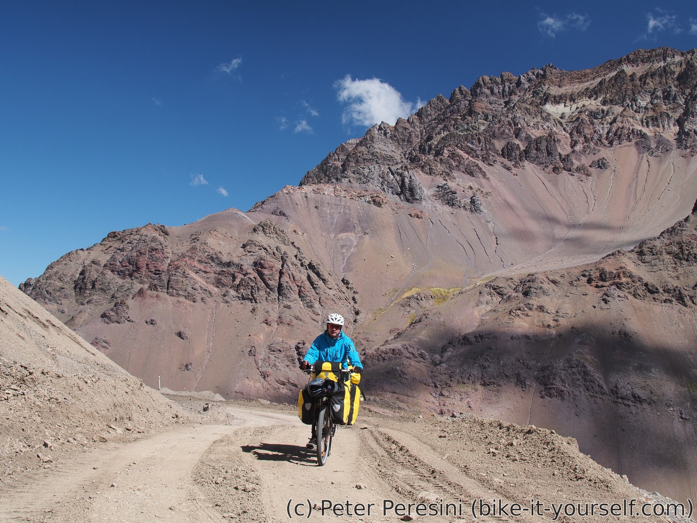
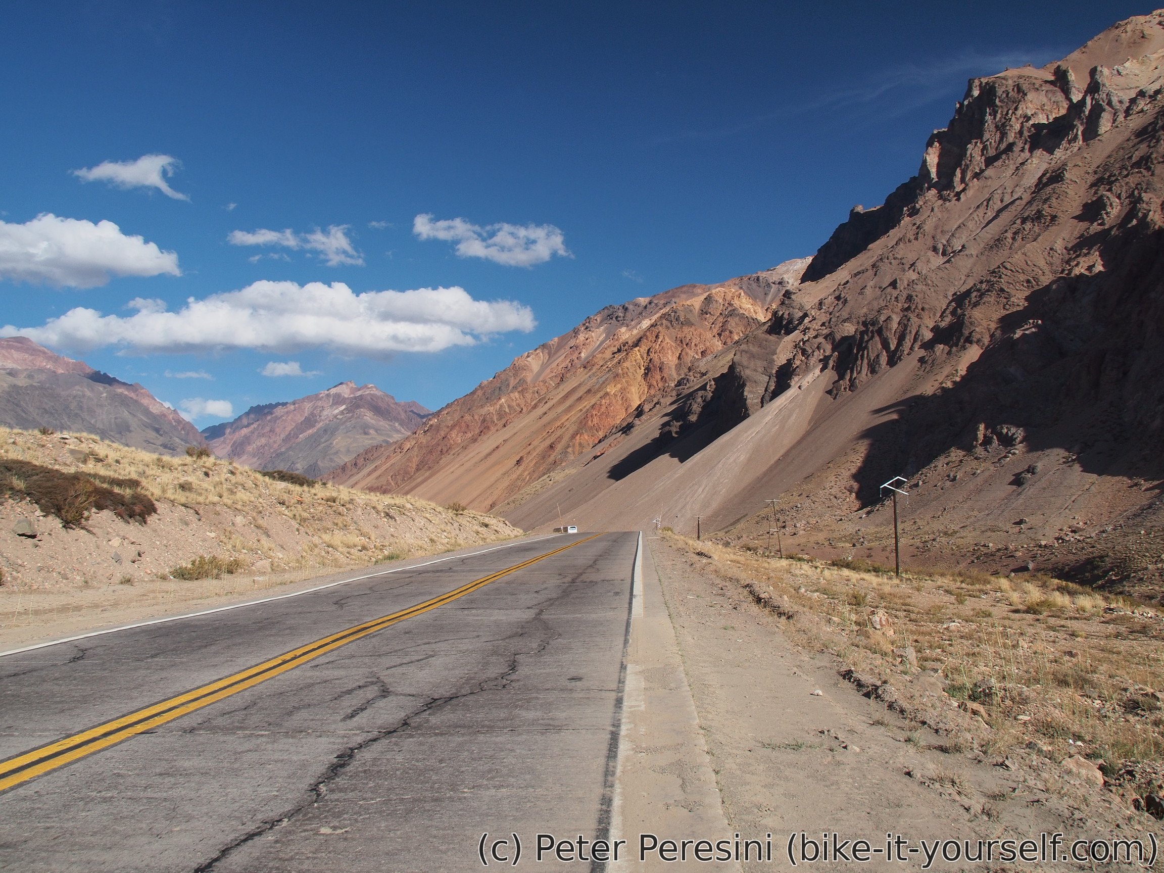
With the morning discussion taking a lot of time I am rather late to start today. I am quickly passing by the Chilean immigration. There they are sending me to the Argentinian side. Apparently everything should happen there. Then I manage to bypass a long gallery and I am ready to turn from the main road (leading to the tunnel) to ripio towards the pass.

The road is steep and the switchbacks continue for another 600 elevation meters. While I can ride almost all of the road it is quite strenuous.


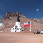
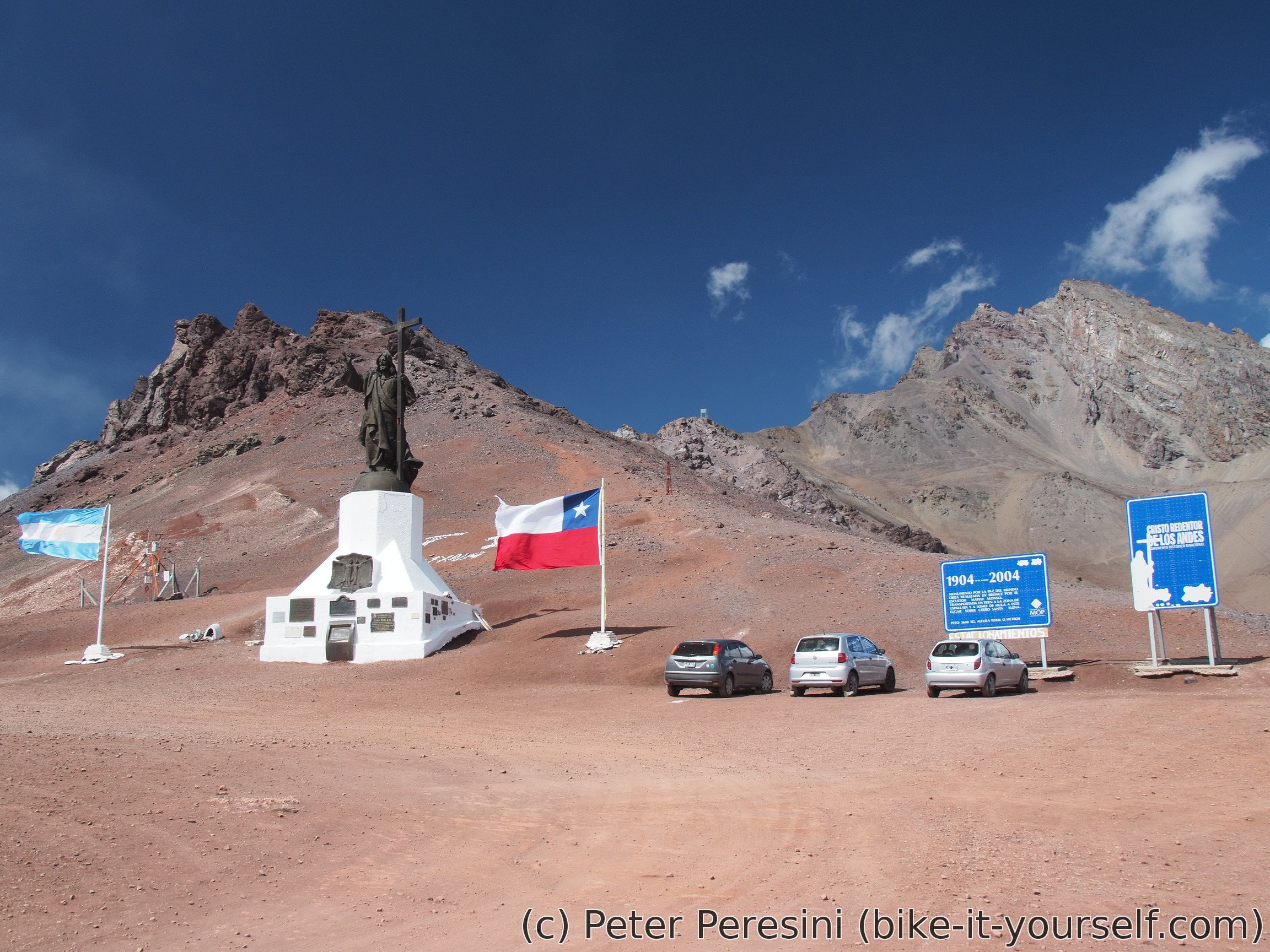
Thus I am more than happy when I finally reach the top. There I am visiting the Cristo Redentor monument and getting a cup of hot chocolate before I am ready to go down. Apparently the Argentinian side of the pass is much more busy -- there are several buses full of tourists visiting the monument.

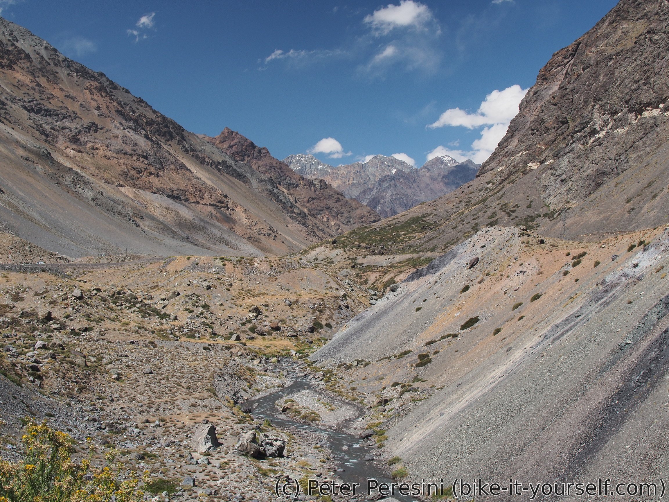
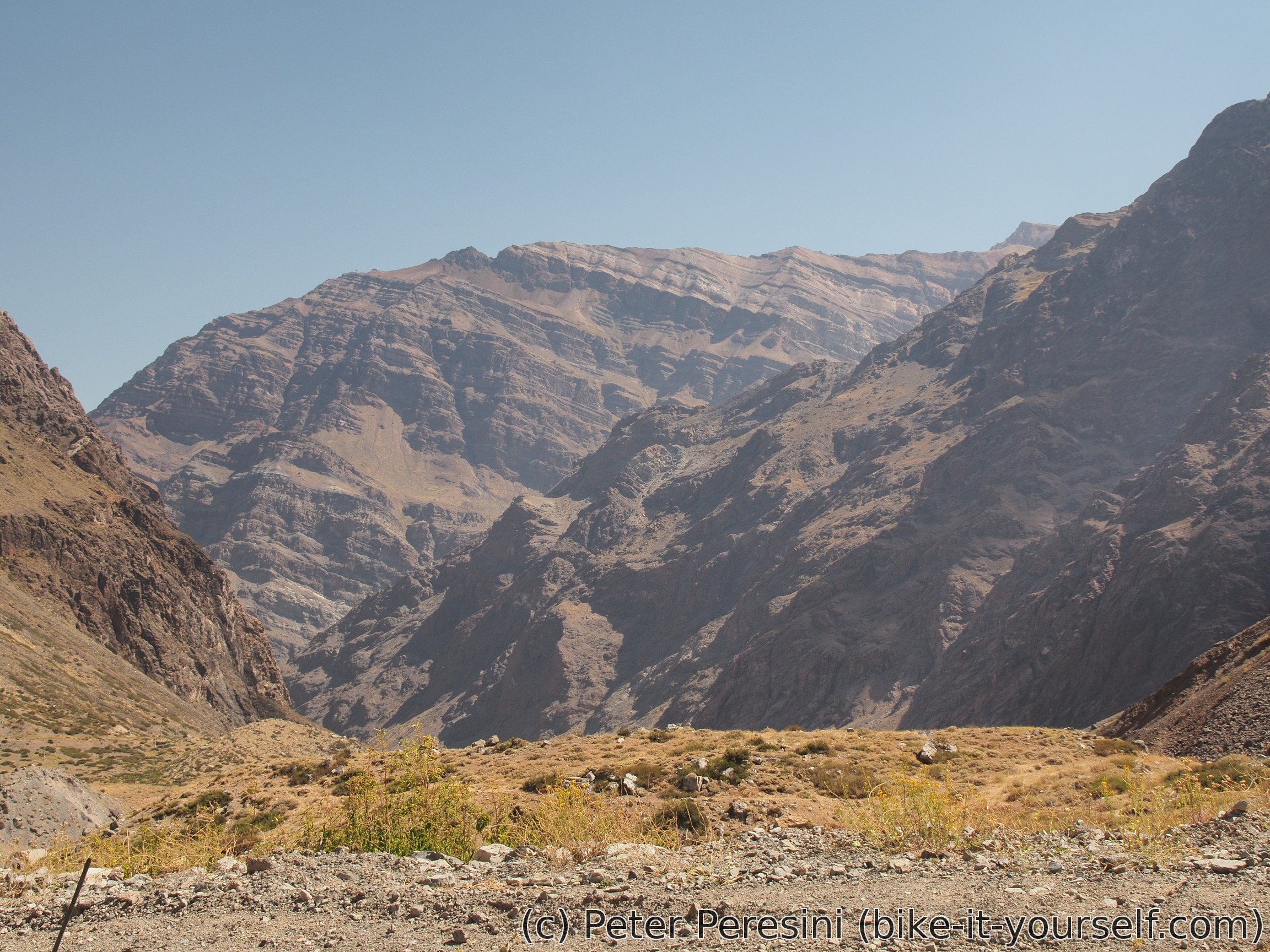
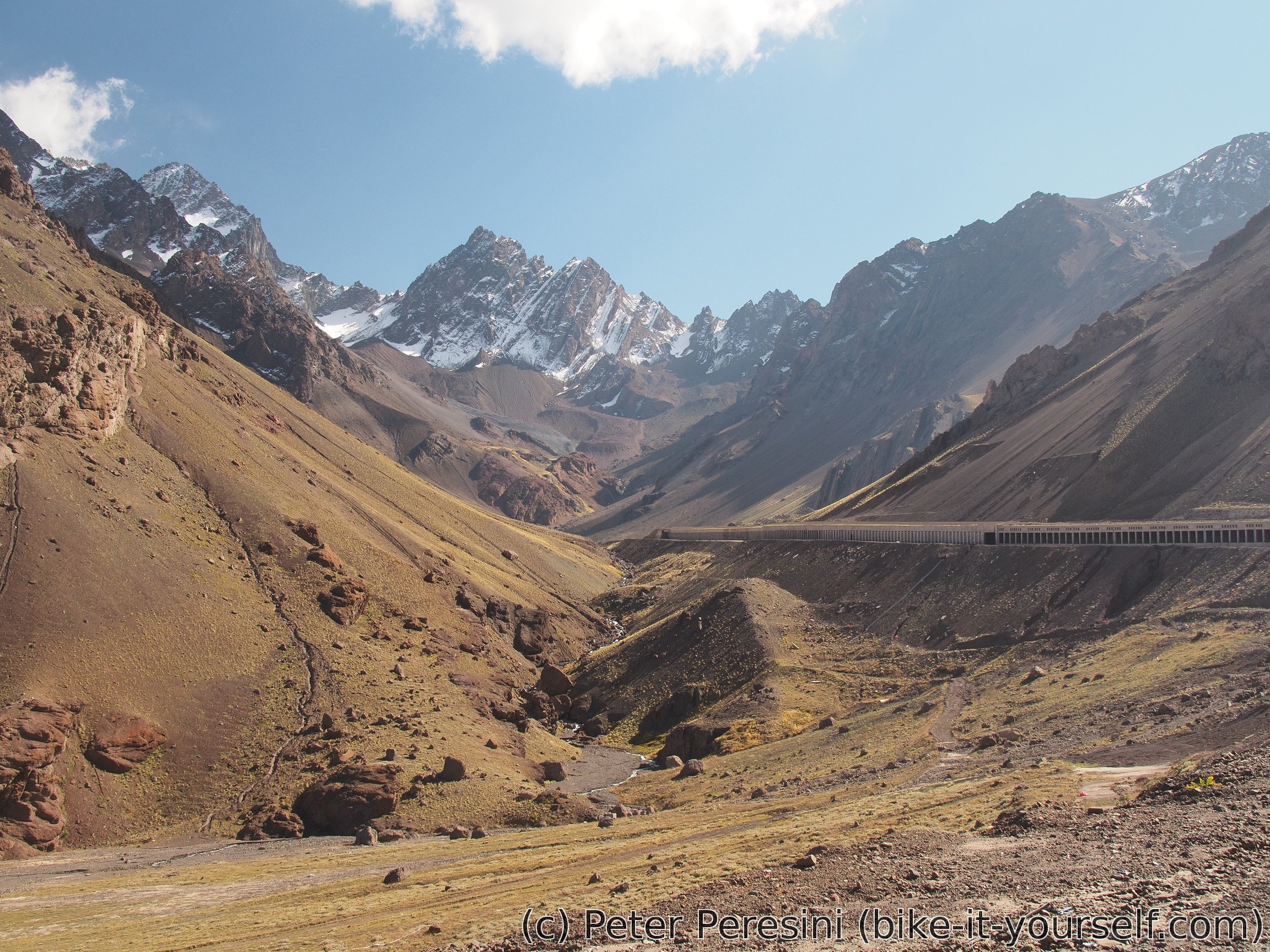
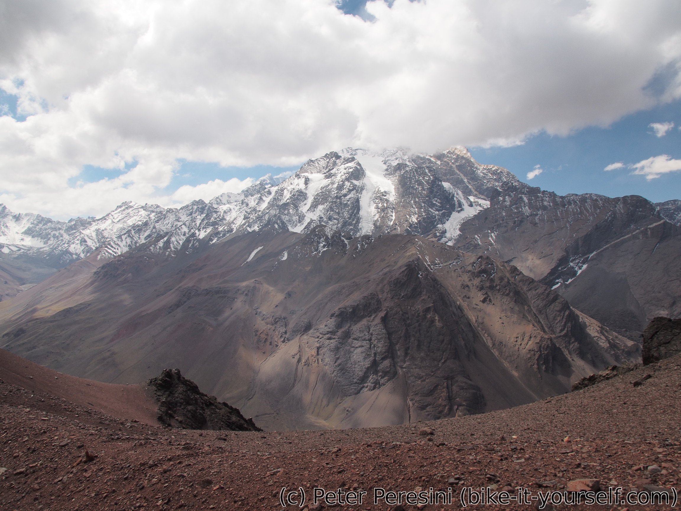
The hot cup of chocolate did not last very long. The pass is quite windy and the temperature isn't exactly high. The descent isn't better -- without any manual work my body is not generating enough heat and I am bitterly cold even through the layers I have on me. Perhaps I should have prepared a bit more layers but now I don't want to stop and fish them out of my gear. The views are stunning though -- the main vista is snow-covered Aconcagua but of course there is much more to look at than just a single mountain.
When I finally arrive at Argentinian immigration I am facing a new problem. Apparently they forget to give me some checkpoint paper and now there is a huge chaos around me. At one point some guy even takes my passport and goes somewhere with it without returning. In the end they resolve it though and I am free to go. Unfortunately, I lost quite a lot of time at the immigration and today I want to get to Uspallata which is quite far. Fortunately, from here it is just a downhill ride.

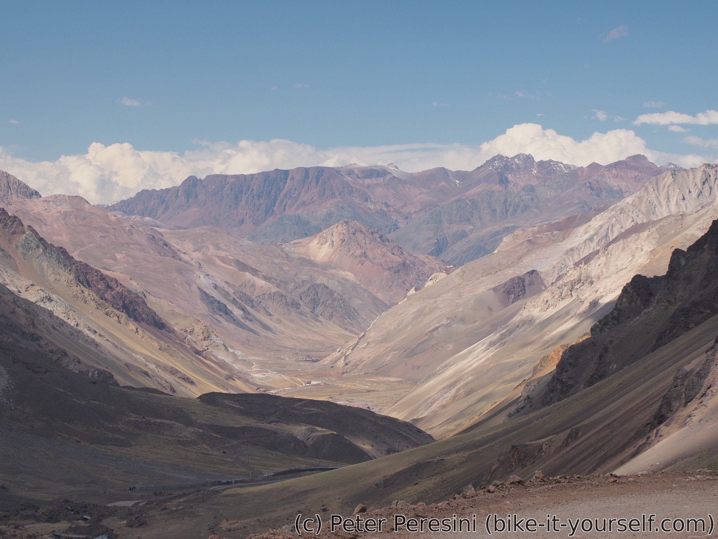
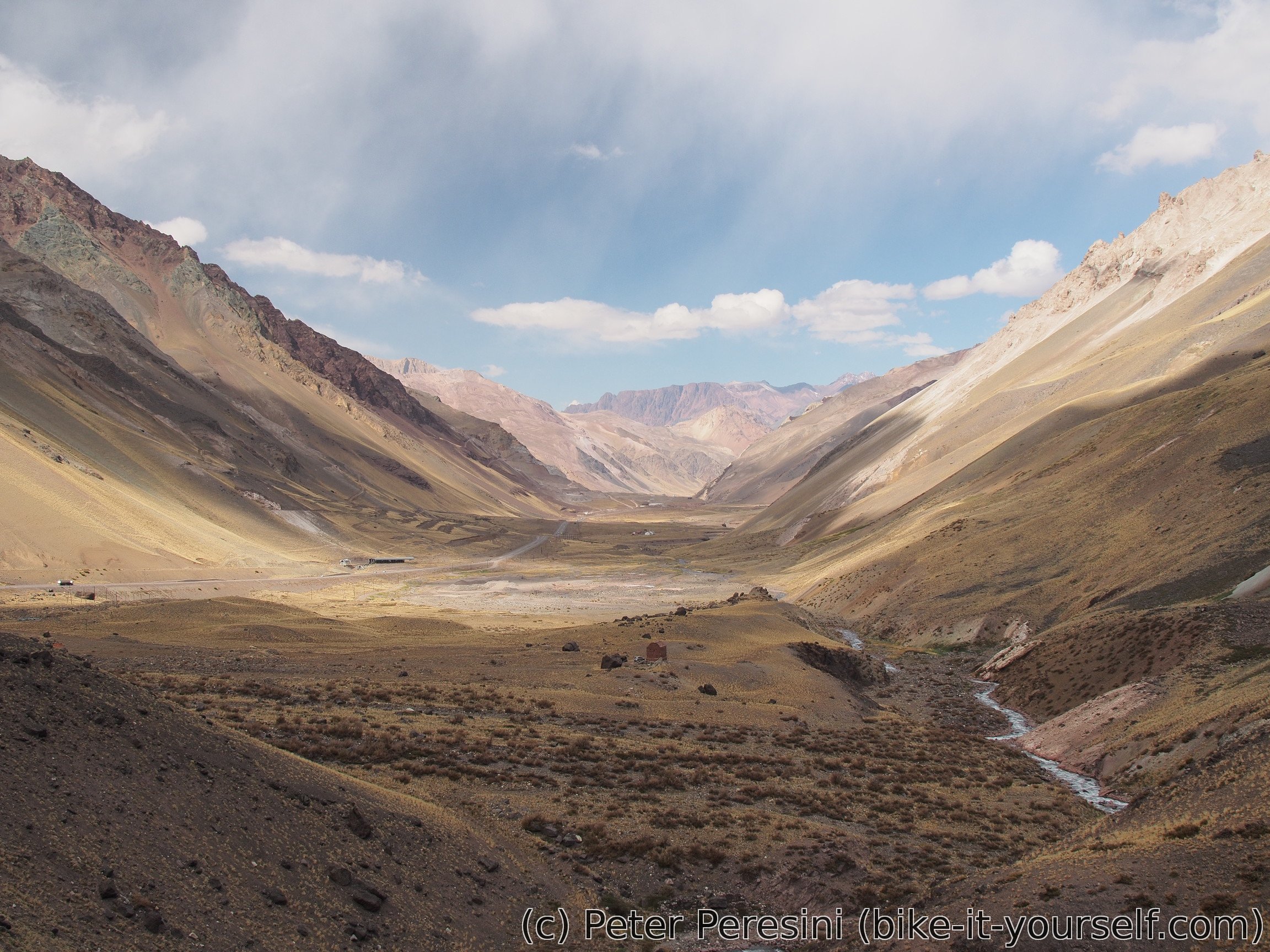
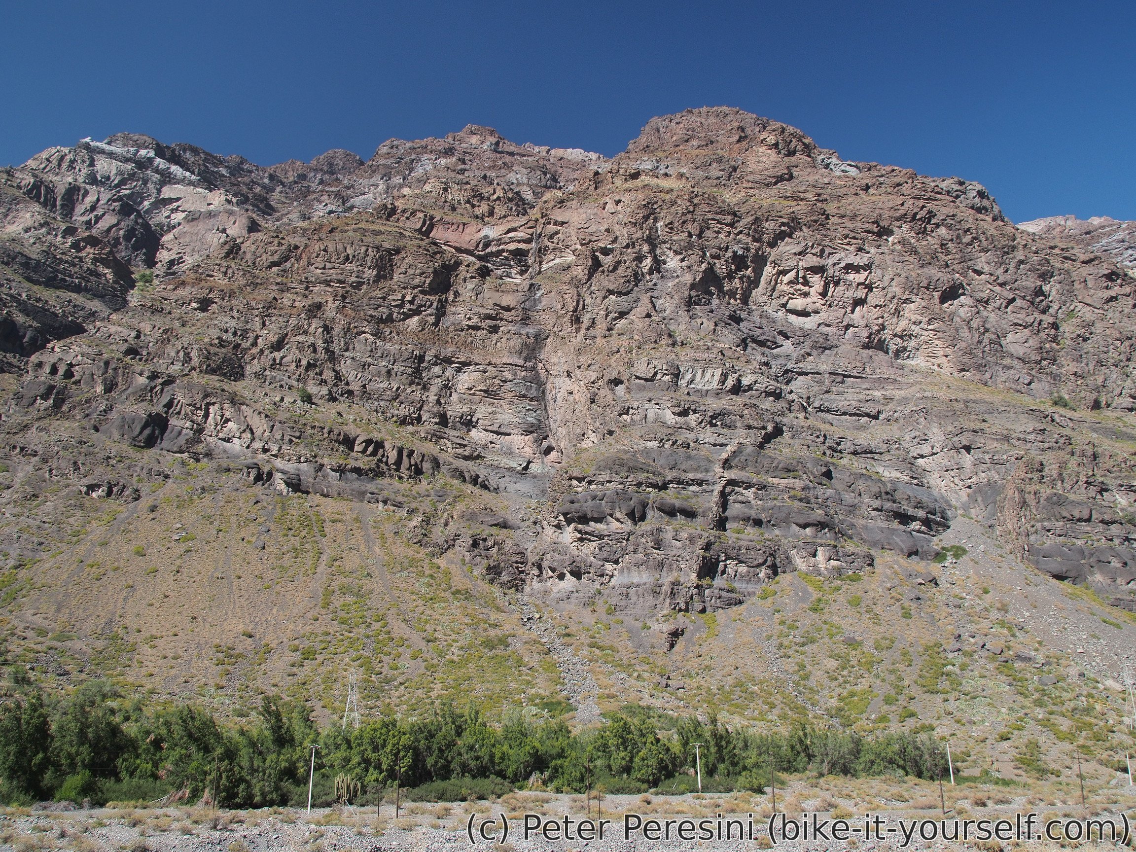
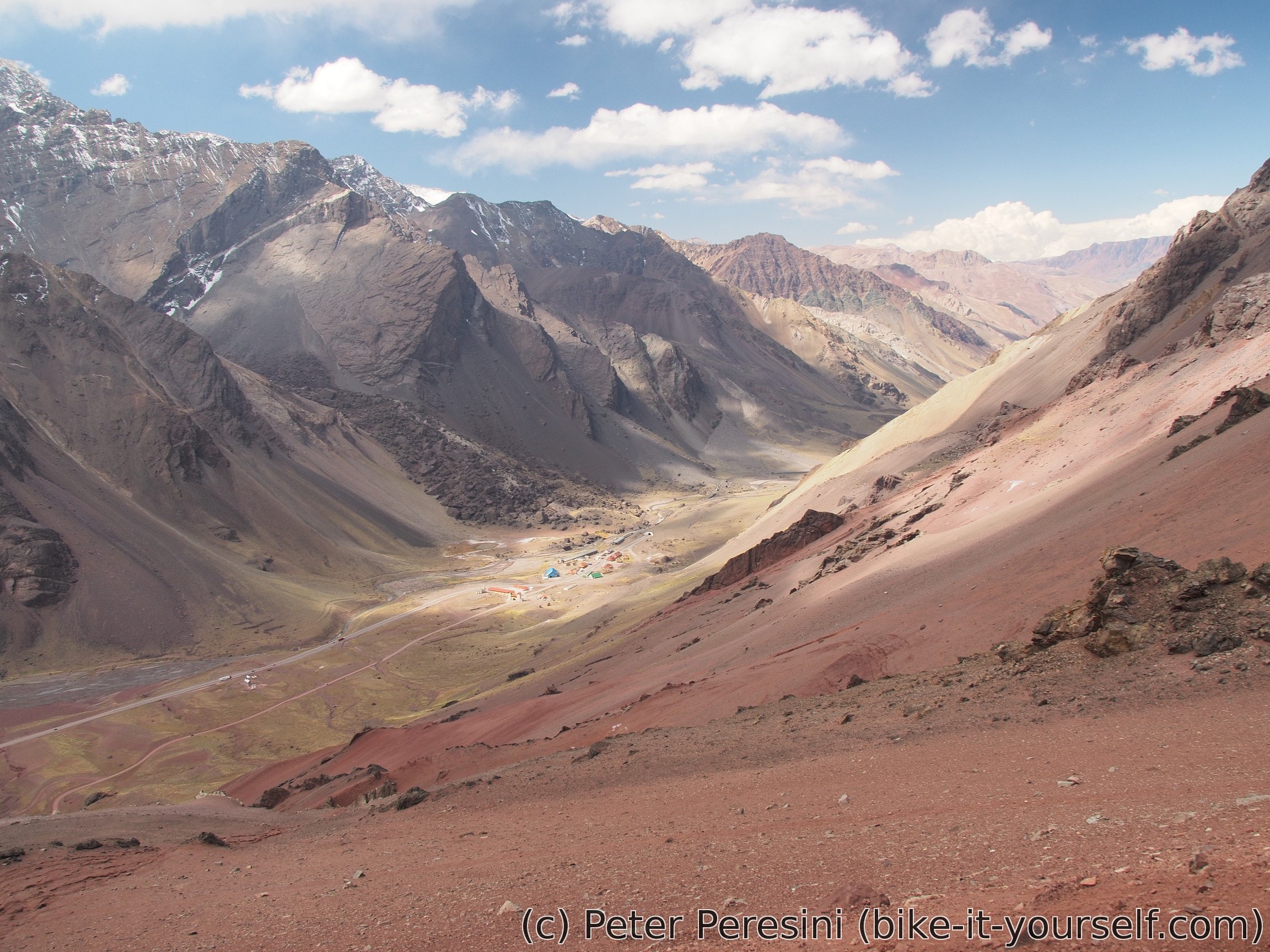
As I am passing kilometer after kilometer, it becomes clear that Uspallata is a far-fetched goal. Instead, I am now concentrating on a camping which I have on my GPS. In the meantime, I am riding through Rio Mendoza canyon which provides lots of stop-and-take-a-photo distractions.

The camping I was going to isn't actually camping. Either the GPS coordinates are wrong or they figured out that camping isn't making much money and it is better to replace it with a radio communication tower. Fortunately, from this place there is a ripio road down towards the river. I am quickly learning that the road is disused by anything motorized as there is a big rockfall through it. But then, this means I found my place for the night.
Route
Download simplified GPX of a route here
Stats by activity:
| Activity | Distance (km) |
Ascent (km) |
Pedal rotations (thousands) |
|---|---|---|---|
| bike | 269 | 4.6 | 70 |
| Date | Distance (km) |
Ascent (km) |
Avg. temp (moving, C) |
|---|---|---|---|
| March 22, 2017 | 90.3 | 0.60 | 29.8 |
| March 23, 2017 | 70.1 | 1.32 | 29.0 |
| March 24, 2017 | 37.1 | 1.64 | 20.5 |
| March 25, 2017 | 71.9 | 1.06 | 13.1 |
Elevation data
The next table is only for cycling activity.
| Grade(%) | Ascent (km) | Descent(km) |
|---|---|---|
| < 2 | 119.2 | |
| < 4 | 17.4 | 20.7 |
| < 6 | 10.6 | 9.0 |
| < 8 | 12.4 | 6.9 |
| < 10 | 6.4 | 3.8 |
| ≥ 10 | 5.3 | 7.0 |
Notes for cyclists
- The last place to get food on Chilean side is Rio Blanco. The first place on the Argentinian side to get some decent provisions is probably Uspallata but you might be able to get some very basic food in the smaller villages on the way.
- The pass is better to be climbed from the Chilean side even though it is much steeper than the gentle Argentinian slope. There are several reasons for this: First, the ripio part of the climb is comparably steep on both sides. Climbing the Chilean part of the paved road prepares you for the steepness. Second, the Chilean side contains wide shoulder almost all the way from Los Andes. While there is a shoulder on the Argentinian side, it disappears around immigration complex and the road from there to Uspallata is quite narrow (not to mention that the gentle slope means fast-going trucks). Finally, the Argentinian side could potentially get quite head-windy.
- There is no need to lug too much water on the Chilean side. Argentinian side has a bit less opportunities to get water but there are a few streams and villages around.
| Distance | Elevation | Place | Notes |
|---|---|---|---|
| 0km | 810 | Los Andes | Large city. A semi-continuous habitation from here |
| 27km | 1300 | Sharp turn right | Trun left into a steep tracks for a good camping spot around a viaduct |
| 36km | 1420 | Rio Blanco | The last village on the Chilean side |
| 52.5km | 2220 | Military refugio Juncal | Switchbacks start |
| 62km | 2800 | Military complex | You might be able to convince the two soldiers guarding here that you can sleep there |
| 63km | 2870 | Hotel Portillo | Hotel with outrageous prices |
| 65km | 2950 | Chilean Immigration | If going to Argentina you can go straight through as everything is done on the Argentinian side |
| 68km | 2060 | Start of a long gallery | Go around it |
| 69.5km | 3180 | Tunnel entrance down the road | Turn right to the ripio road |
| 78.5km | 3830 | Top of the pass | Enjoy the Cristo Redentor monument and a cup of hot chocolate |
| 87km | 3180 | Campanento | There might be an open restaurant here |
| 95.5km | 2830 | Don't forget to turn left for the immigration complex | |
| 102km | 2750 | Puente del Inca | Seems like a touristy village with hospedajes and food |
| 109km | 2610 | Villa los Penitentes | Ski center. You might be able to get water here |
| 118.5km | 2430 | Punta de Vacas | You should be able to get water here |
| 131km | 2250 | Polverades | Looks like a small village. You should be able to get water here. |
| 173km | 1890 | Uspallata | A small city. Has stores and restaurants and possibly accomodation. |
Viagra Frau Rezeptfrei Badype <a href=https://bansocialism.com/>buy cialis cheap</a> Nurify Desmethyl Kamagra
<a href="http://t.me/s/alcohol_yakutsk">Доставка алкоголя якутск</a>
"Greetings! Very helpful advice within this article! It's the little changes that produce the biggest changes. Thanks for sharing!" https://israely-girls-lypgent.tk/news/trepbobsdelhea