Tierra del Fuego - part 1 - Ushuaia to Rio Grande
November 29
I started my whole trip (and the Tierra del Fuego) at Ushuaia by leaving quite late from my airbnb accomodation -- I actually wanted to go sooner but then Sam (my host) told me that between 12-3pm there is a siesta time and everything is closed. Thus I waited for three more hours, went to a grocery to stock up and then continued my way.
The way to grocery store showed me how greenhorn I am in terms of bike touring. After fully loading my bike, it had super-heavy steering and I felt more like riding a truck than a bike. Of course, this got even worse after I loaded the bike with few more kilograms of food. Fortunately, I learned from my mistakes the next days and gradually redistributed weight from the front rack (which really affects steering) to the rear one (which affects steering much less). I also learned how to pack my stuff more efficiently and by the time I was in Rio Grande, I had pretty much figured out a good setup for all my belongings.
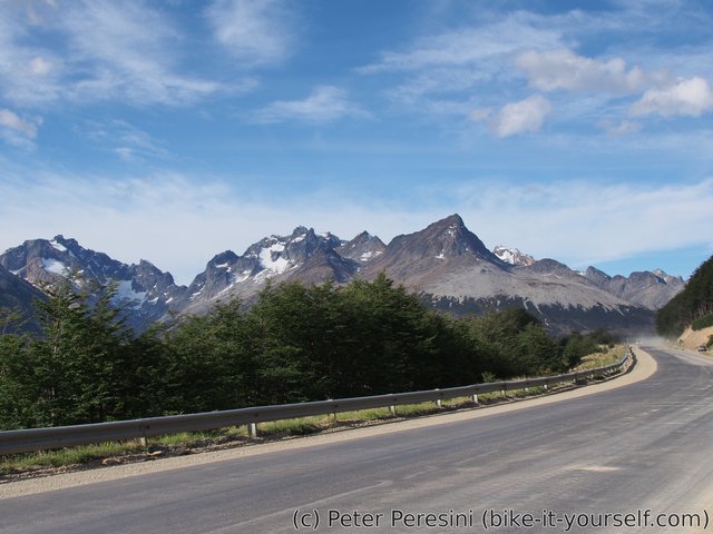
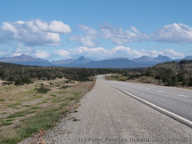
But back to my trip. The road goes from centre of the city through an industrial outskirts. Then it leaves Ushuaia, is (surprisingly) paved and leads through nice valleys but fortunately it does not climb too high. Instead, you are rewarded by a great views of mountains around Ushuaia.
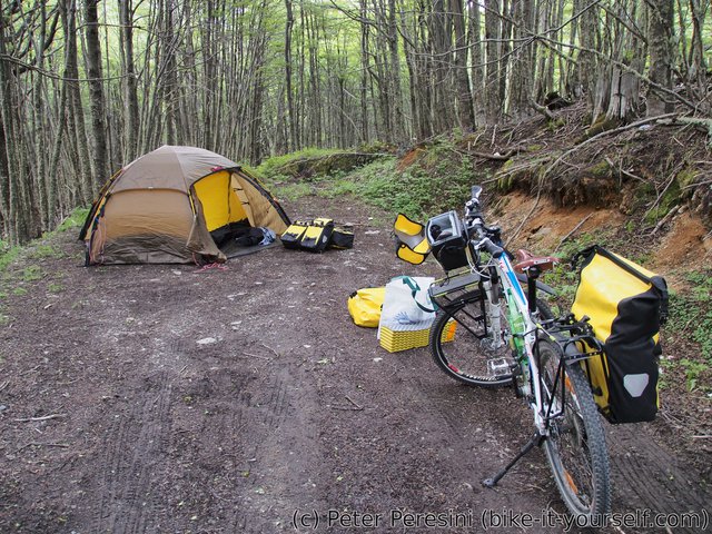
Because I started too late, this day I didn't cover too much. I spread my tent only 30km from Ushuaia near the road and enjoyed my first practice of evening rituals of setting up a tent, cooking and eating and setting up for the night.
November 30
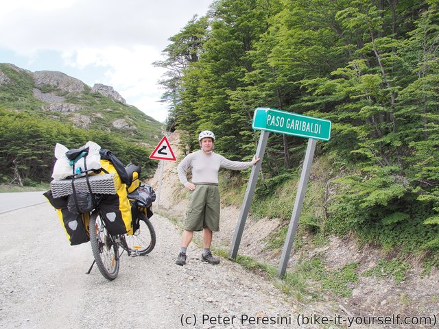
The next day I climbed my first Andean pass -- with 400 meters this wasn't a hard climb but it is nice to start easy.
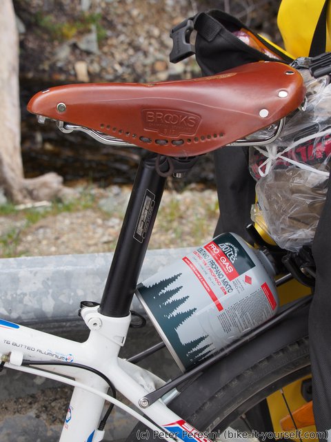
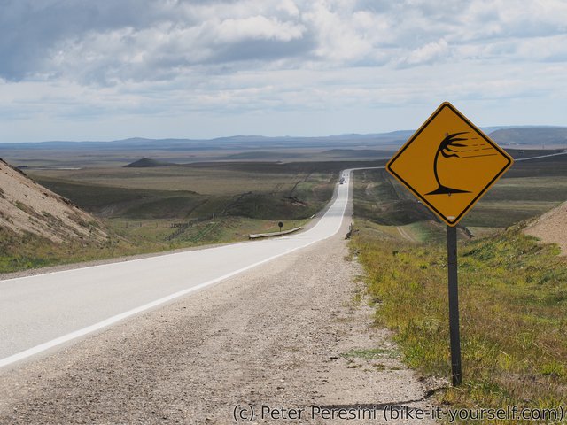
And sometimes I felt like sitting on a ticking bomb ...
After Paso Garibaldi, the terrain changed from high hills to a nice cycling along a lake. There I arrived to Tolhuin and got some wifi and more importantly sweets from famous La Panaderia bakery. Normally, La Panaderia let's cyclists stay for free for a night but it was early and nice enough and I had plans to roll further so I left Tolhuin and continued on Ruta 3.
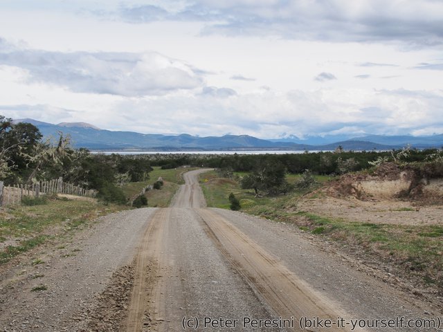
After few kilometers, I abandoned Ruta 3 for a much more quit alternative on ripio roads. Importantly, my linguistic impression is that "ripio" comes from "ripple" which exactly describes how a bad ripio road looks like -- bumps at regular intervals which are super annoying to the bike tourer. At some times, I just felt like a disco dancer on a roll.
December 1
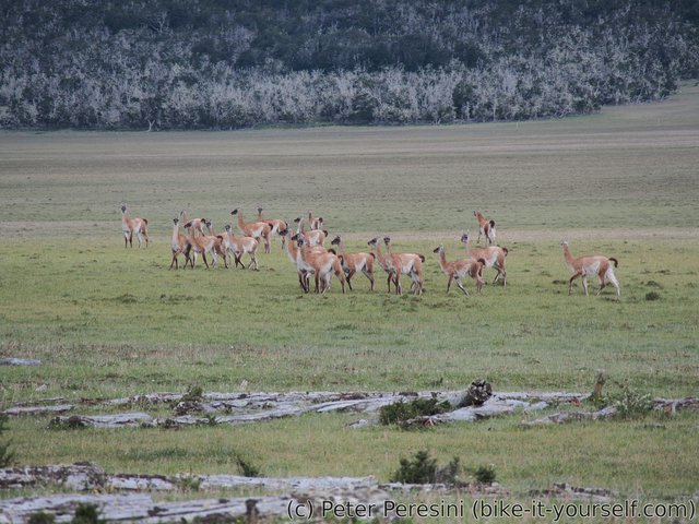
But the reward for all of this ripio trouble is the safari that the back roads of Tierra del Fuego provide. You can see guanacos (Patagonian type of llama) basically everywhere.
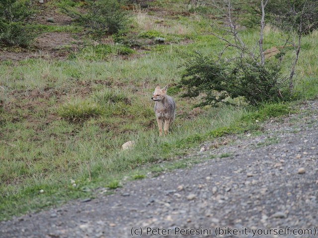
While they are a bit shy and don't want to be too close to you, they make it up by the sheer amount of encounters. Apart from guanacos, I also met a few grey foxes. I first thought that it the fox is a cat because from the front it looks exactly like a grey cat. Except that cats don't have these bid fluffly tails...
Of course, because this is Tierra del Fuego, I got some share of a rain as well.
December 2
Today's night was really cold but the morning comes with a sun and everything suddenly looks amazing. I even managed to pack my things even more effective than the previous day and I am left with ~70 kilometers to Rio Grande.
Unfortunately, the weather forecast was too much optimistic for today and I encountered more rain than expected. This got quite tricky at one spot because when ripio road changes to mud, you can expect a lot of trouble. Fortunately, it was only on a short piece of the road.
After finally joining the tarmac road, Tierra del Fuego is still not yielding easily. The final kilometers to Rio Grande are underscored by a strong headwinds but fortunately I am winning this time and rolling into Rio Grande which is much bigger and much more industrial city than I anticipated.
I am finding a hostel to stay for the night by visiting the information centre and everything is set good as I am warm and happy inside while the rain starts.
Route
Download simplified GPX of a route here
Stats by activity:
| Activity | Distance (km) |
Ascent (km) |
Pedal rotations (thousands) |
|---|---|---|---|
| bike | 255 | 1.7 | 30 |
| Date | Distance (km) |
Ascent (km) |
Avg. temp (moving, C) |
|---|---|---|---|
| Nov. 29, 2016 | 30.3 | 0.33 | 19.0 |
| Nov. 30, 2016 | 103.1 | 0.76 | 17.9 |
| Dec. 1, 2016 | 52.3 | 0.33 | 11.3 |
| Dec. 2, 2016 | 69.3 | 0.31 | 12.3 |
Elevation data
The next table is only for cycling activity.
| Grade(%) | Ascent (km) | Descent(km) |
|---|---|---|
| < 2 | 138.9 | |
| < 4 | 22.1 | 24.6 |
| < 6 | 9.7 | 9.2 |
| < 8 | 4.5 | 1.8 |
| < 10 | 0.8 | 0.8 |
| ≥ 10 | 0.7 | 0.4 |


