
Villa Cerro Castillo to Coyhaique
 Share:


There is only 90 kilometers of road between Villa Cerro Castillo to Coyhaique. And all of it is paved (finally). Still, this stretch took me three days. You ask me why? Well, there are amazing hiking possibilities around Cerro Castillo National Reserve.
January 20
The previous night I am hard-pressed to make a decision. Should I do a one-day hike with the highlight of Cerro Castillo or should I do a four-day trek which captures all of what Cerro Castillo can show. In favor of longer hike is a good weather forecast and amazing views. In favor of shorter bike is less organization --- there is no need to re-pack my tent without a footprint, no need to buy food in the morning and also no need to hitchhike to the starting point which is 30-40 kilometers away on the road to Coyhaique. Plus no need to store the bike and the rest of the things. In the end, this resolves by an incident. When I return in the night from the common room to my tent, my dry bag is stolen and inside it was a wallet (including a credit card). Oh no! But this is not an ordinary thief -- an ordinary thief wouldn't spill half of the content of the dry bag, including a camera, on the ground. Instead, I am suspecting a local dog. The damn animal already tried to stole my things in the afternoon. Unfortunately, a quick search with a headlamp does not reveal anything and I am having a night with bad dreams.
Fortunately, the search in the morning proves to be more lucky and I am finding the drybag including my wallet and a bit of dried mango in the bushes maybe 20 meters from my tent. I am really relieved. But it is also clear that it is no time to start preparing for a multiday hike now (and let's face it, I am lazy too). So instead I am joining a French guy named Bas and an American named Kurt to do the one-day hike alternative.
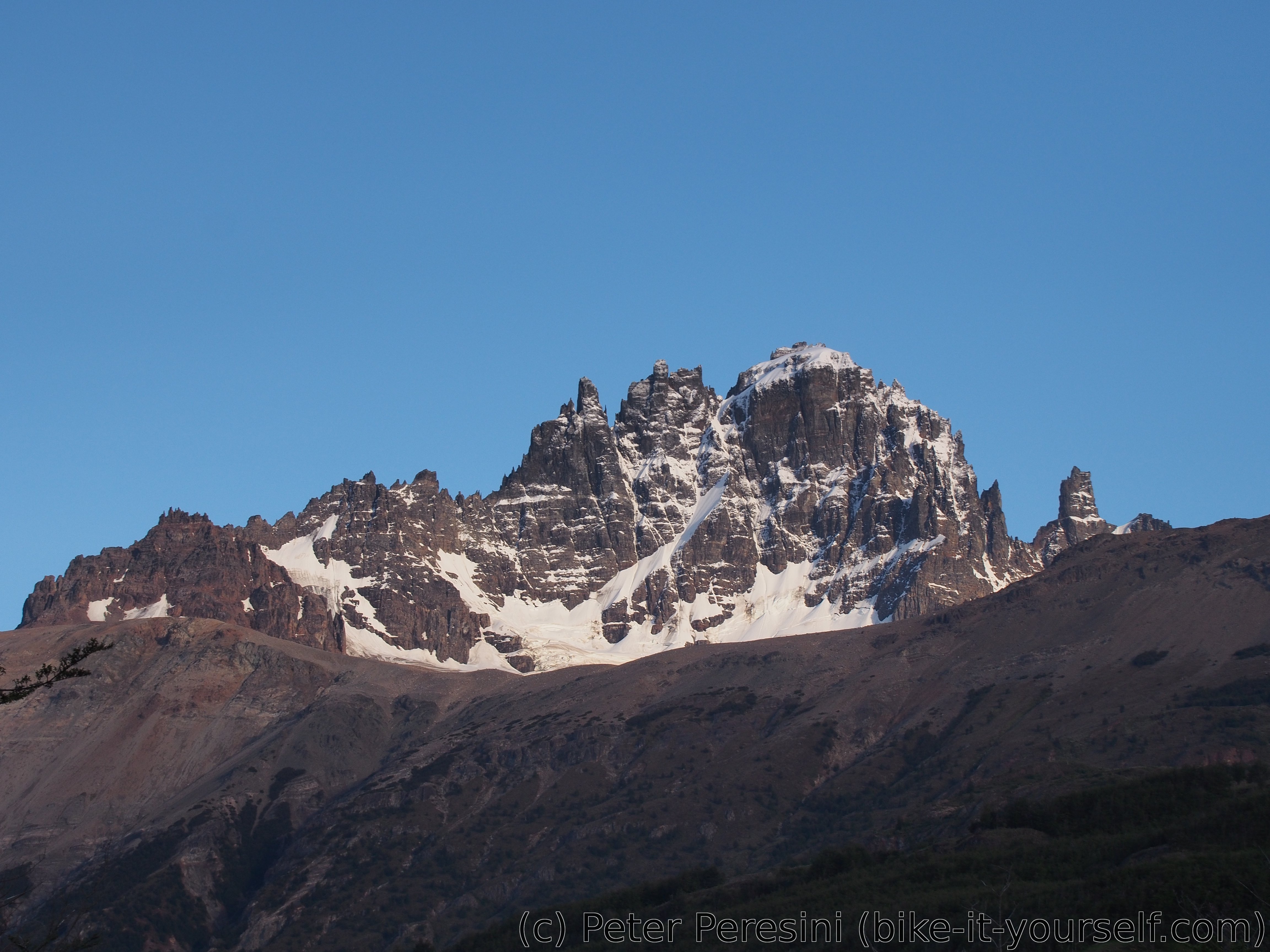
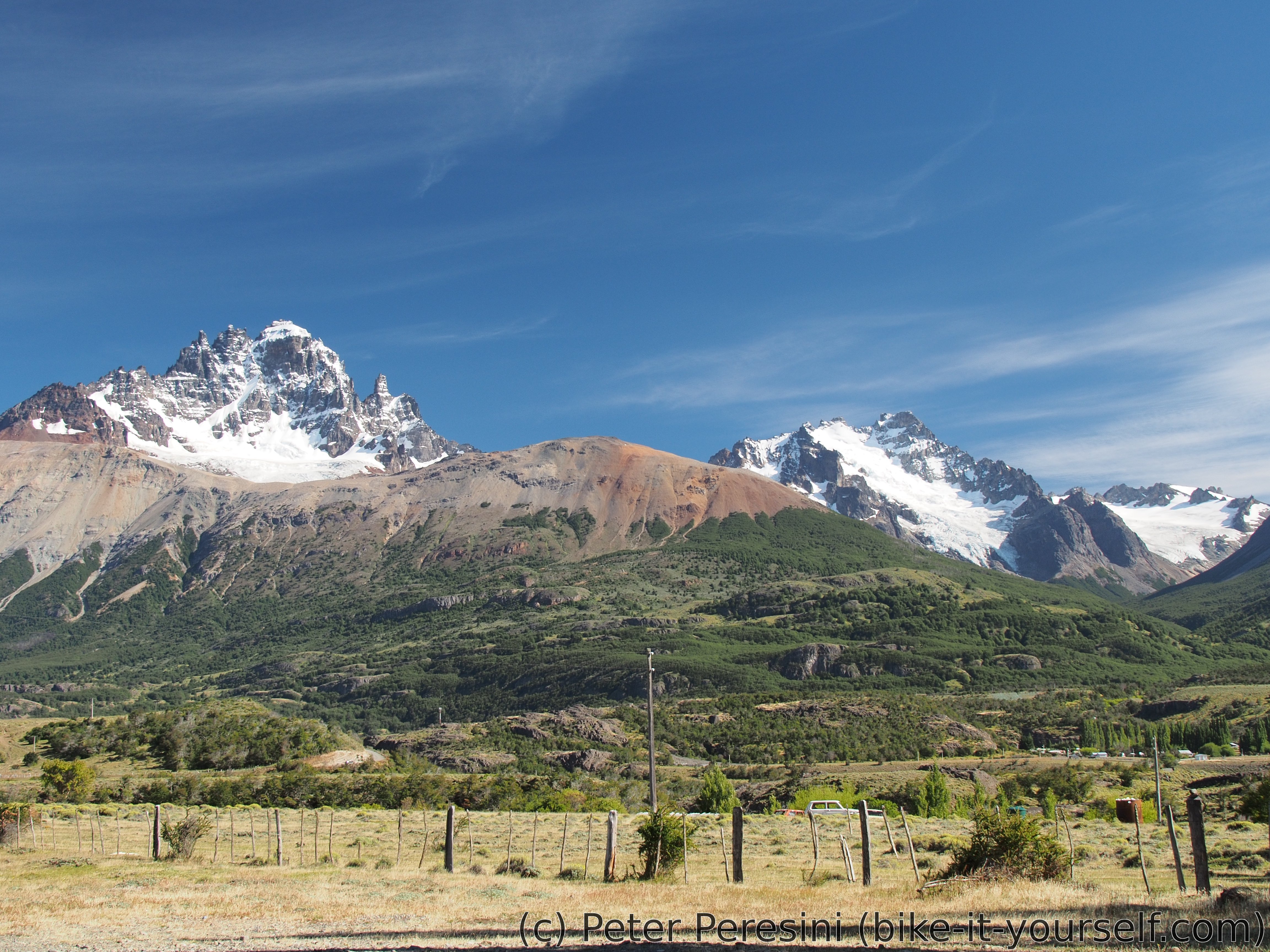
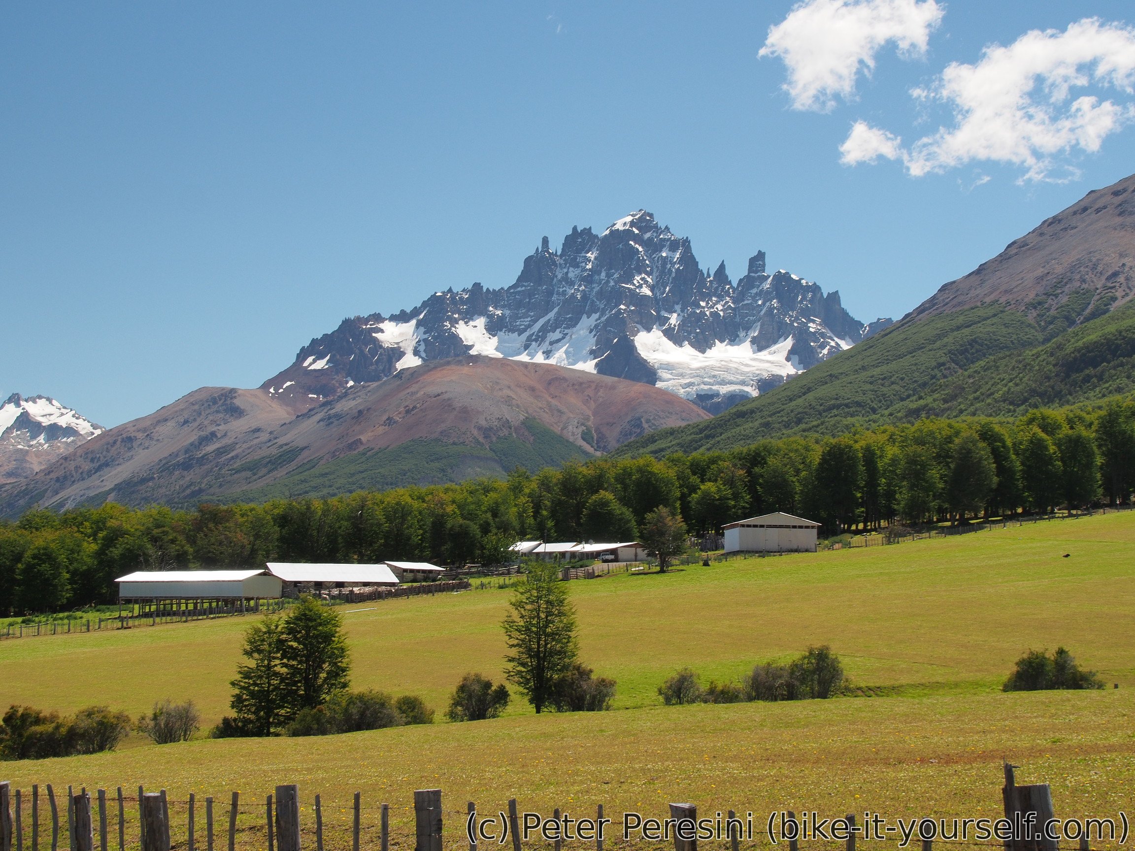
The views of Cerro Castillo are quite good in the morning. The trail goes up through grass more than anything else. This means I can see glaciers and mountains in the distance. It also means that it is quite hot. The look back is also quite interesting -- Villa Cerro Castillo (e.g., the village) and Carretera Austral form a picturesque scenery.
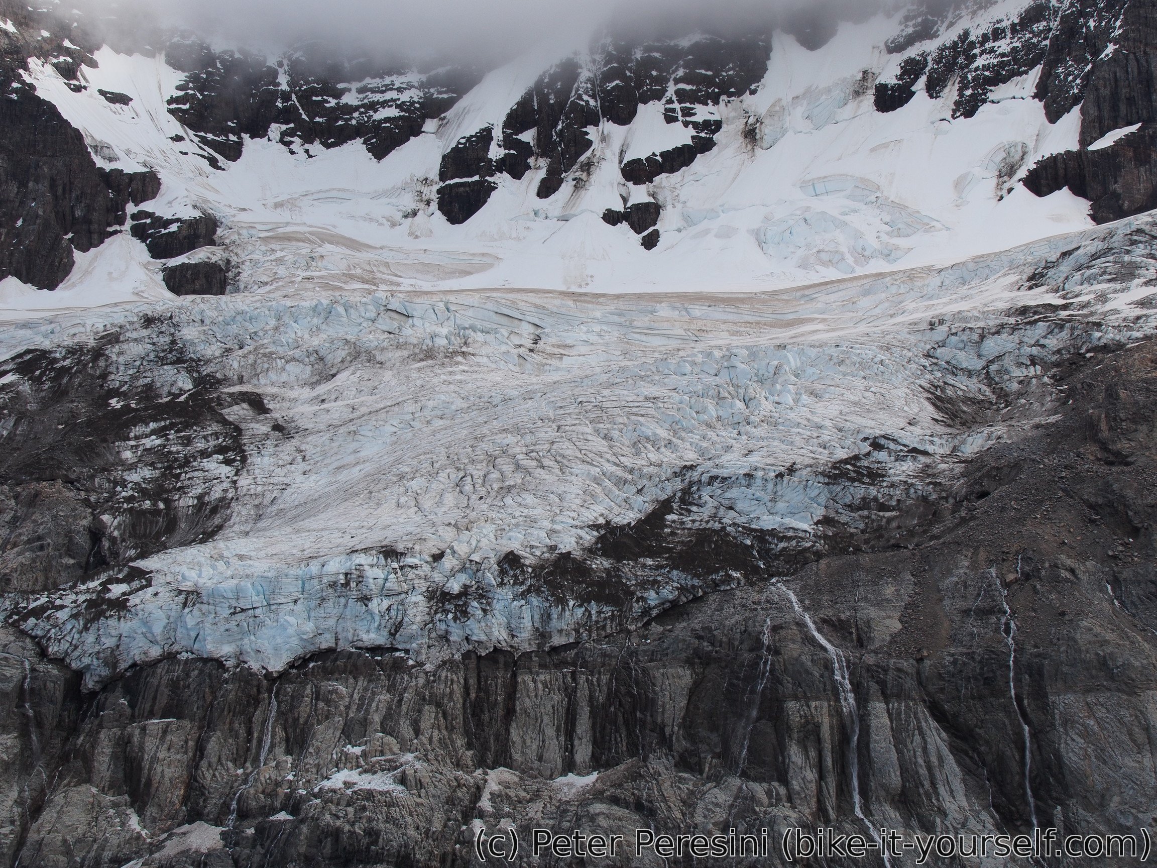
When we finally climb a small pass and we are at the viewpoint above a glacier lake below Cerro Castillo mountain the views are good but could be better -- the Cerro Castillo itself is in clouds. Unfortunately this won't improve over the rest of the day.

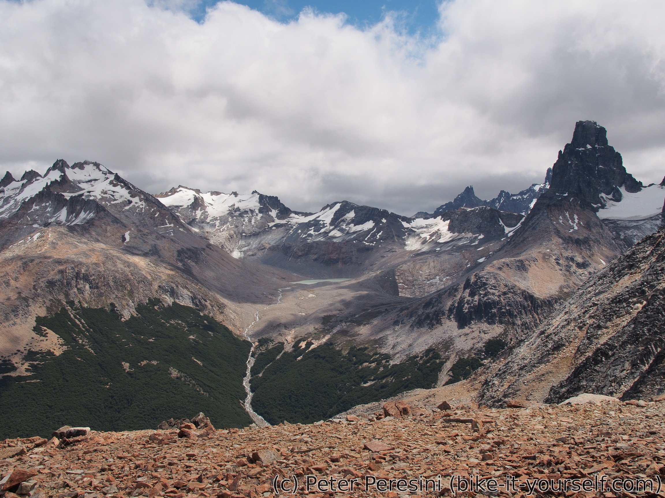
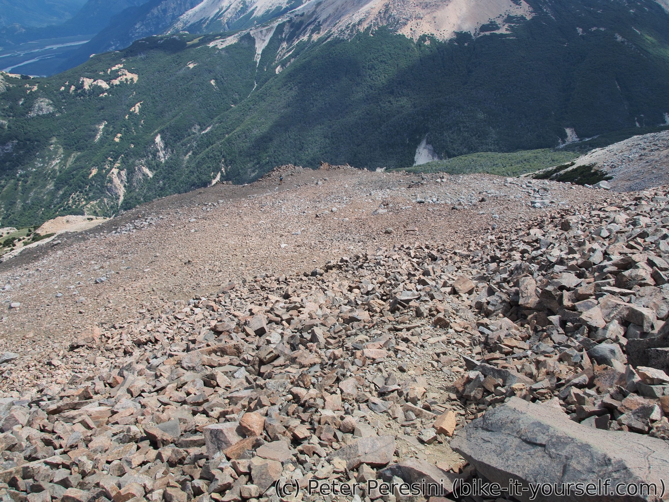
After a lunch we are deciding to climb up even more to 1600m high hill nearby. At the top Bas decides to return but Kurt and me continue down through a different trail. The trail isn't very well visible and I am thanking that I am not with a multi-day-trek-heavy backpack on my back as this trail looks more like a moraine than a normal hiking trail. Plus there is heavy wind here which does not help walking straight. All in all, this is more like a mountaineering descent than a nice touristy hiking trail.
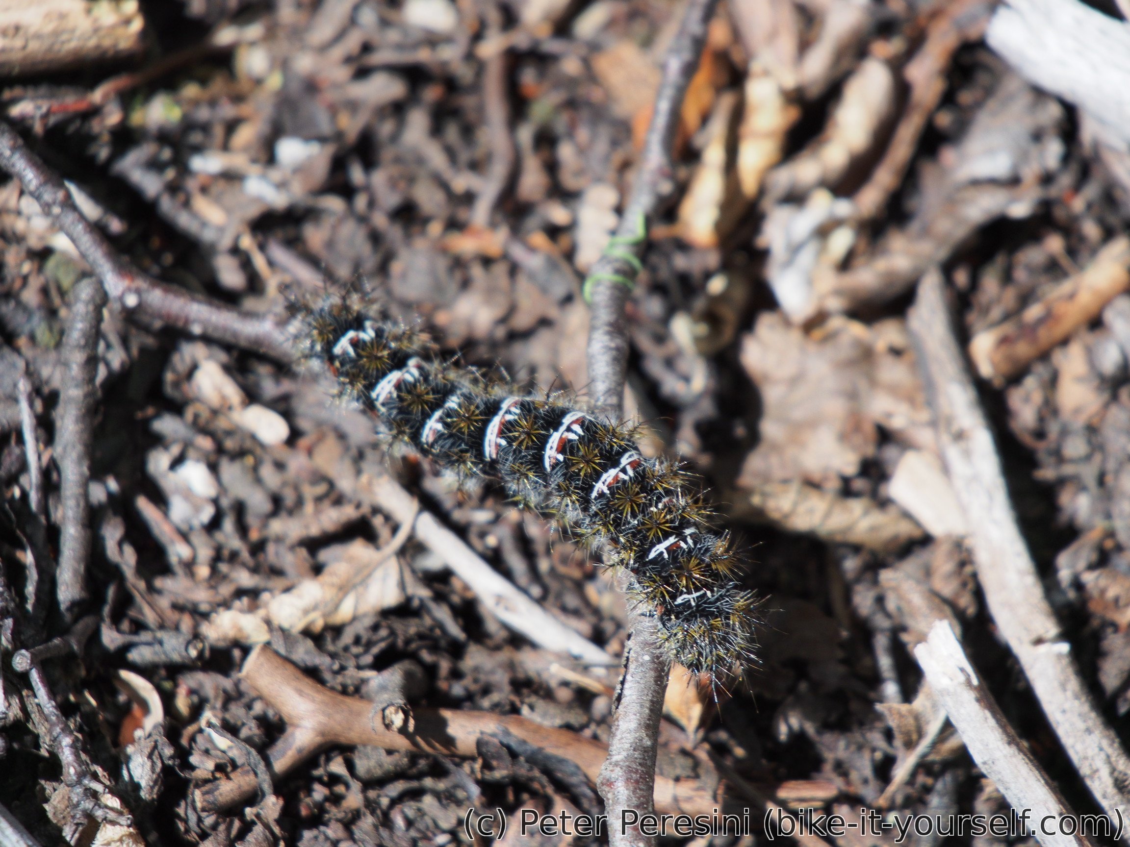
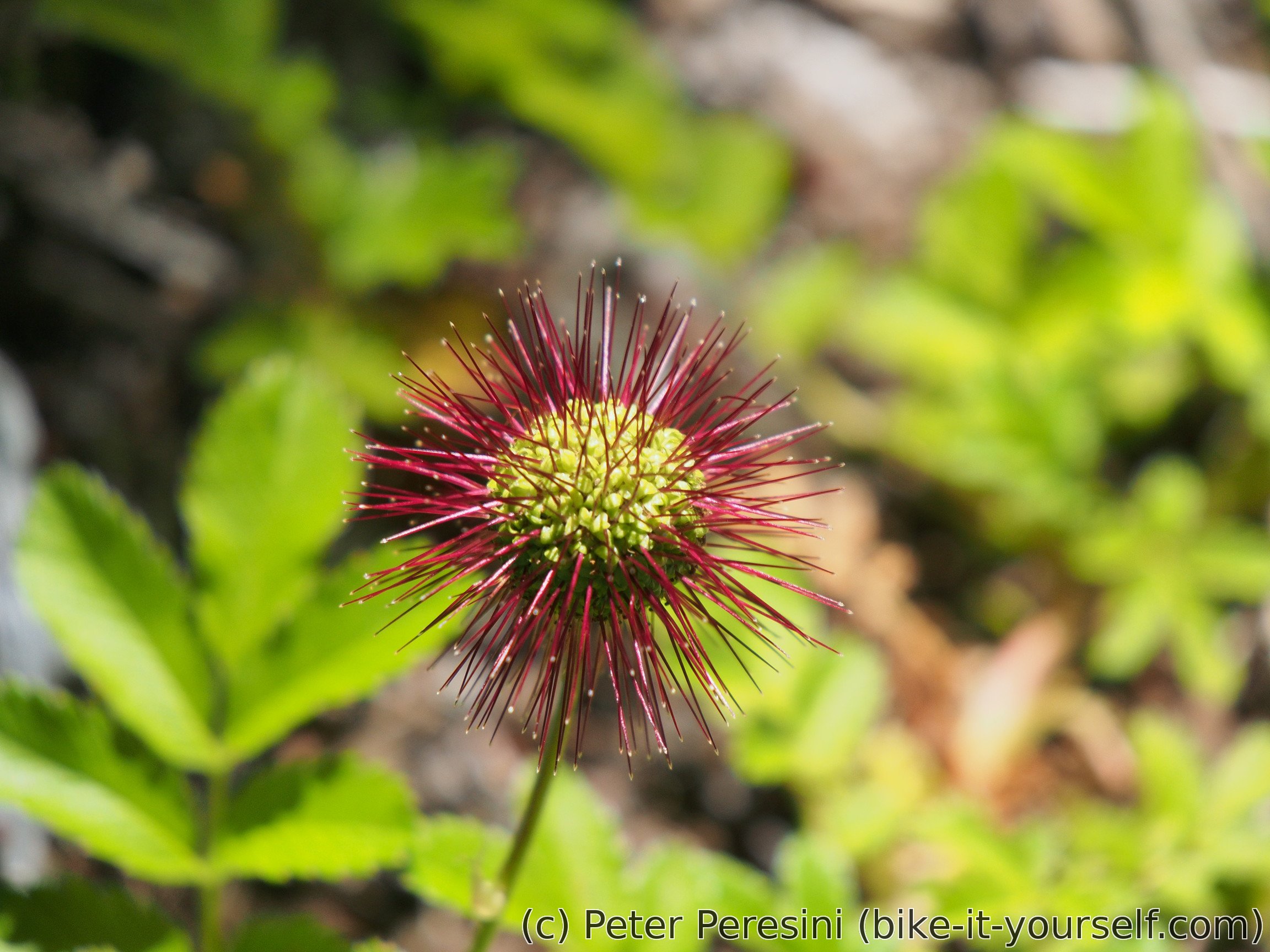
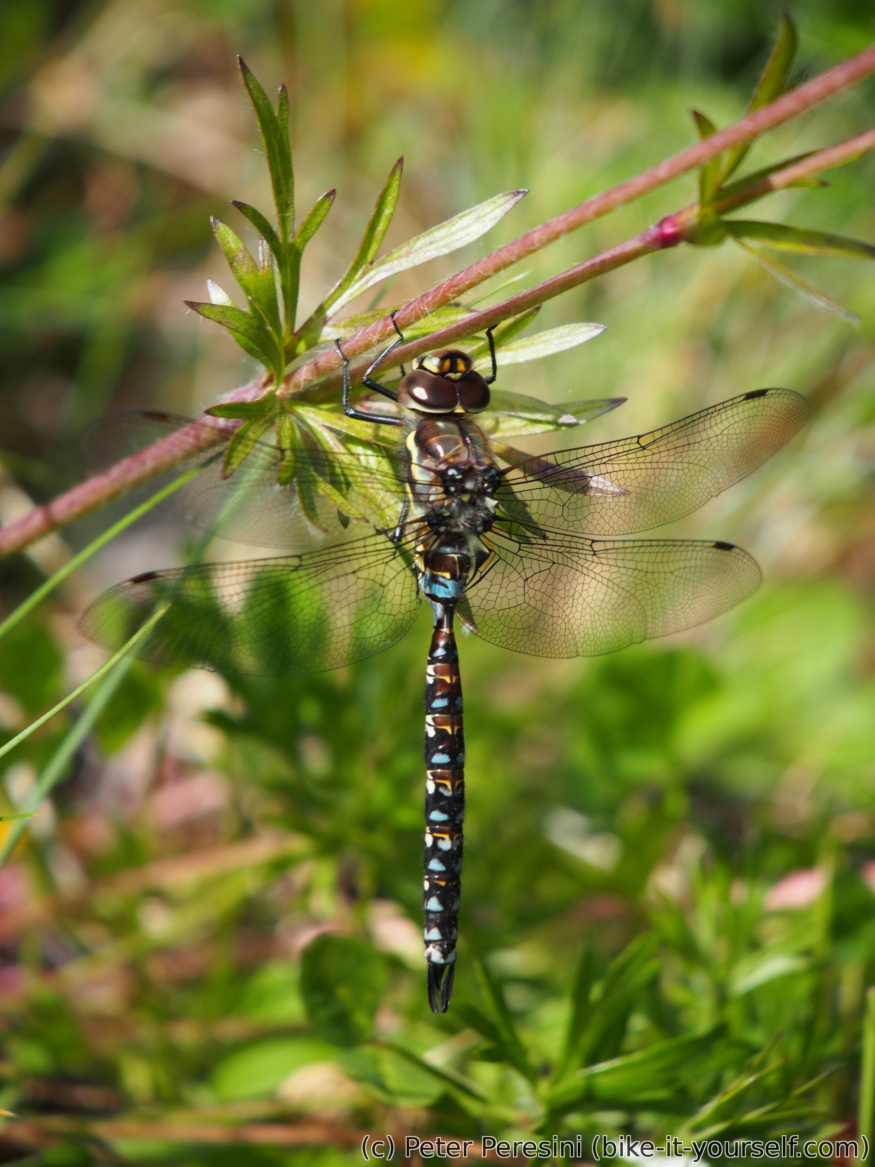
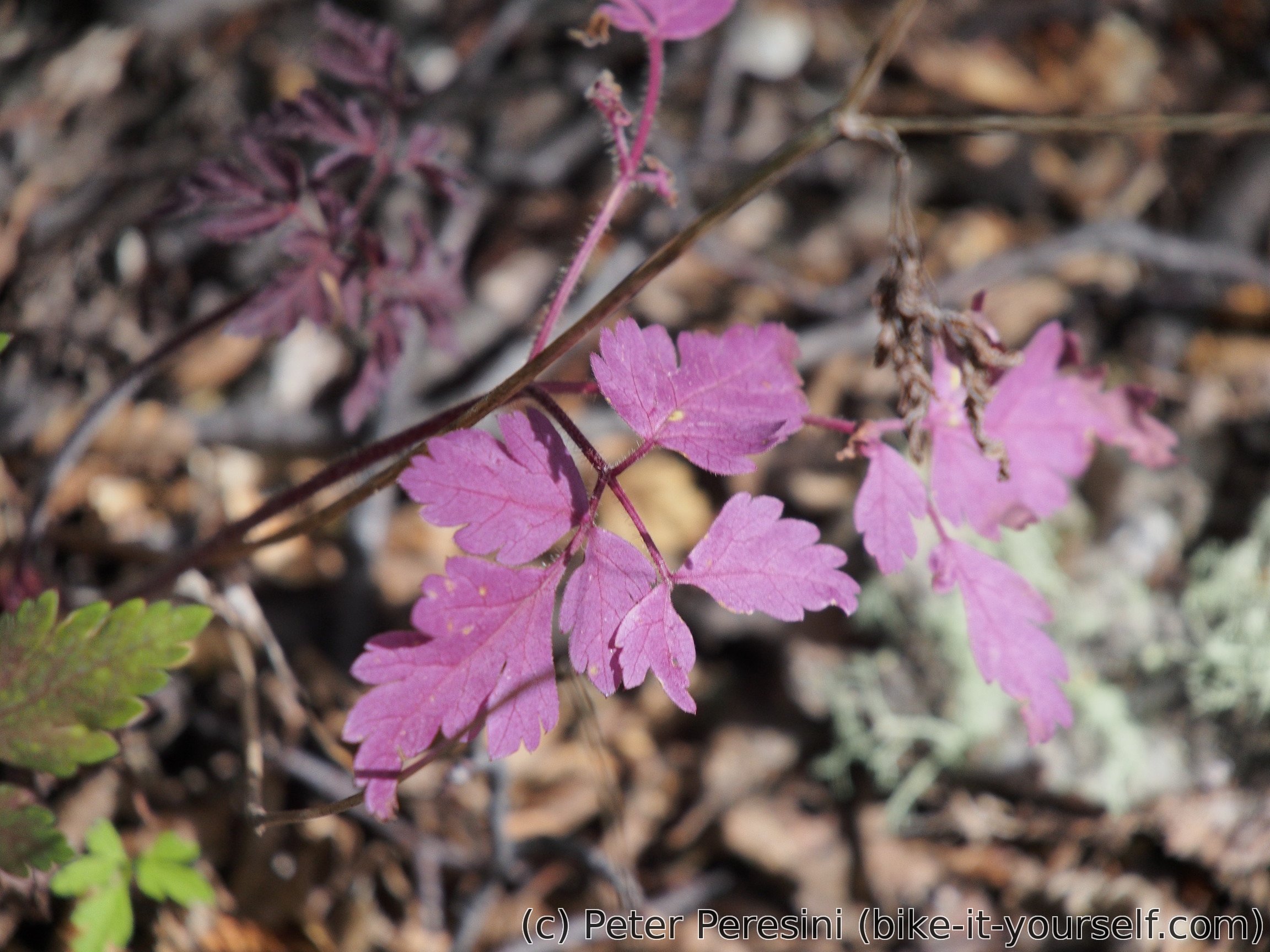
When we are back at the forest, I am saying goodbye to Kurt as he is much faster than me and wants to make it back sooner. Instead of fast walk I am enjoying the magic of the forest with caterpillars, nice plants and dragonflies -- I stop at one meadow for maybe fifteen minutes and try to catch one on a photo but it is hard as dragonflies seem to be quite busy all the time and they never stop for long.
After I descend back to the valley I am entering the last part of the hike. This is a super-boring 6 km walk on ripio back. Fortunately, after 3 kilometers I hitchhike a car (the first one passing by) with a local family. There isn't much that I understand or that I can tell but they are a good company.
Finally back at campsite, I am taking my bike and hoping to do some shopping. Fortunately, while it is quite late, there are still some shops open and I can get things for the dinner. Which is going to cook for a veeeery long time because the stove is a wooden one and we need to re-start the fire that already died out. In the meantime it starts to rain. Quite unexpectedly according to the forecast but the clouds that were tailing me during my hike on ripio already predicted this outcome. And to close the day with anouther (mis)adventure, I manage to lock myself on a toilette. It takes me a long time to figure out that the locking mechanism actually works in the other direction that I thought but to my relief I don't need to sleep there.
January 21
Despite the fact that it was raining in the night the morning comes with amazingly clear sky. It looks like a perfect day without a cloud. For a breakfast I am eating a lot of marmelade because I was able to buy only 500 grams chunk of it and I can store a bit less than half of it. A bit too much sugar for a morning but what can I do?
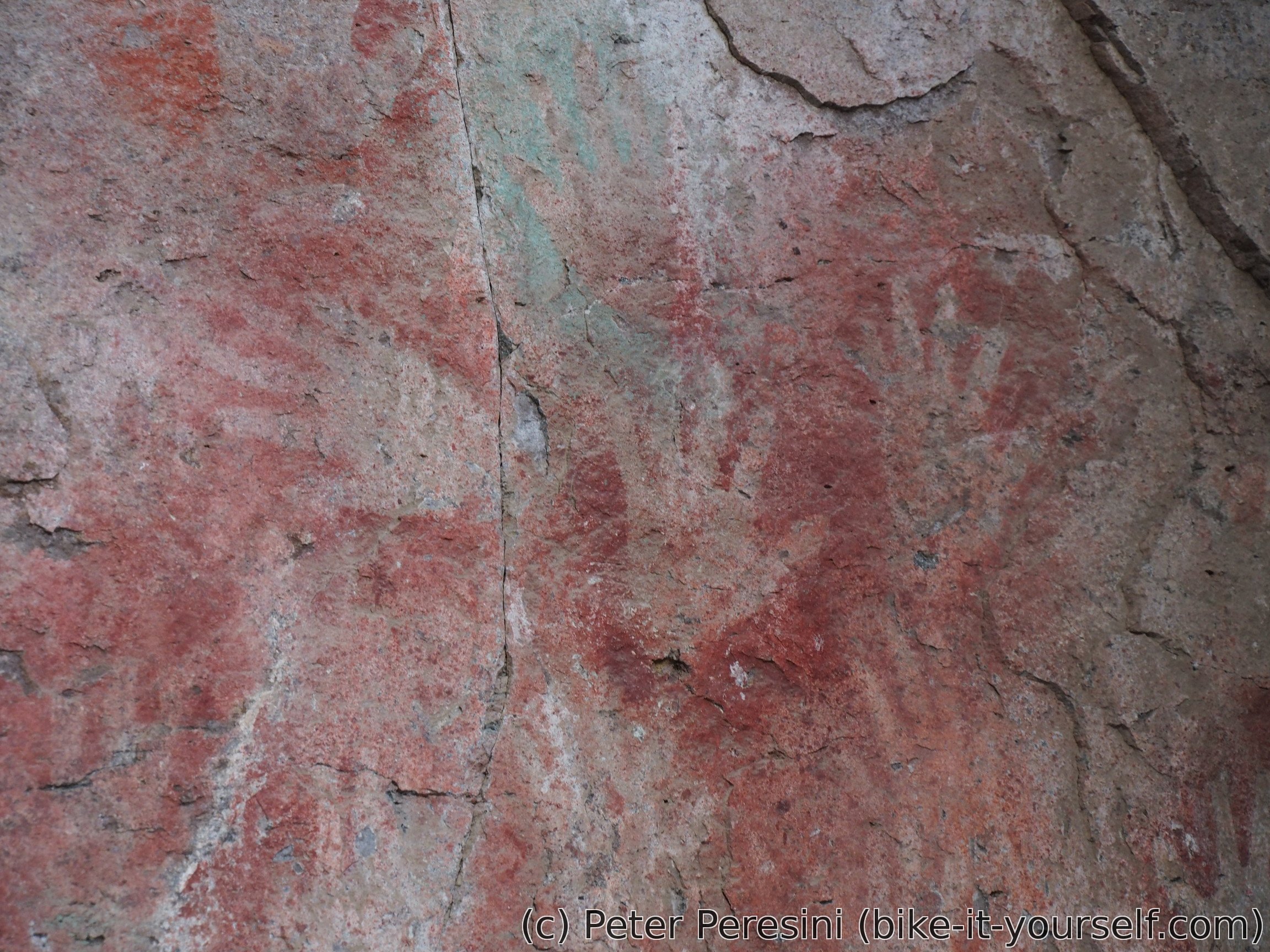
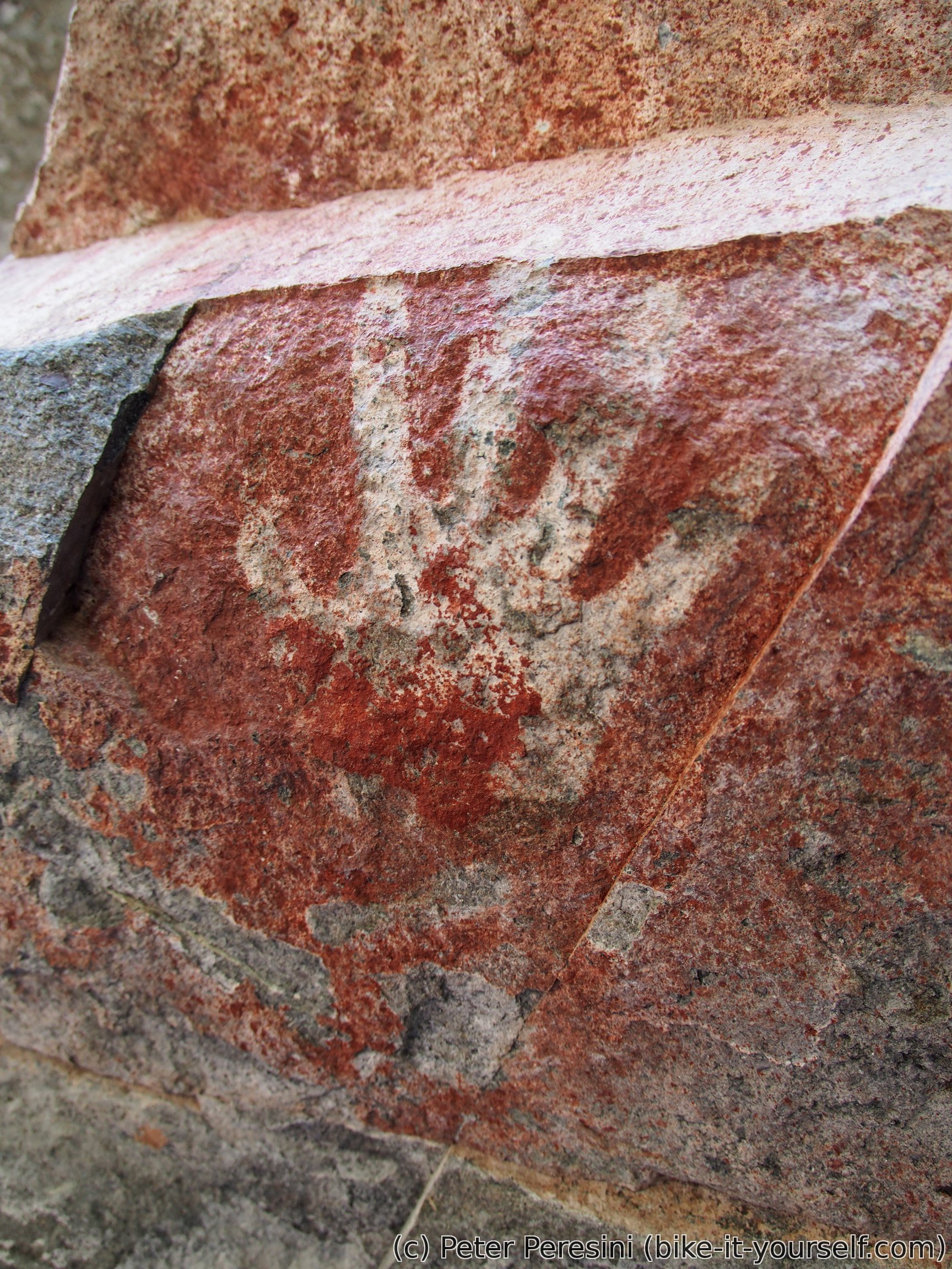
In any case, today's plan is very simple -- go around 30 kilometers to a campsite in the Cerro Castillo National Reserve. But before that I am making a little detour to Paredón de las Manos -- a rock paintings which are about 4-5 kilometers in the direction back so I am not bringing my gear with me. Instead, I am enjoying an unloaded bike. Which is a little bit weird sensation. After these long hours, it is actually hard to ride a normal bike again -- for the first kilometer I am overcompensating steering so much that I feel like a novice on a slackline. But then I get accustomed to the ride and it is great as carrying 30 kilos less makes a difference.
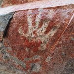
Paredón de las Manos is a little marvel on its own. It is a small archeological site where you can see handprints painted on a rock. They come in different variations -- either positive or negative (depending on whether the hand or the outline was painted) and different colors although nowadays only the red is mostly visible. In either case, this is a site with a lot of history. Afterwards, I am also visiting a small museum in the old school building.
By the time I am back at the camping, pack my things and gpoing to do some groceries, it is almost 2pm. Before a grocery store I am meeting a cyclist travelling from Alaska and a woman which joined him in Mexiko.
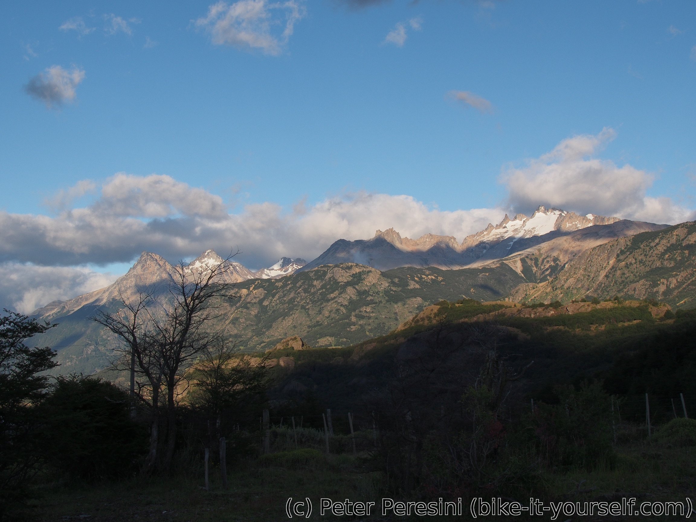
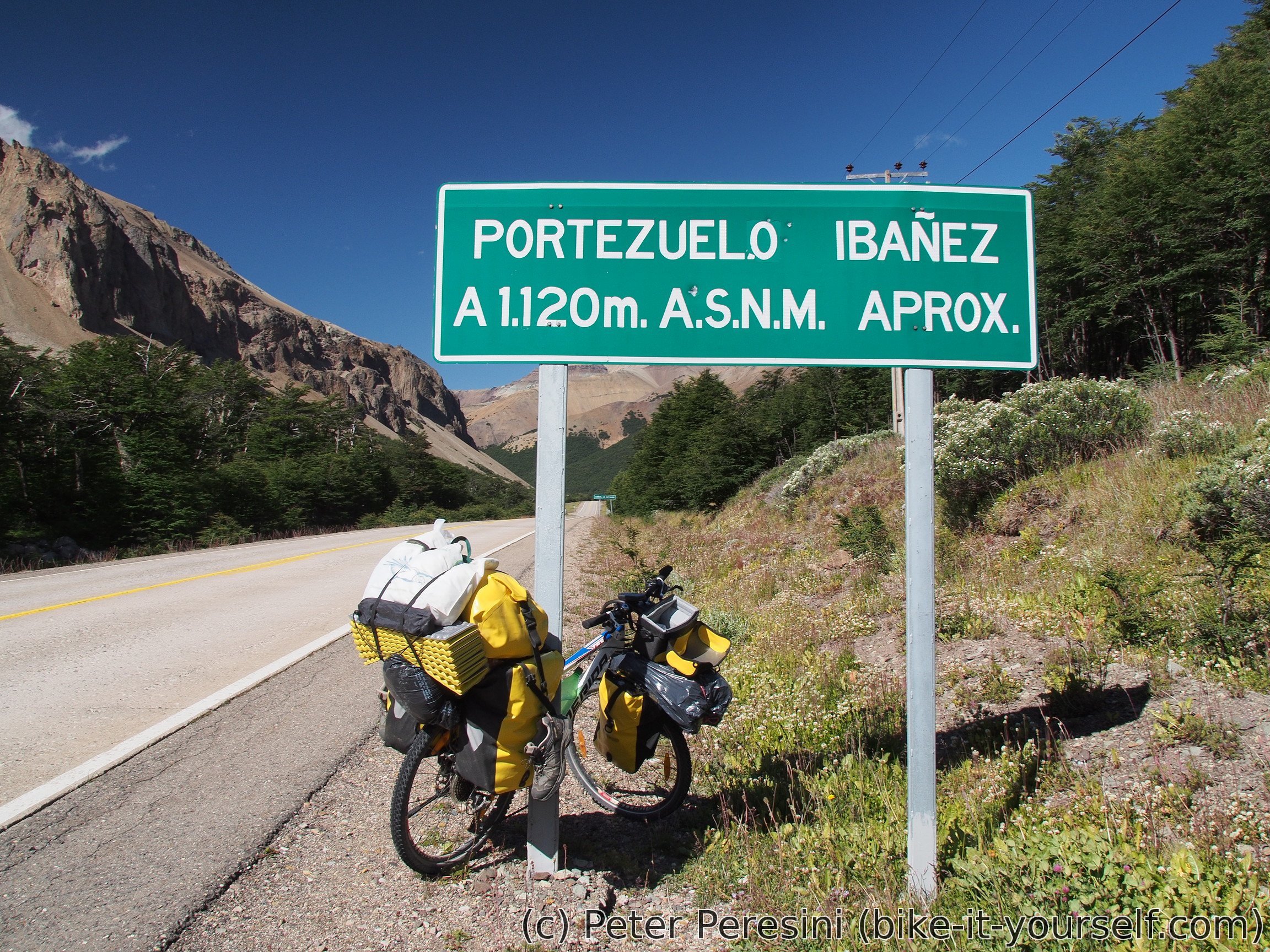
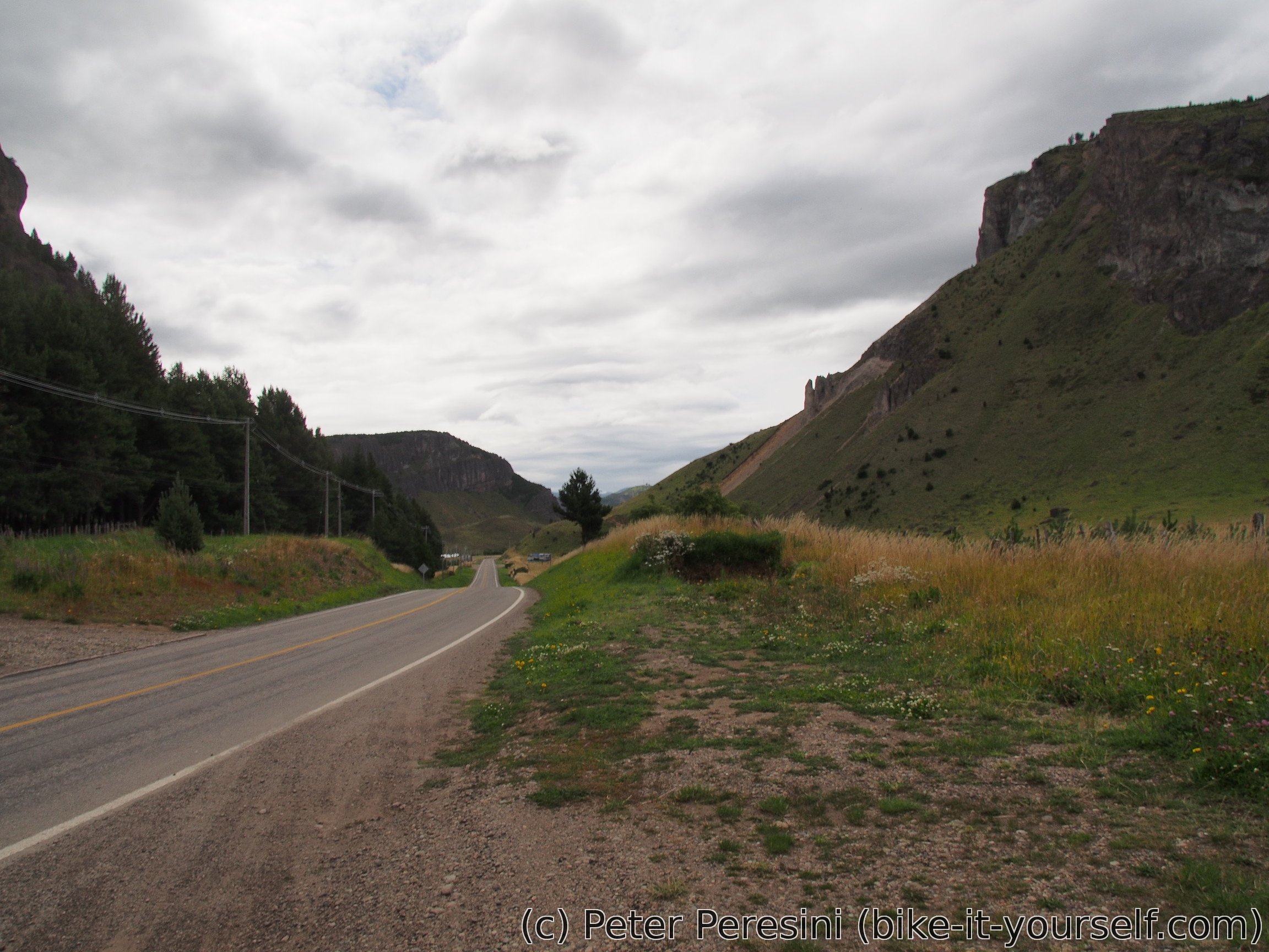
While the day is short, it also brings so far the highest pass on my way -- with 1120 meters above the sea this is one of the few high points on Carretera Austral. The road from Villa Cerro Castillo is paved though and the climb is easy, though a bit long. On the other way of the pass the ride is amazing -- I have a tailwind and a long and not very steep descent.

On the descent I am meeting a hiker which stops me. He explains to me that he met a Huemul with an injured leg and tells me to tell the park guardian. I promise to do that but then I am welcomed by a second climb which slows down my progress. In the end the hiker hitchhiked to the camping and is there sooner than me. Unfortunately, the park guardian is not there right now but the office is unlocked so he stays waiting in front of the cottage. I just hope the park guardian will get there soon and go back to the camping without paying (I plan to do that tomorrow).
January 22
To my surprise, it is quite chilly in the morning. My quick inspection of my GPS tells me that I have 5 degrees of Celsius in my tent, this further drops down to 3 as I open the door. So instead of a chilly descent, I am planning to go on a simple hike.
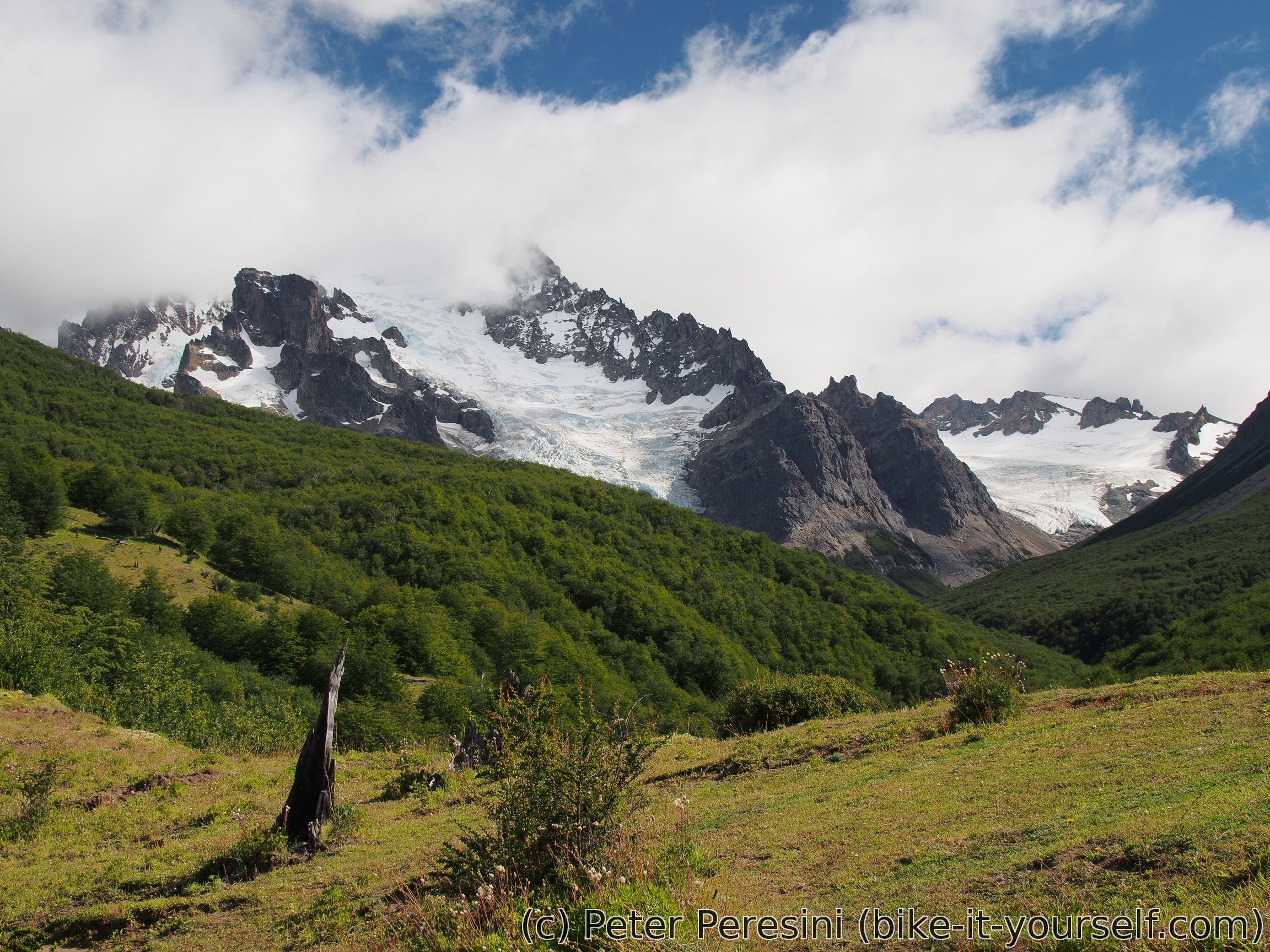
The hike is named Buena Vista and looks to be going around the lagoon. As the there are high clouds, is it still quite chilly and on my way I am scaring a rabbit which hops away. As I go more into the hike, the trail suddenly turns upwards to the woods. Hmm, I should have known that "Buena Vista" name with trail length (around 2km) which does not correspond to the estimated time (which is around 2 hours) is not going to be super easy. And I am making it even harder as there is apparently a trail going up the nearest hill. It is not a stellar trail as the upper part is on a rock scree and it really goes to a place with good views as it ends near a top of a highest mountain around me. I am actually tempted to go up the to highest point but after some scrambling I am returning just 70 vertical meters from the top. The way is quite steep, there is no used path and I am not sure if I am allowed to climb there anyway plus the spot is super-visible from the guardian hut.

I am back at the tent after 11am and the tent is dry by this time so I am packing and leaving, but before that I am making a stop in the guardian office to pay for the camping. This time there is a ranger there.
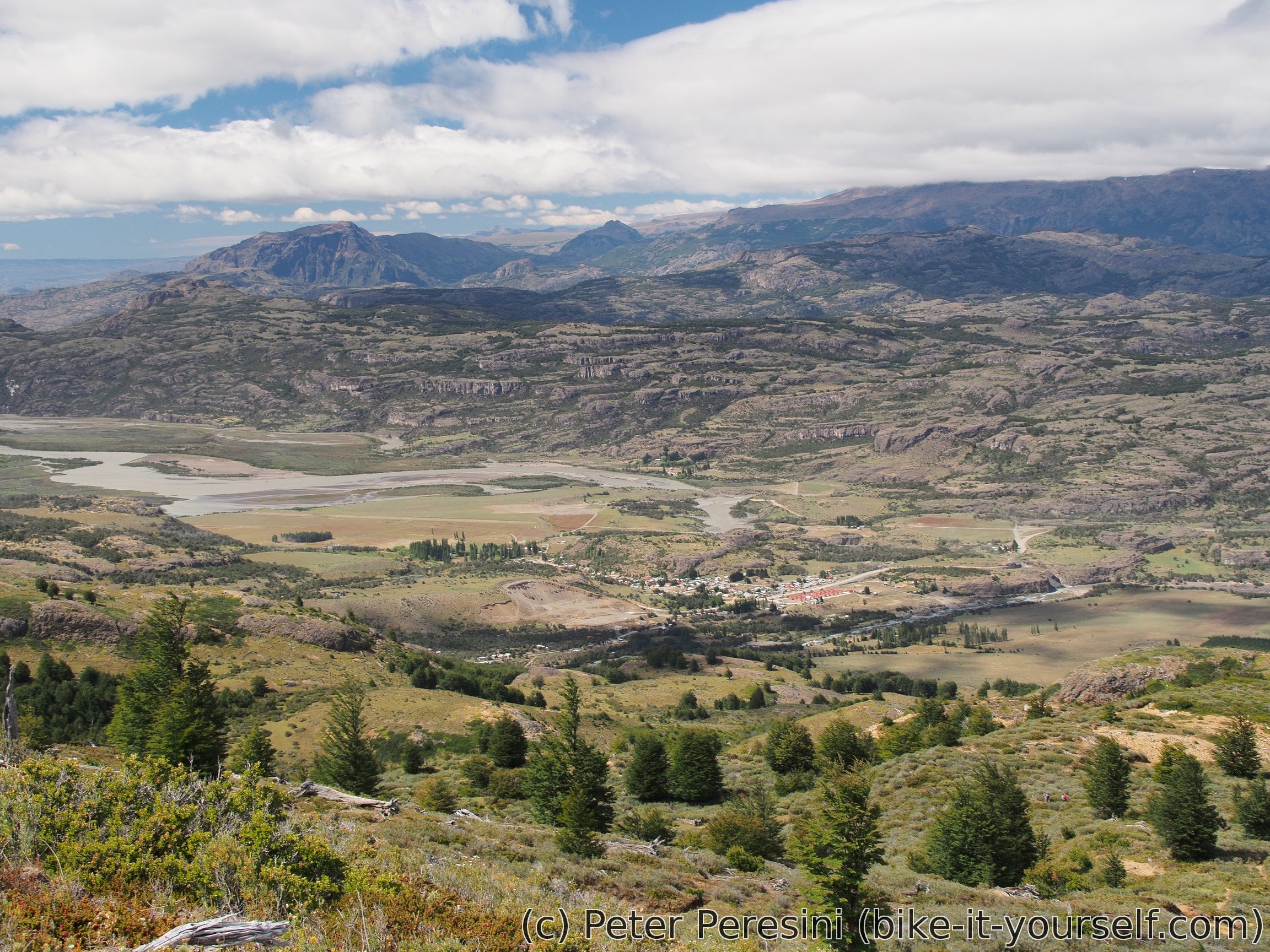
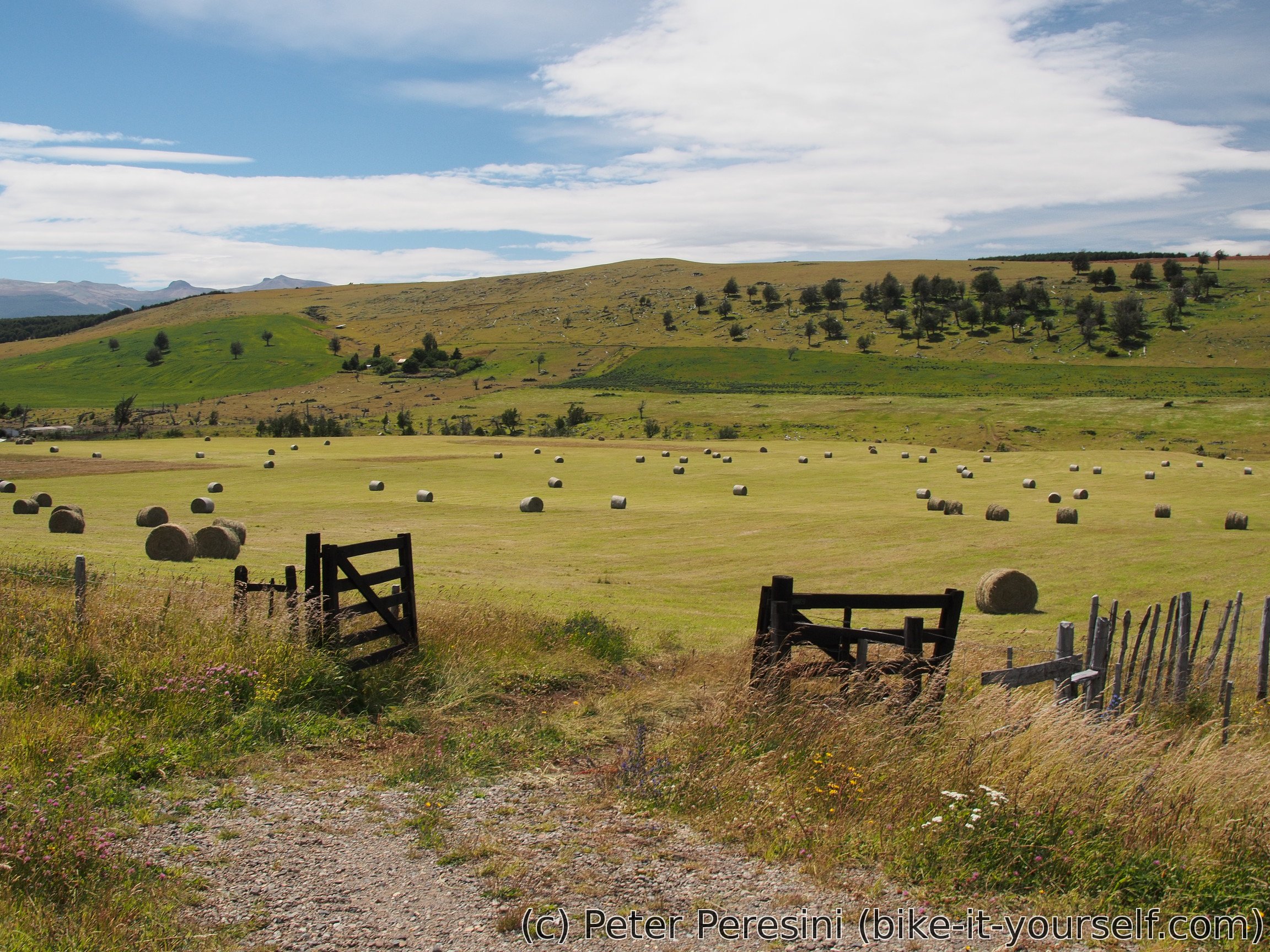
Today's plan is to go 60 kilometers on a paved road. Sounds easy, right? As I descend to the valley, the views shift from mountains to green fields. The road should have rang all the bells in my head though -- it goes north-west on a flat terrain. What could go wrong? Well, it's my usual enemy the wind. Fortunately, the wind is not Patagonian-strong here so I am able to go against it.
There is another annoying part of the road though and that is cars. the road is not particularly curly and some cars going in the opposite direction decides to overtake despite me being in the way. Not very nice. In the absence of other ways to tell the drivers what I think, I am resorting to the standard middle finger gesture. And I can tell you, I am getting a good practice.
At Coyhaique I am arriving at El Camping. A nice campground with a fast wifi though without a communal kitchen. I will stay there for two days.
January 23 and 24
These two days are quite busy. First I am buying a new chain. I still have around 400km left on my current one but I don't expect to be able to buy a new chain very soon. In fact, the first bike shop did not have a chain for me and in the second one I bought the last 9-speed chain they had. I am also getting a new front derailer and trying to fix a bike stand which suffers from my heavy bike and is slightly bent so I need to bend it back and figure out how to make it so that there is less torque on it. Apart from bike, I am also fixing myself -- I finally get rid of the bandage on my leg and check that the wound is healing all right. Next I am buying new sandals and I am getting a new haircut. Finally, I am spending a lot of time tending to my photos and the blog.
Route
Download simplified GPX of a route here
Stats by activity:
| Activity | Distance (km) |
Ascent (km) |
Pedal rotations (thousands) |
|---|---|---|---|
| bike | 108 | 1.6 | 22 |
| hike | 27 | 2.0 | - |
| Date | Distance (km) |
Ascent (km) |
Avg. temp (moving, C) |
|---|---|---|---|
| Jan. 20, 2017 | 20.8 | 1.46 | 16.7 |
| Jan. 21, 2017 | 48.4 | 1.18 | 21.5 |
| Jan. 22, 2017 | 65.2 | 0.92 | 18.1 |
Elevation data
The next table is only for cycling activity.
| Grade(%) | Ascent (km) | Descent(km) |
|---|---|---|
| < 2 | 34.3 | |
| < 4 | 5.7 | 12.2 |
| < 6 | 3.6 | 6.7 |
| < 8 | 2.5 | 3.9 |
| < 10 | 3.2 | 1.7 |
| ≥ 10 | 3.4 | 1.9 |