
Machu Picchu
 Share:


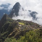
The Salkantay trek continues with a visit of Machu Picchu -- the famous Inca ruin. The "lost" city is definitely an impressive sight which makes you wonder about the greatness of the people who built it. And the hike to Aguas Calientes along a railroad is interesting as well. There is only one problem -- with Machu Picchu being #1 tourist attraction of the whole Peru, getting some solitary photos is totally impossible.
July 26
As a continuation of the Salkantay trek, today we have two options. There is a hike along an unpaved road to Hidroelectrica. Or an option to go ziplining and get to Hidroelectrica by a car. Given my experiences in enjoyment of dusty roads full of traffic, I choose the second option -- so far I never did ziplining so why not try it anyway?
A car picks us (i.e., the guys/ladies that go ziplining) and we rattle for a while until we get to the ziplining center. There we get a safety harness and a helment and we are ready to go flying over the valley. I must say the ziplining is quite fun, seeing the bottom of the valley zooming by at rather high speeds. Of course, the "adrenaline" part of the selling pitch is completely lost on me. I guess I would need to go ziplining without a safety harness just holding onto the pulley to get the real adrenaline rush. Anyway, with ziplining I did a major mistake of the day. I forgot to apply mosquito repellent in high quantities. And as it takes more than an hour for our group to go through all five ziplines in the complex I end up looking like an inverse mushroom.
With the fun activity done we continue by car to Hidroelectrica. From there it will be walking along a rail tracks. But before that there is an important part of the day, namely lunch. We walk a bit until we come across the restaurant our guide was telling we will meet at. I must say that I already miss our perfect cook. The restaurant dish tasted just too bland to me.

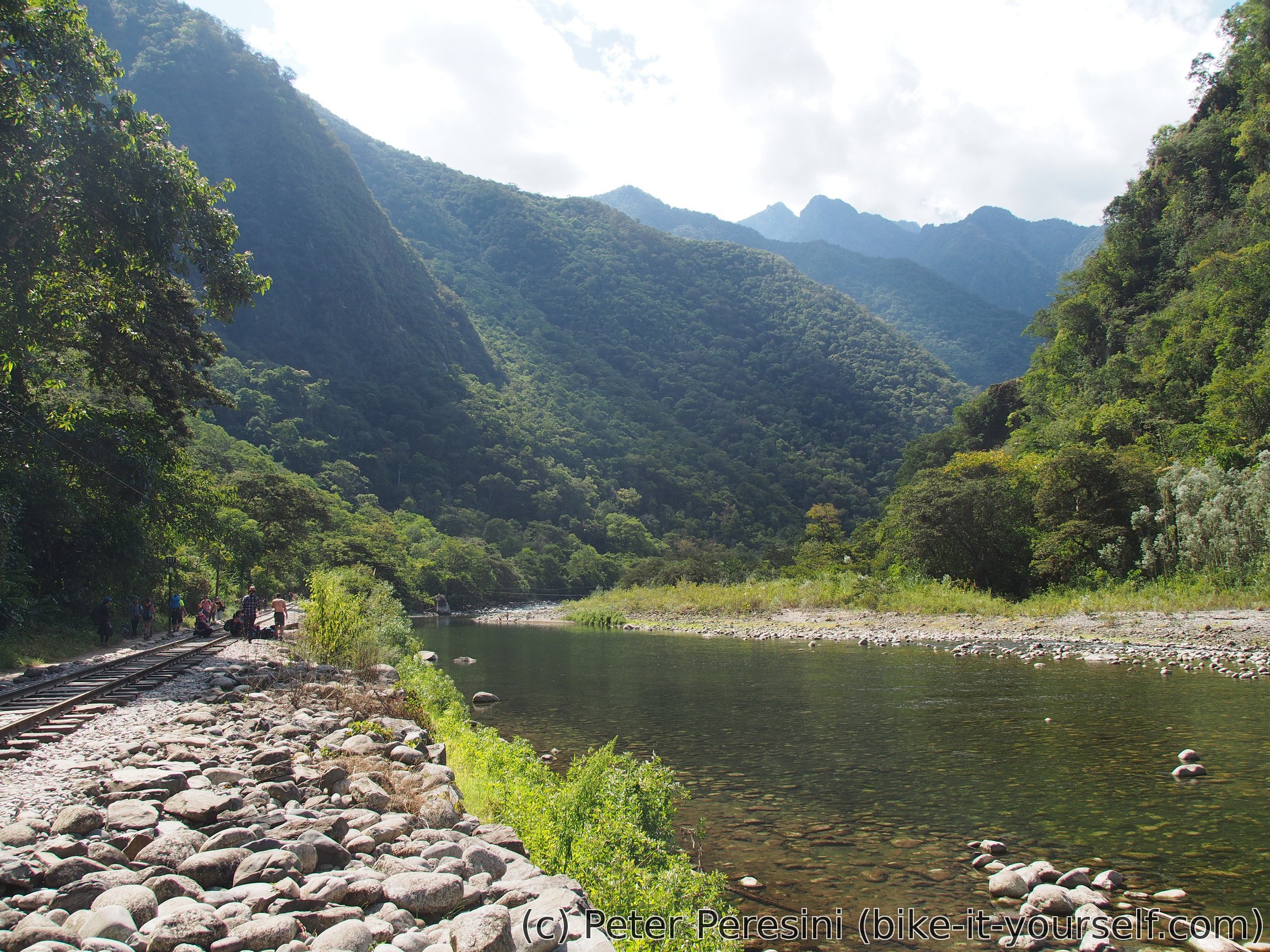
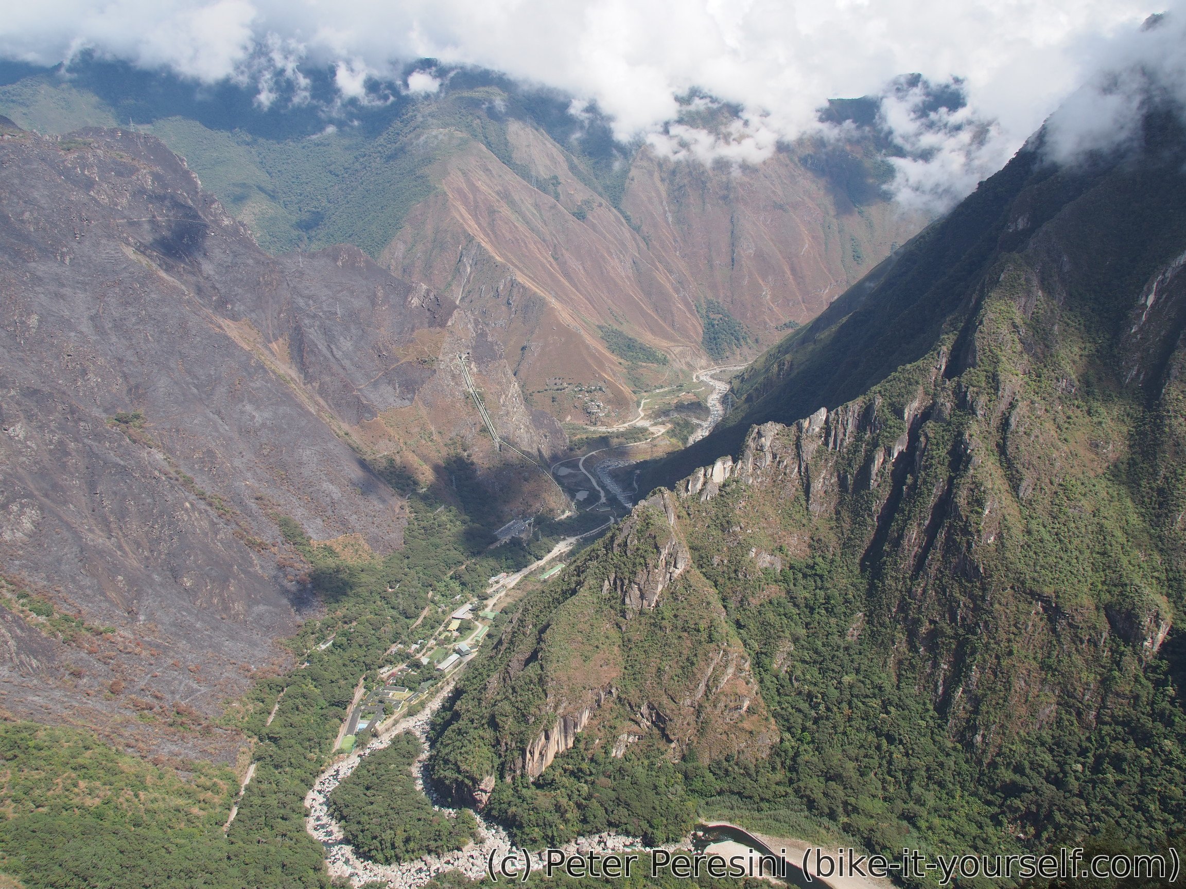
From Hidroelectrica it is about two hour walk to Aguas Calientes. The trail goes next to the railway line, sometimes quite close. And sometimes it is just easier to walk on the tracks anyway. With all the posters advising not to do that I guess this must be a bit dangerous. But then the tracks doesn't seem to be in a shiny new condition so I have no fear of a Swiss-like train suddenly pulling from behind a curve at 100 kilometers per hour.
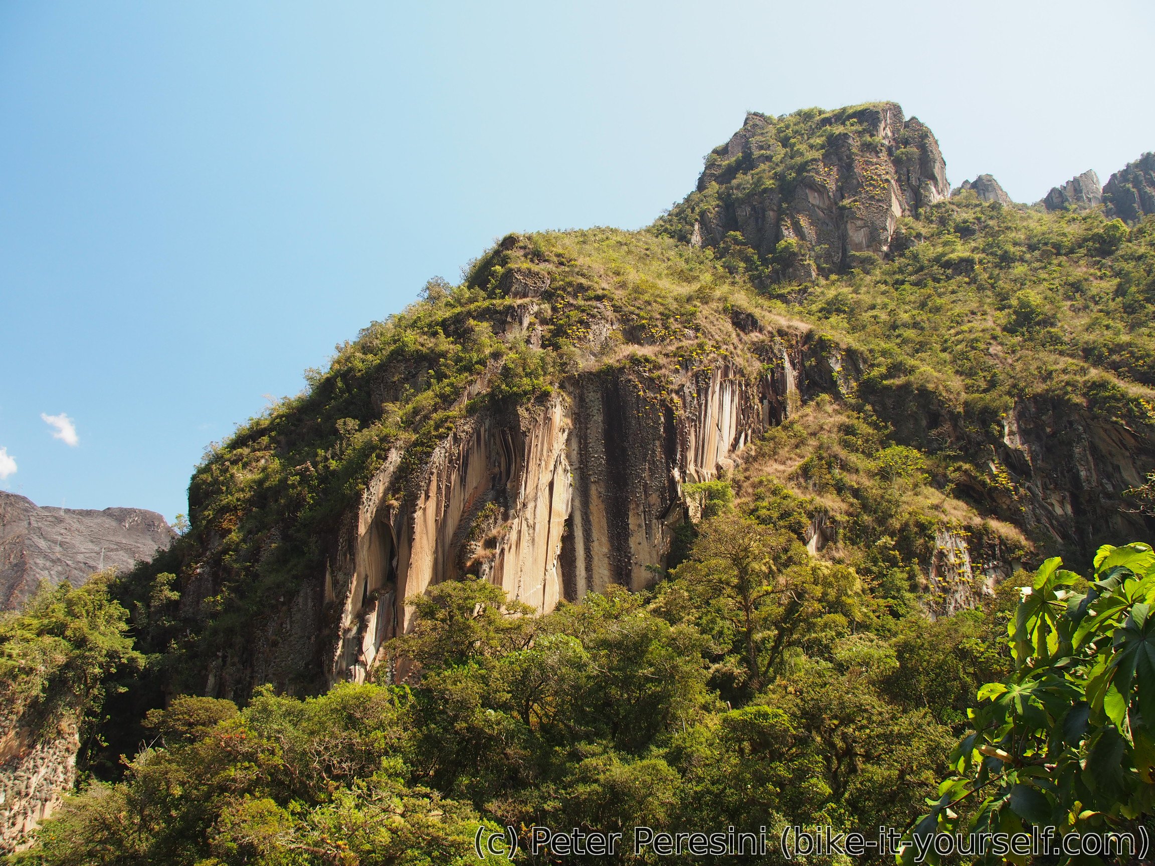
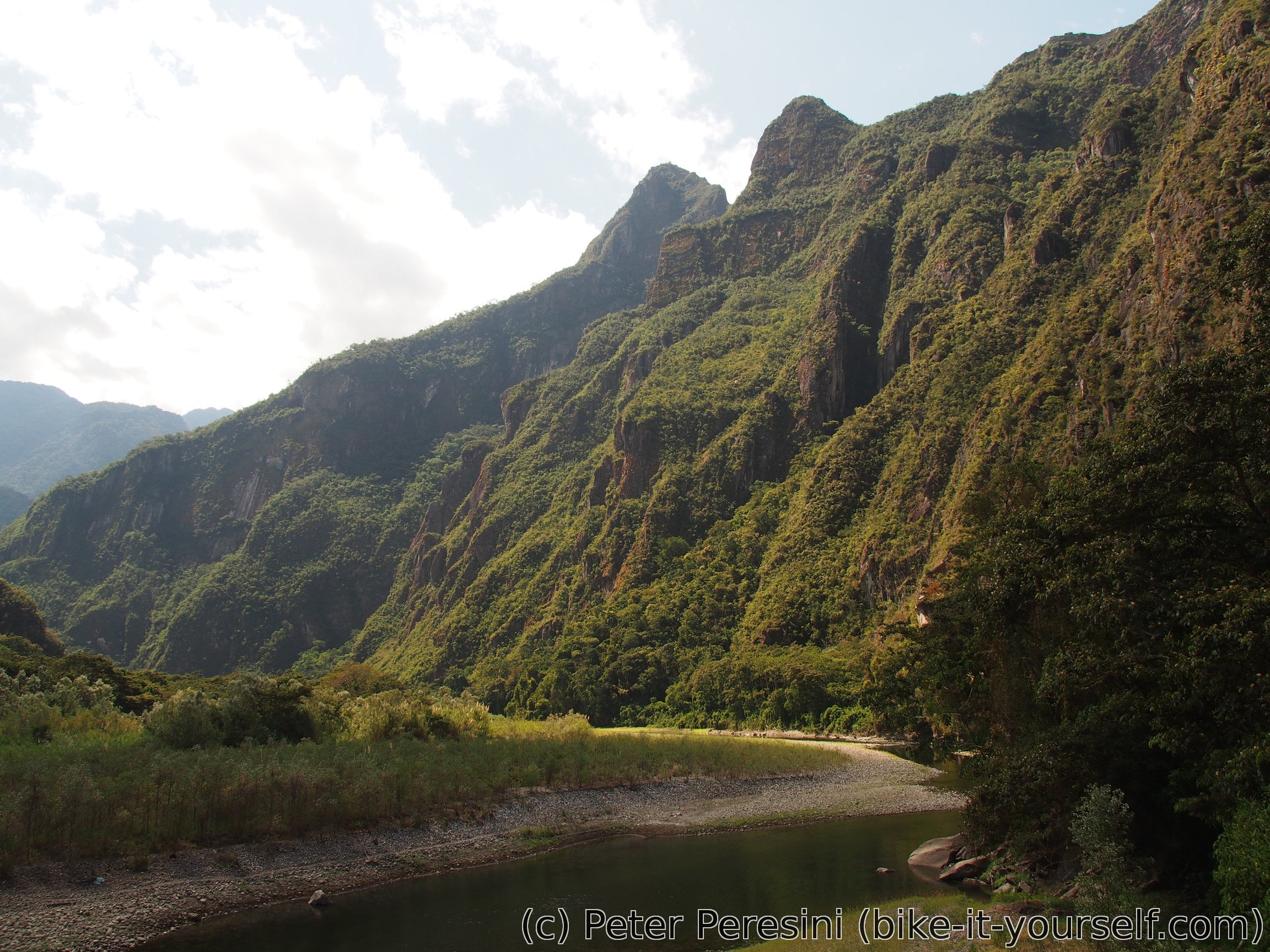
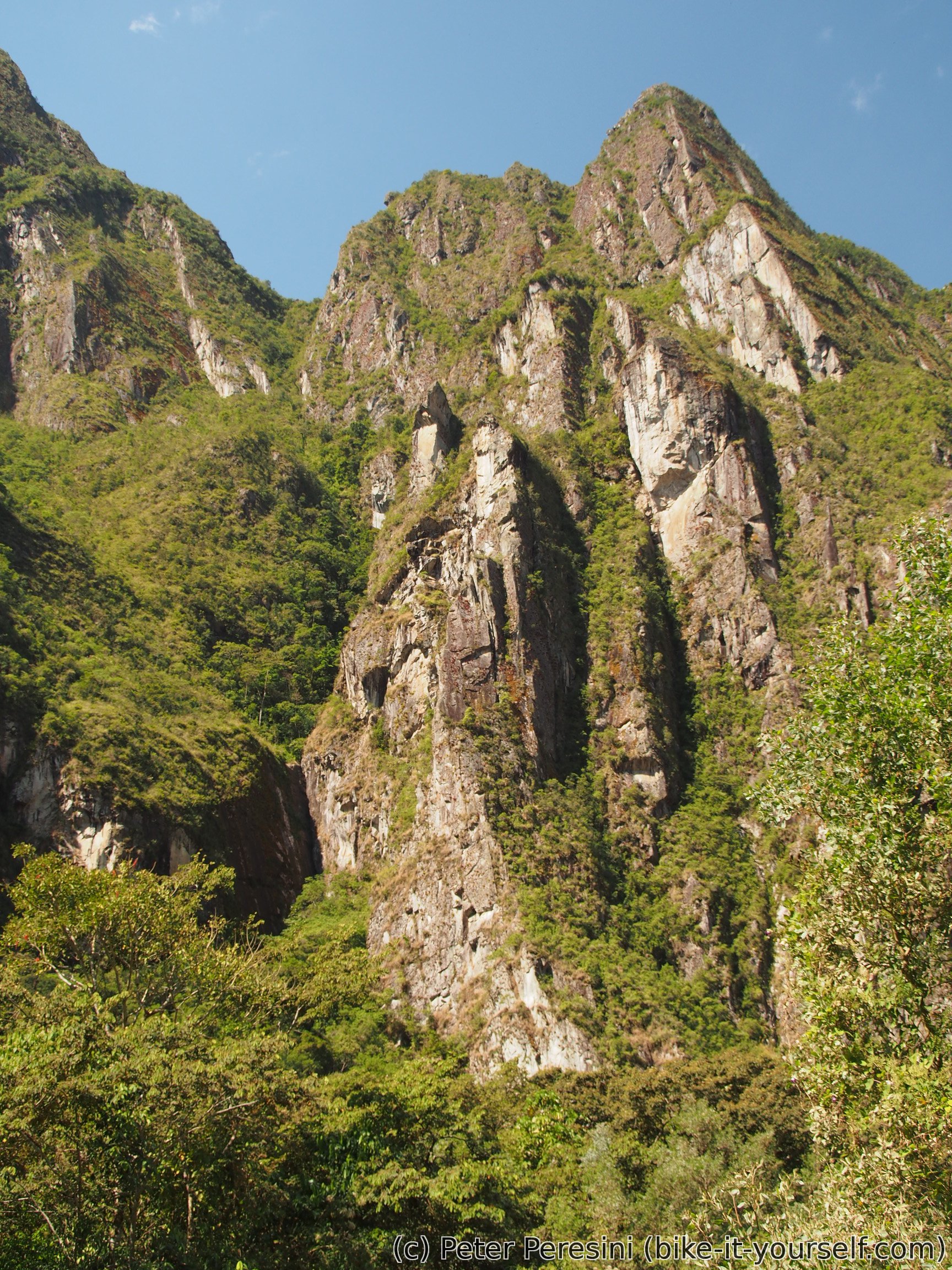
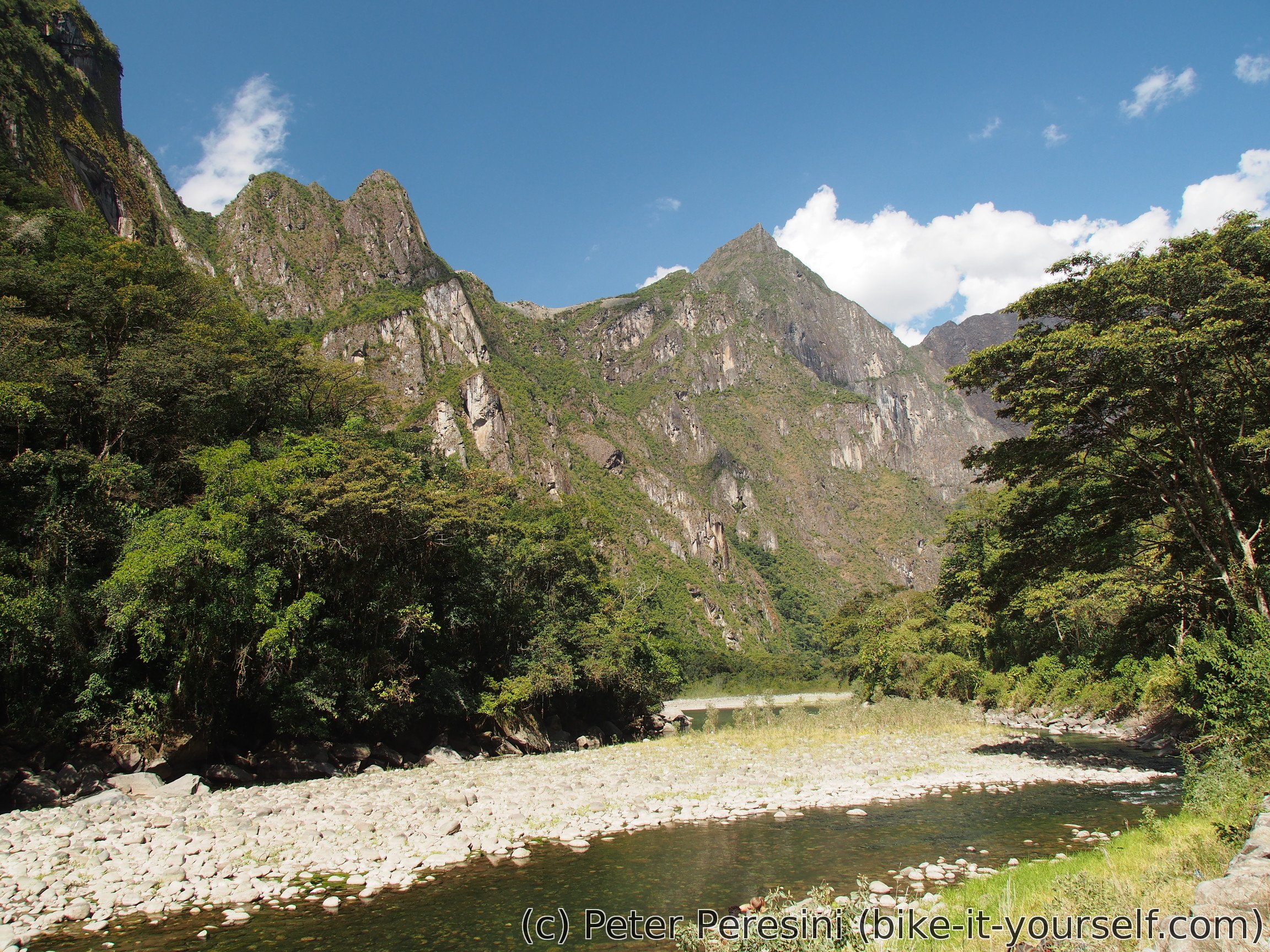
The railroad goes inside a scenic valley. Overlooking from both sides are steep cliffs of mountains. And to top up, everything except for the rocks is deep green. Which is why I am quite happy that there are some clouds over us -- as soon as the Sun starts shining it gets really hot.
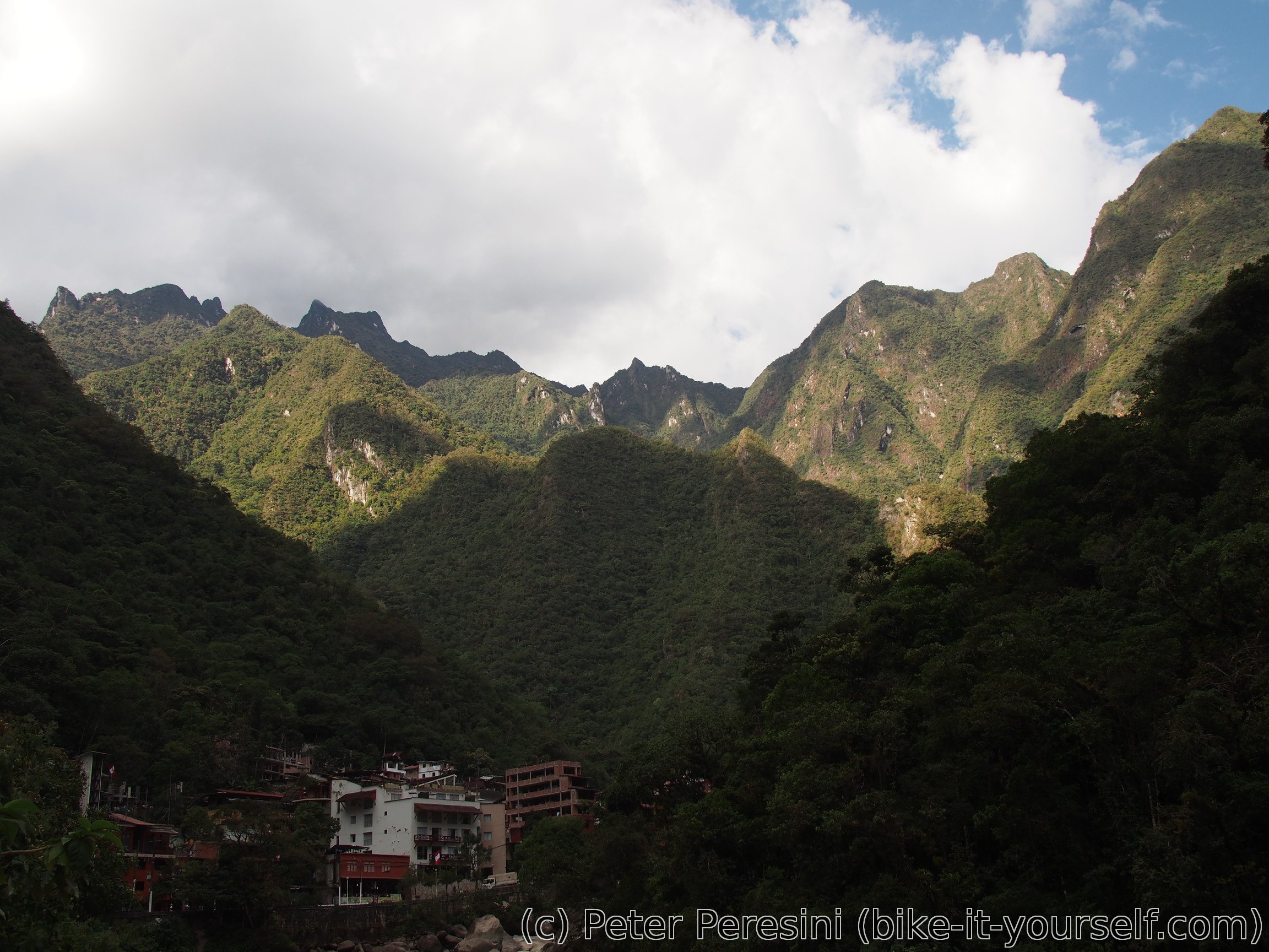
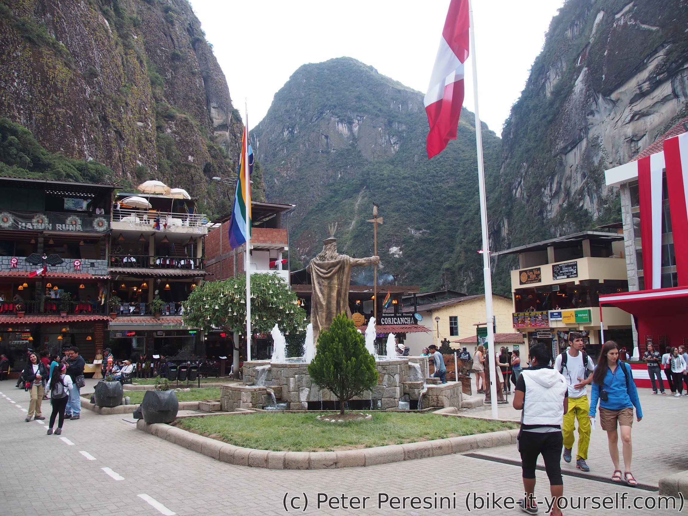
We arrive to Aguas Calientes where we will stay for the night in a hostel. As there is some free time before the dinner I decide to hike up a nice mountain which should have a good view of Machu Picchu. Unfortunately, I quickly find out that the trail is closed :-(. So I wander around the village and try to figure some snack before the dinner as the lunch was desperately small for a cyclist's stomach. Unfortunately, Aguas Calientes is living only from tourism and thus the prices of everything are just crazy.
July 27
One would think that getting up early morning is over with the trek done. Nope, we wake up at 3:40 so that we can start walk at 4am from Aguas Calientes. We then join a long queue before the bridge which should open at 5am. While standing in a queue I feel like a lunatic before an Apple launch. Though, to be fair, Machu Picchu is definitely worth waiting for compared to the shiny overpriced gadgets.
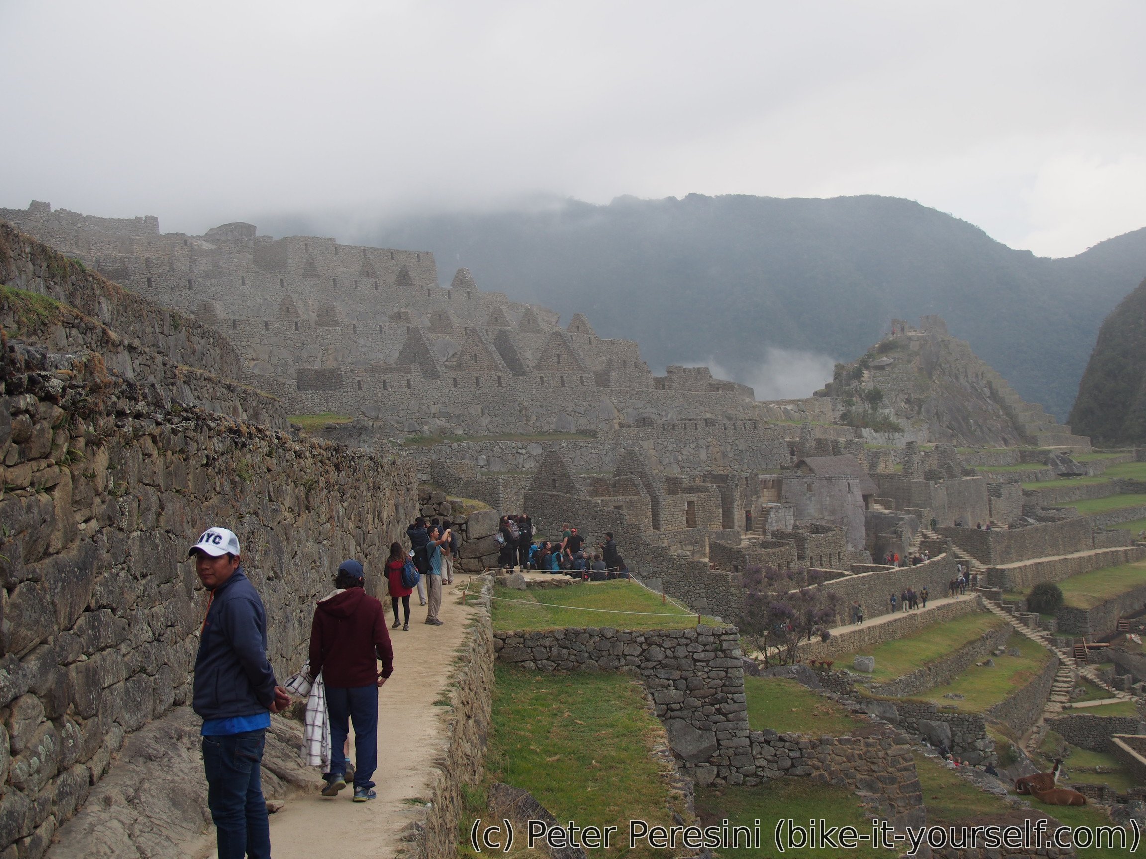
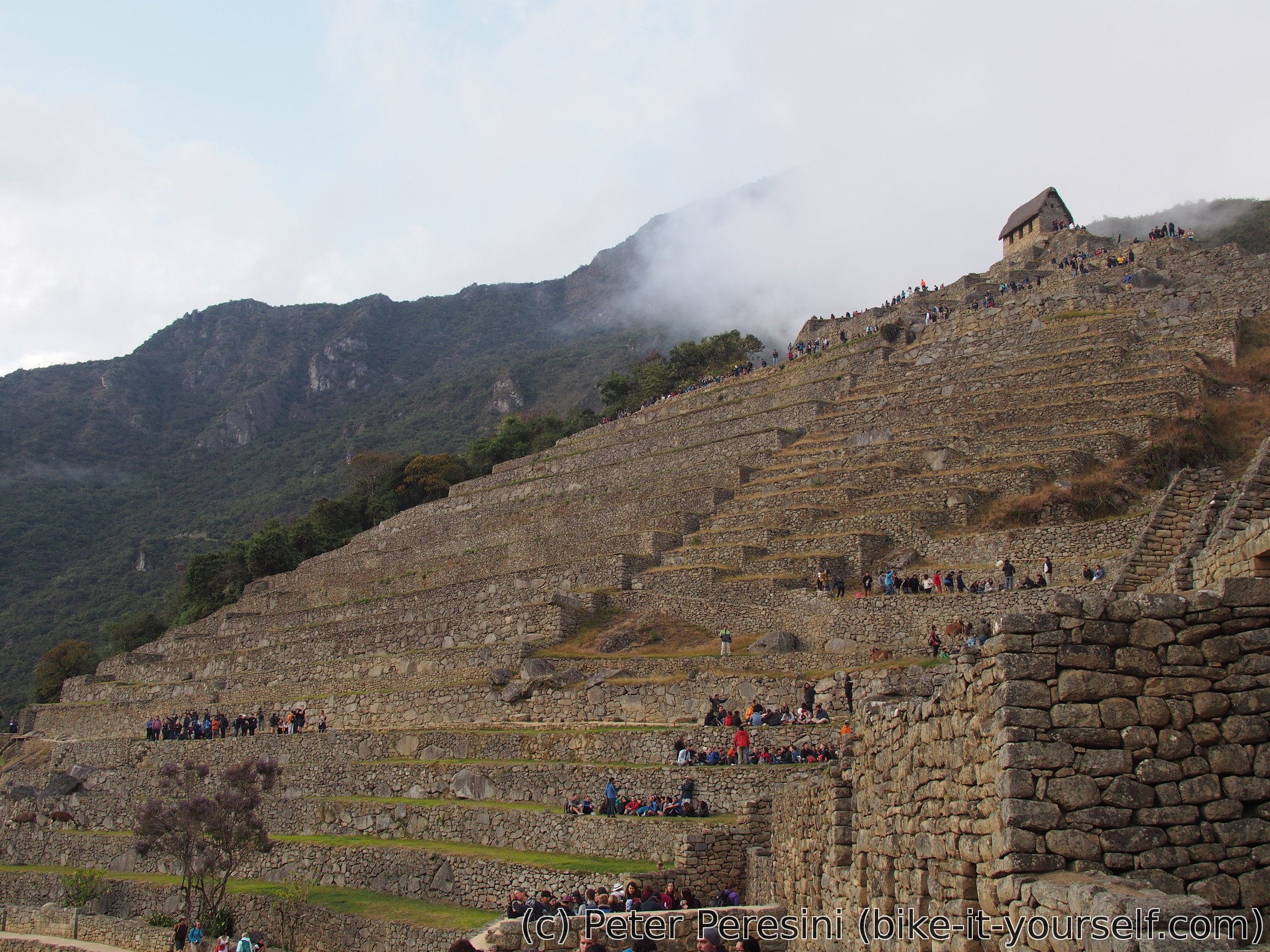
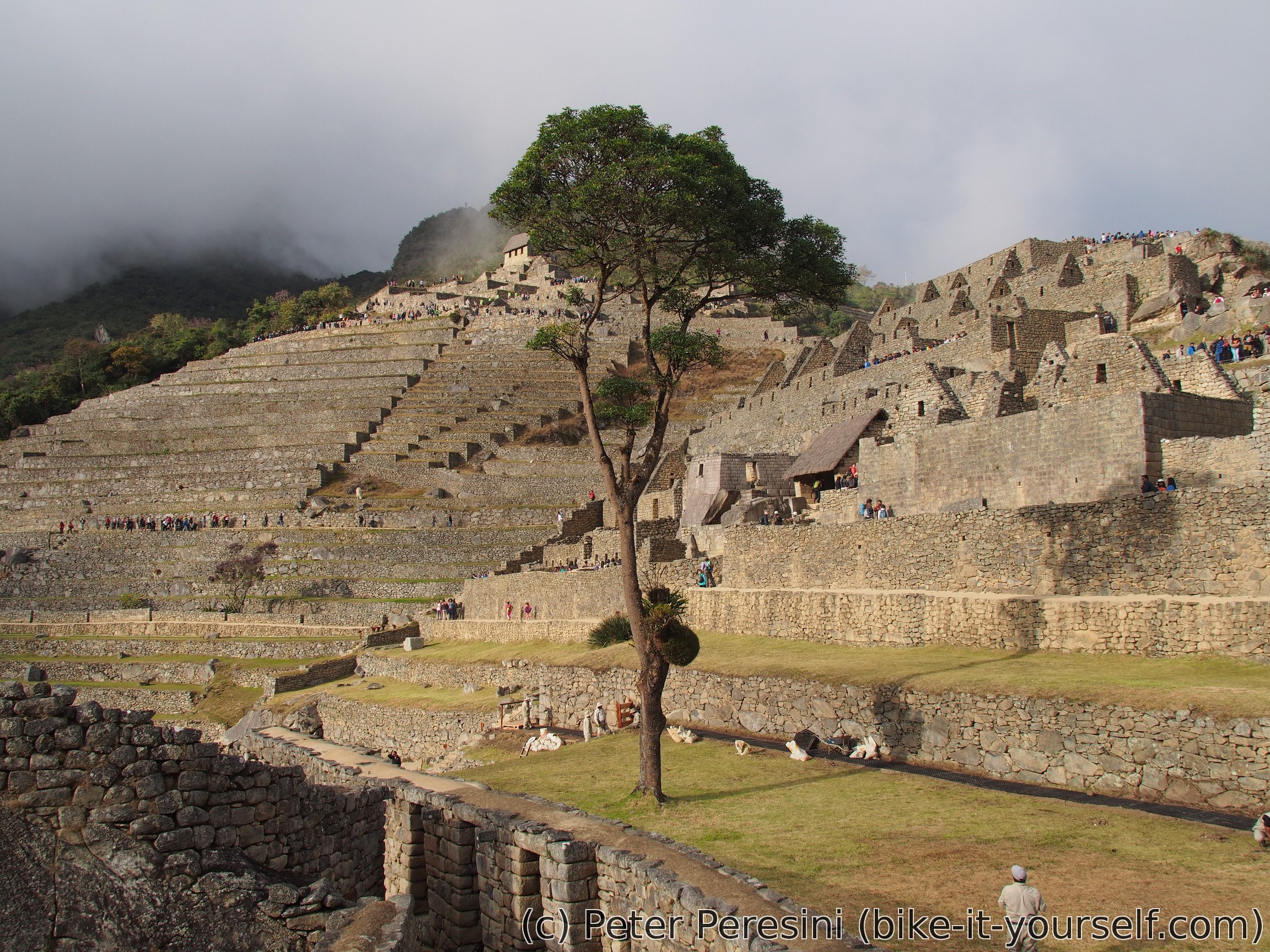
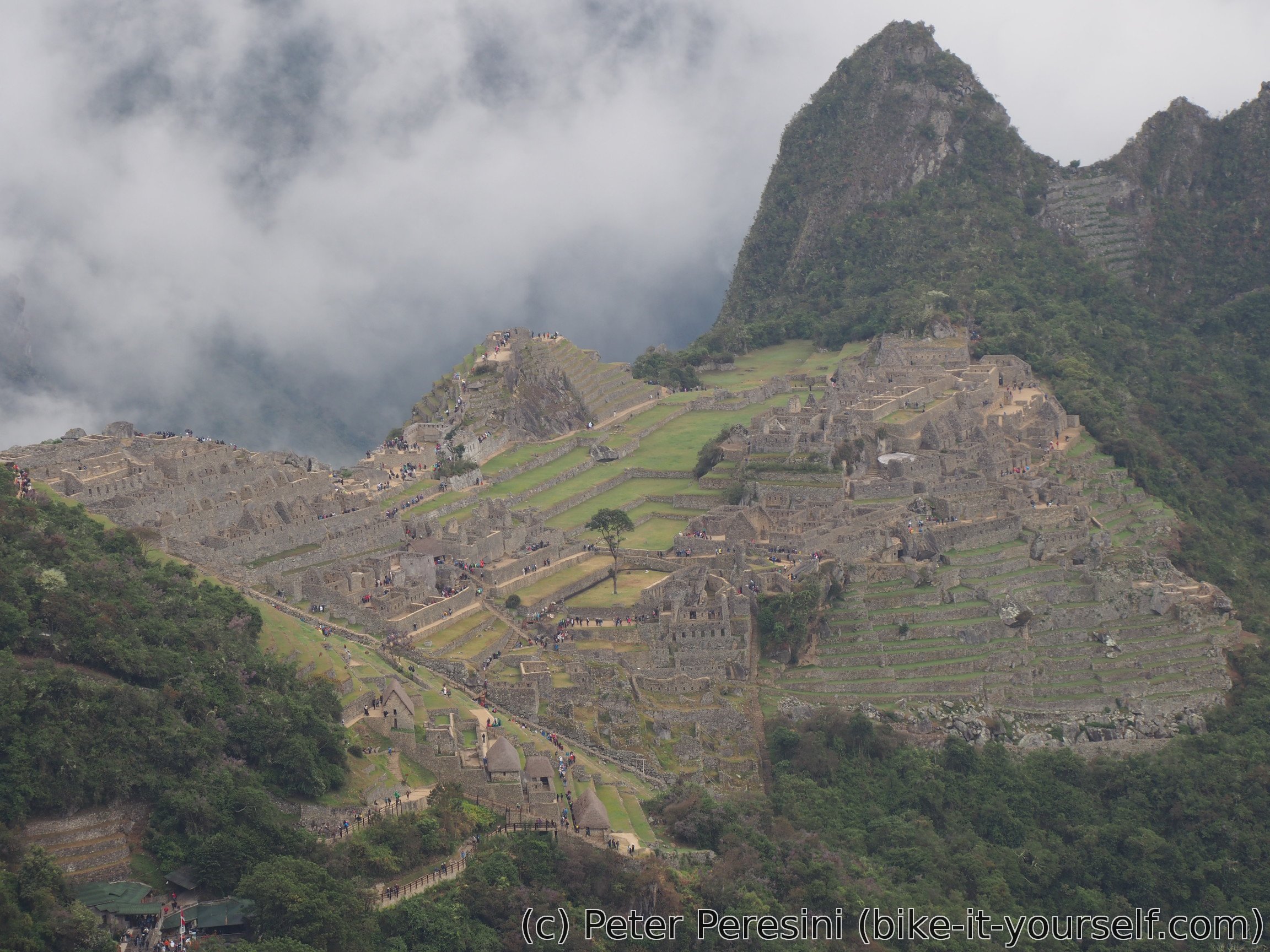
When the queue finally starts moving we get our tickets checked and walk up steep stone stairs. Not happy with the speed of progress I watch out for every opportunity to jump up in this single line of people. The more I go the more opportunities seem to be. After I finally overtake a few slow groups the progress is now fast. Half-breathless I arrive up to a big parking lot with tons of people who got there by buses (damn you!). As I wait for the last of our group to join us an English-speaking tourists arriving by a bus asks how long does it take to go up. Their guide says one hour - one hour and half. I can't not join the conversation to point out that it is only 45 minutes. The guide seems to be a bit surprised by this :-) By the time our group is ready it is clear to me that we won't escape the crazy anthill of people -- Machu Picchu is definitely overcrowded with tourists. There is this limit of "only" 2500 people per day for the main attraction + more for people also doing walk up a mountain.
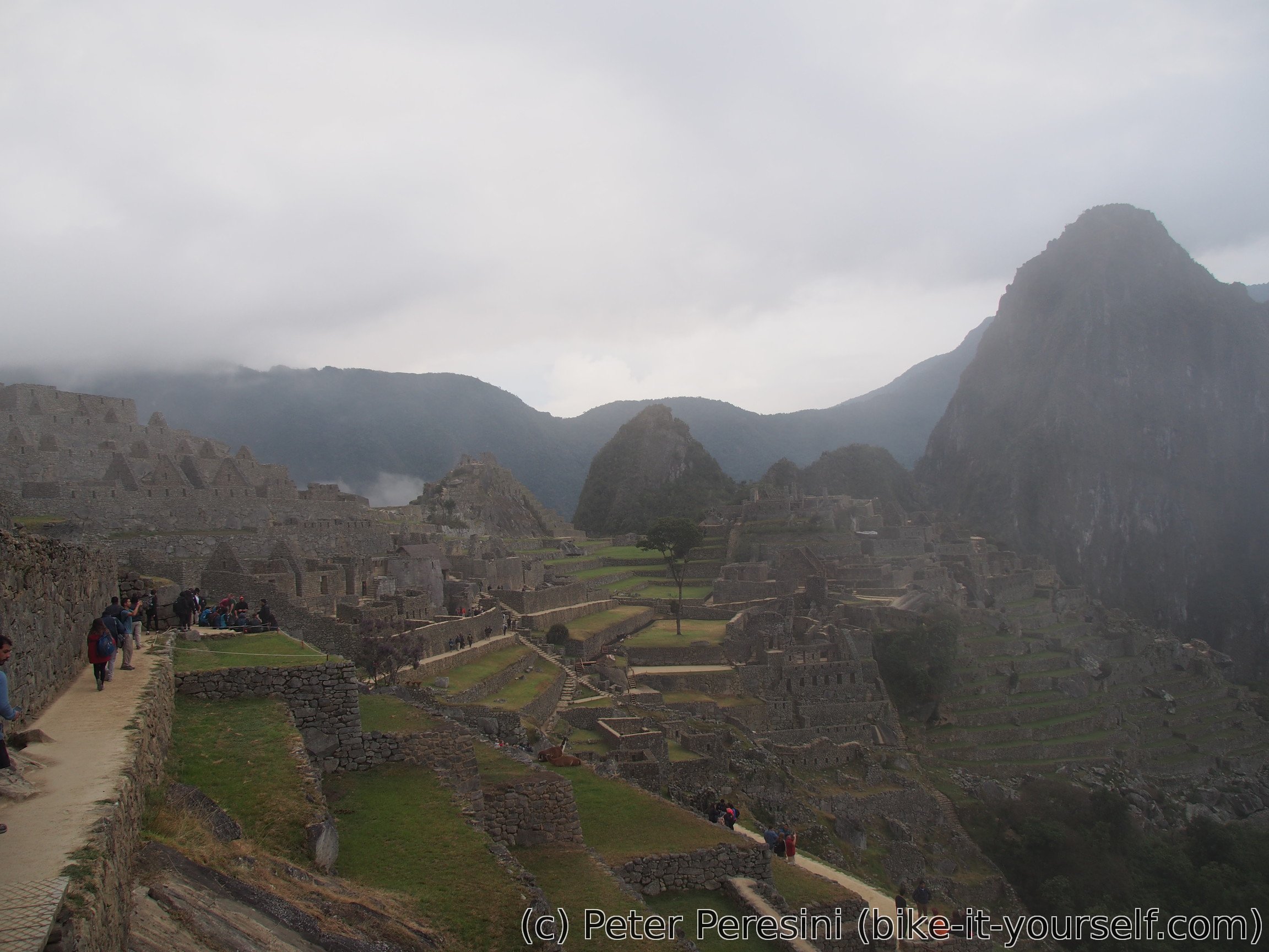
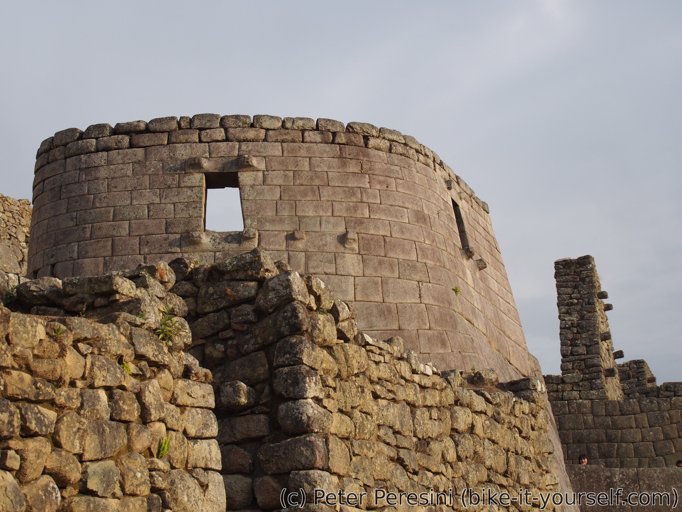
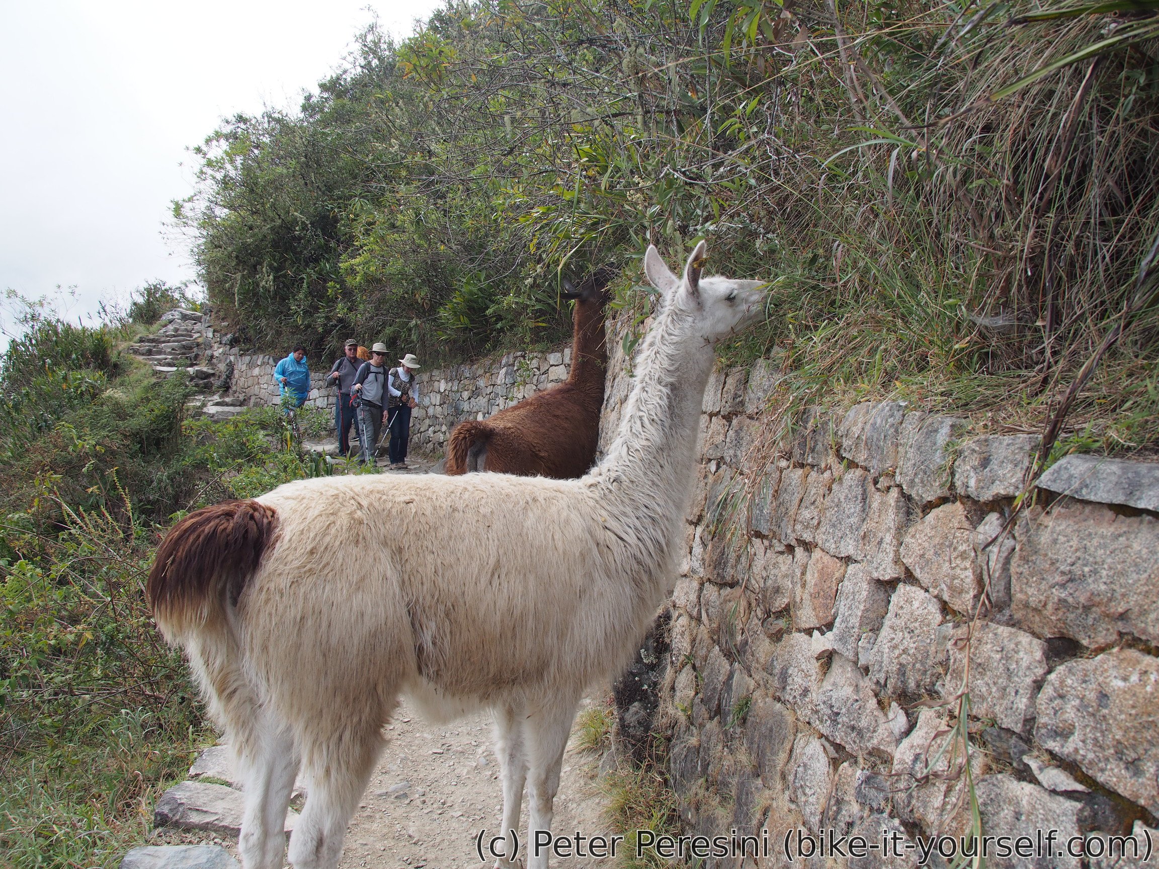
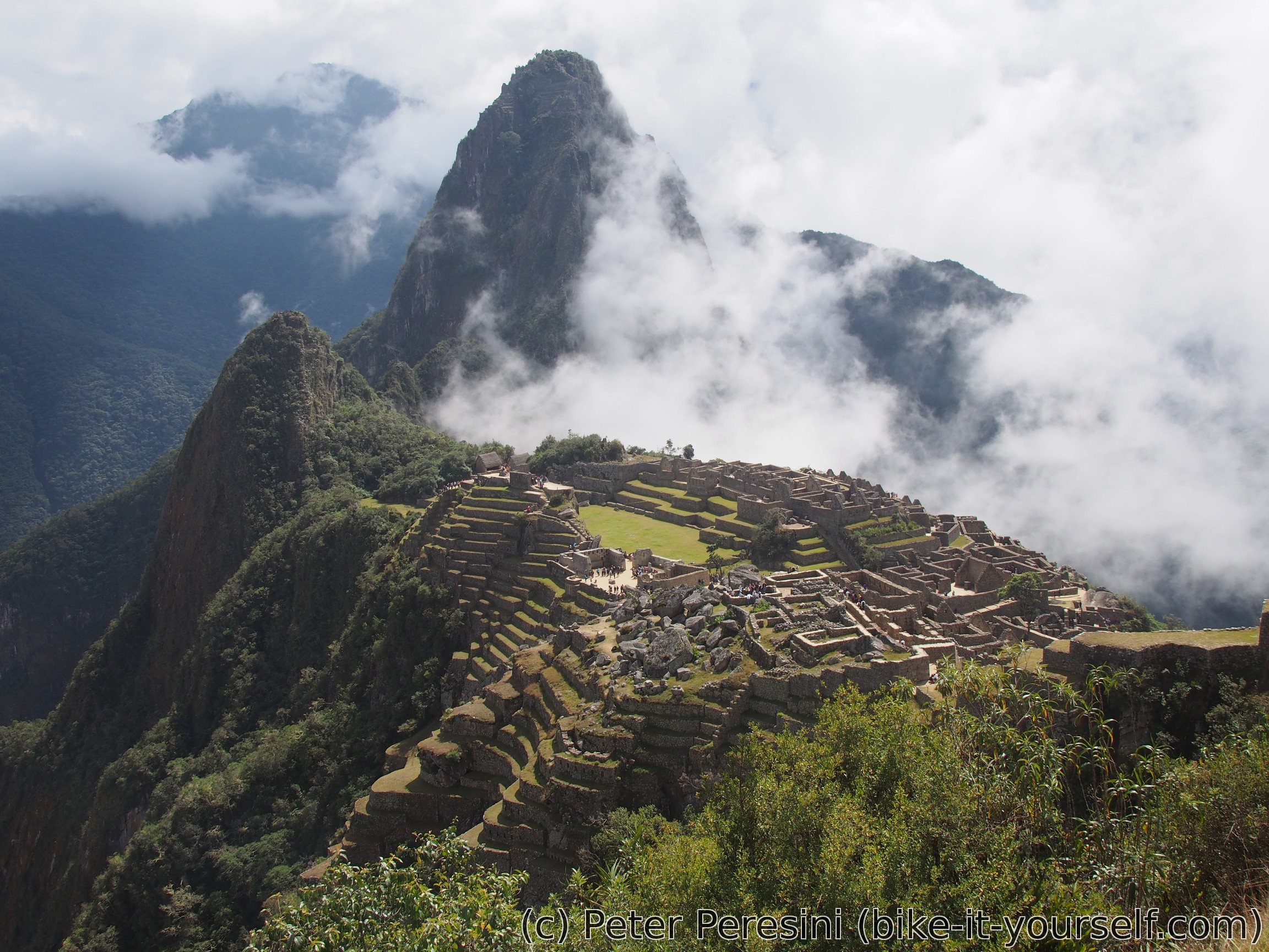
We start the visit with a guided tour. The name Machu Picchu isn't very creative -- it actually means "Old Mountain". Next to it is Huayna Picchu - the "Young Mountain" and this time it is really a mountain (the one you can see in iconic Machu Picchu photos). Unlike most of other "Inca" ruins, Machu Picchu was never destroyed by Spaniards. In fact, the never found the city as it was (probably) quickly abandoned before they arrived to the area. This is corraborated by the fact that the city isn't completely finished -- there are houses and other structures that still need finishing. Nevertheless the city is totally impressive. I have seen Machu Picchu on photos but being there is a completely different matter as you only then realize how really big the place is. I mean, it is damn big!

Incas were conquerors. They conquered a pretty damn big area (basically from Colombia to Bolivia). And with each new tribe conquered they made sure to transfer all the technological knowledge to the whole empire. However, unlike Spaniards, Incas did allow conquered tribes to keep their culture (including religions) though every Inca ruin also has the Inca religious sites (usually Temple of the Sun).
With the guided tour done we are left to wander around this historical monument. At first I join my fellow hikers but we soon split. There is a bit of a rain but fortunately it quickly disappears (I don't have a raincoat with me).
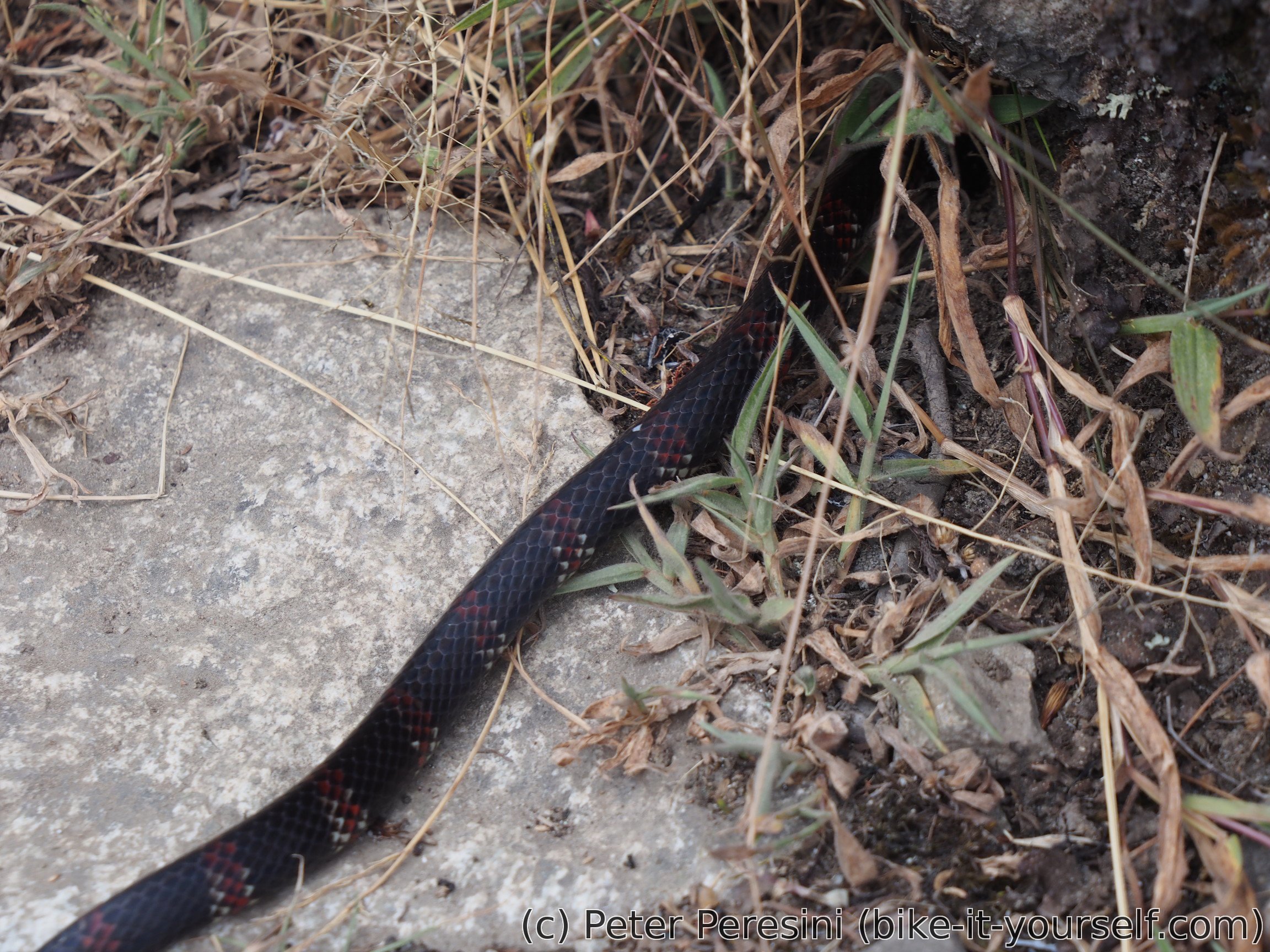
Views of Machu Pikachu are similar to Pokemons. You gotta catch'em all! So I set hiking towards IntiPunktu -- the Sun Gate. The place is quite far from the main city and is actually the first place where people coming from the Inca trail see Machu Picchu. The trail is blocked by a few alpacas happily munching on anything green in their sight. As I am getting a bit hungry I sit down for a while and rummage in by backpack to find something. And I end up quite temporarily scared when while eating a glance backwards reveals a nice snake going just past my back.
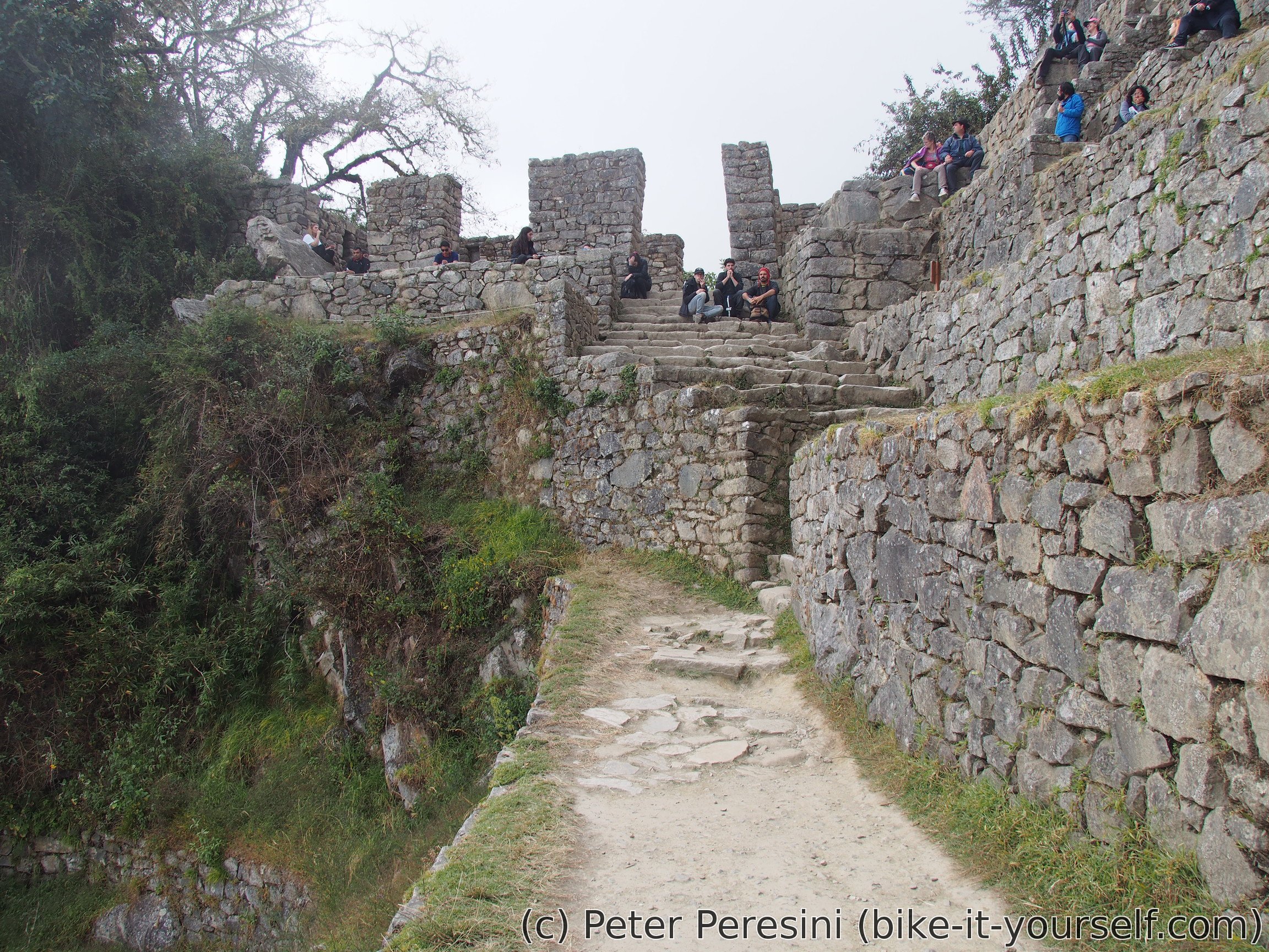
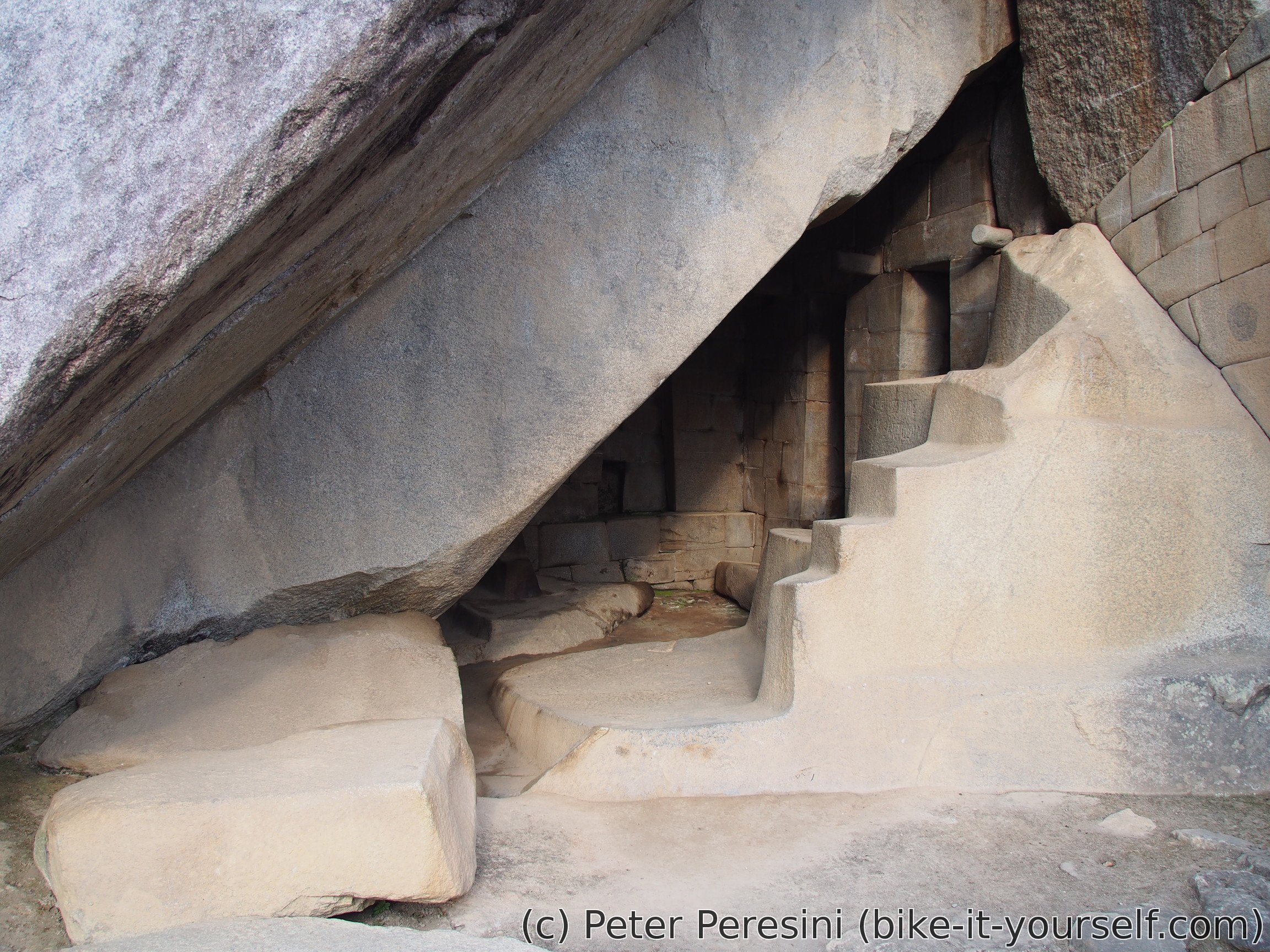
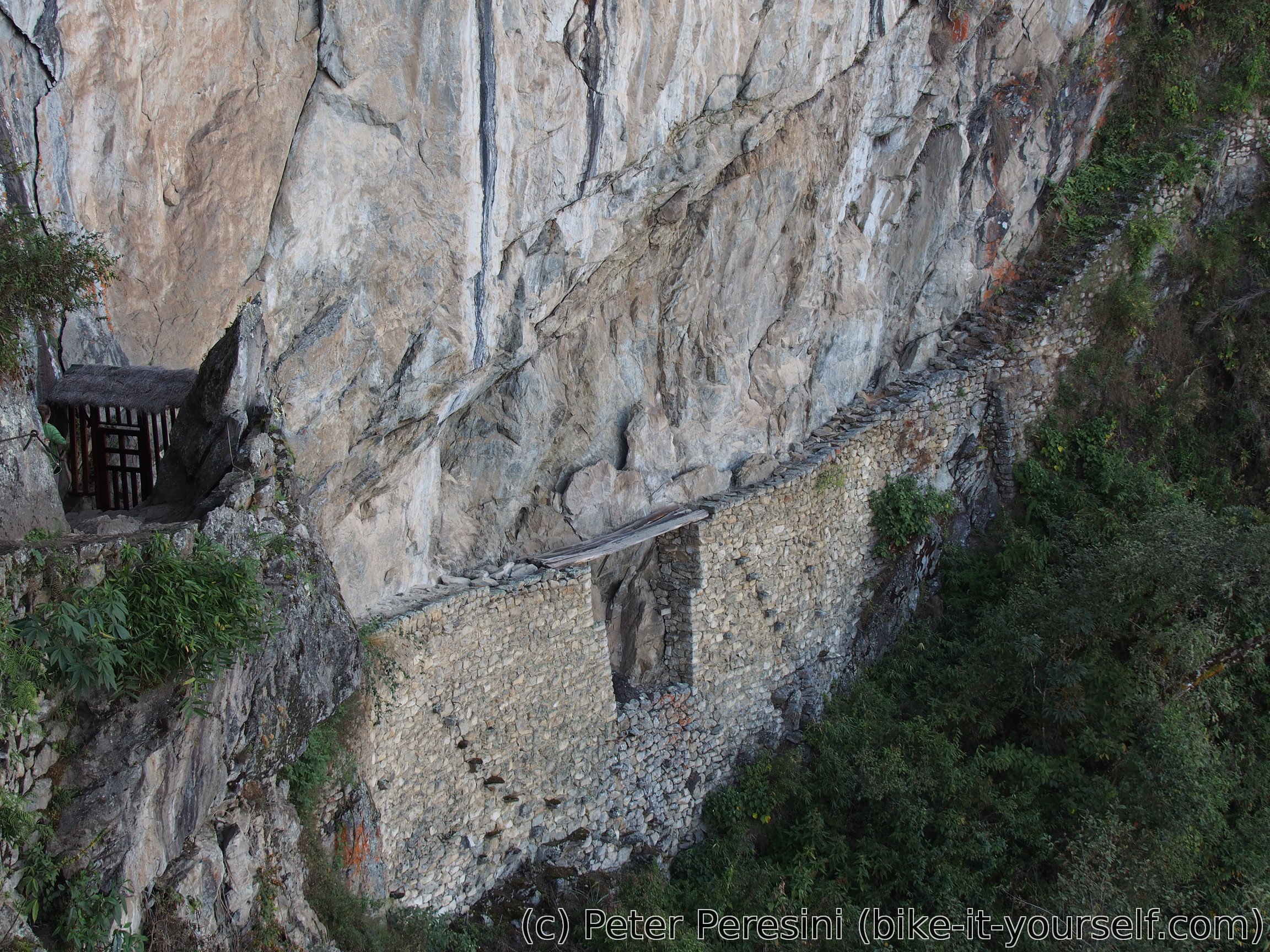
After visiting Sun Gate I quickly return to the main site. There is apparently another attraction called Inca Bridge. Somehow you need to register because the trail to it is quite narrow with a straight cliff on one side. Unfortunately, I find out that I won't be able to walk on the bridge. The most exposed part of the trail is fenced behind a closed gate. I am quite sad because the bridge would certainly reveal some great views down. With Inca Bridge done I am running out of time. Still, I quickly walk around all the other parts of the city we did not visit with the guide.
When I finally exit Machu Picchu the time is quite pressing as I have only about 2 hours to get to Hidroelectrica. So I end up half-running the stairs down. And then quickly walk along the railway with some half-attempts to run. It is however too hot and the trail is too tricky to keep going like this. Fortunately, in the end I manage to get to the spot right on time for the car pickup. Which proves to be a total madness of a mess. There are dozens of vans and people shouting names and in this total concotion of chaos I just can't find the my van. Only after about 20 minutes after the official departure I finally hear the shouts. Good, or at least I thought. It quickly becomes apparent that I am not on the official list. I mean, damn the stupid agencies which just can't get the things properly -- I wasn't on a list on my Vinicunca hike (though they picked me up) and I was missing on some of the lists for Salkantay. As usual, they resolve this by calling the agency, except that they can't get the call through. In the end my status is confirmed and I end up in a middle front seat of the van. It's basically the place you don't really want because a) there is no space for the legs, and b) you have the point-of-view demonstration of Peruvian driving. At least there is a safetly belt which I promptly secure.
The return to Cusco is a veeery long ride. It first starts with unpaved roads where you wonder how many accidents are there in average for a year. The second thing you wonder about is how the heck this car with 150 000 km can still move. By the way the driver goes on its business they probably need to replace suspension every week or so. When we finally get to a pavement we are down in the jungle-like regions with thick vegetation. By now a heavy storm comes and I wonder whether the driver knows that braking in a rain is less efficient. At least we make a short stop to get some liquids out of me and then get something back from a local fast food. By now the evening falls and we end up climbing a pass in total darkness, sometimes with a very short visibility. The descent is similarly long and it is only then that I figure out there will be a second pass to go. In the end, when I finally return to the hotel I am completely done and fell for the bed.
Route
Download simplified GPX of a route here
Stats by activity:
| Activity | Distance (km) |
Ascent (km) |
Pedal rotations (thousands) |
|---|---|---|---|
| hike | 23 | 0.9 | - |
| stroll | 9 | 0.5 | - |
| Date | Distance (km) |
Ascent (km) |
Avg. temp (moving, C) |
|---|---|---|---|
| July 26, 2017 | 10.2 | 0.32 | 28.9 |
| July 27, 2017 | 22.1 | 1.05 | 20.7 |
Elevation data
The next table is only for cycling activity.
| Grade(%) | Ascent (km) | Descent(km) |
|---|---|---|
| < 2 | 0.0 | |
| < 4 | 0.0 | 0.0 |
| < 6 | 0.0 | 0.0 |
| < 8 | 0.0 | 0.0 |
| < 10 | 0.0 | 0.0 |
| ≥ 10 | 0.0 | 0.0 |