
El Huecú to Chillán (via Paso Pichachén)
 Share:


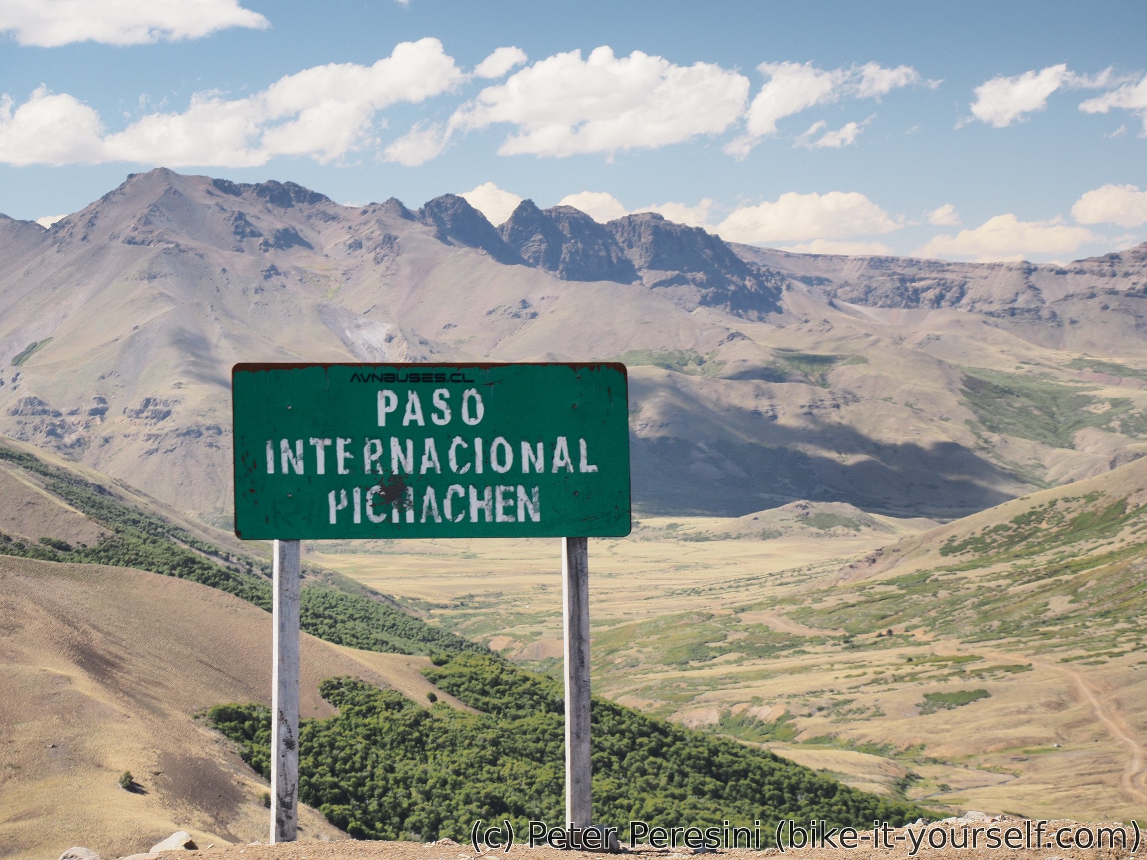
Paso Pichachén is a very nice Andean crossing. Especially if you also count the unforgettable moon-like Laguna del Laja on the Chilean side. With the height of 2060 meters this crossing belongs to the smaller ones. The Argentinian side is quite flat until the gendarmeria after which the climb starts. The steepest part is about ten or so kilometers with a steady 7-9% grade. The Chilean side is definitely steeper though. It averages over 10% at a quite long distance with local spots of around 12-14%. Which is why I was happy to do this from the Argentinian side.
March 3
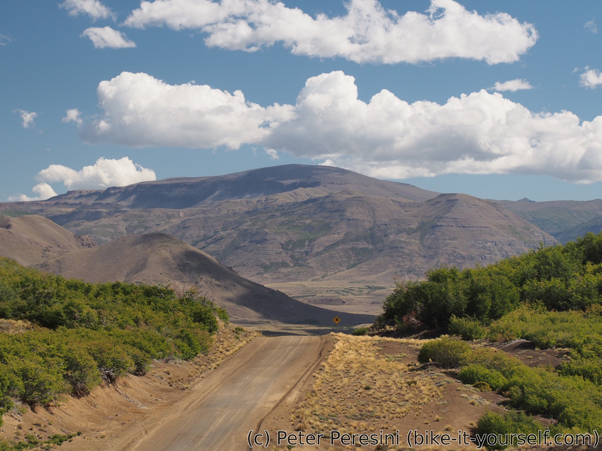
I am waking up into a nice morning. Because of my yesterday's mistake with water, I am spending a lot of time filtering day's worth of it. Afterwards I am ready for a morning climb. It is quite easy though -- grade is just enough to gain elevation and there isn't much of it anyway -- just 300 meters of ascent. Around me is a canyon which ends opening into the valley below.
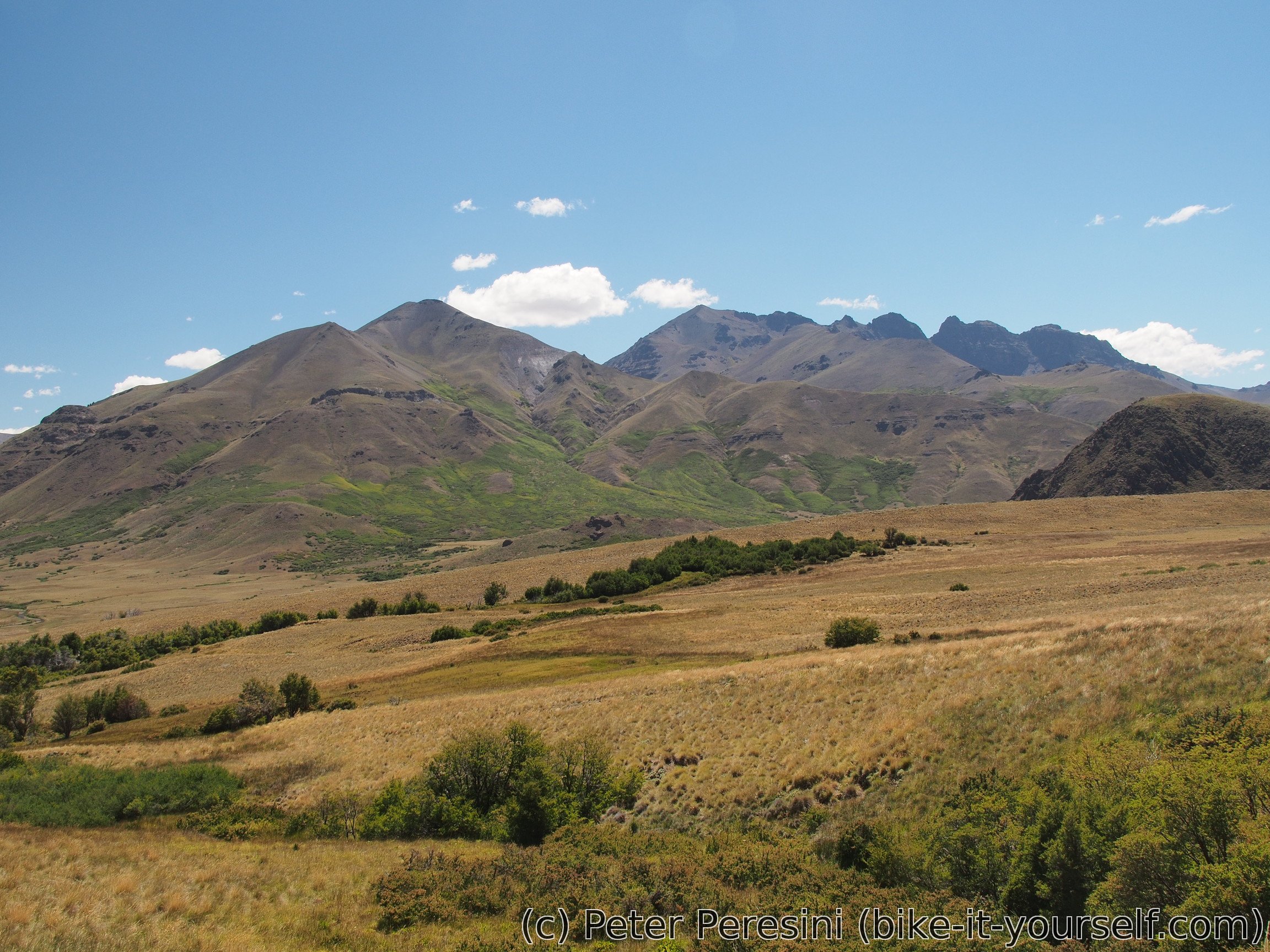
After the short ascent I have some descent to do before it flattens and I arrive to El Cholar. Here I need to stop and get all the necessary food as this is the last village on the Argentinian side and I am up to a long way until the next source of rations. Fortunately I do not need to buy anything fancy here, just basic supplies. Which is good because I apparently find some small mercado which kind of closes for siesta after I leave. My only complaint is that I cannot but chocolate on the Argentinian side -- I did not see one in Loncopué, nor one in El Huecú and in El Cholar I can see only extra small bars which cyclists could probably buy by cartons and still won't have enough of them.

I am also restocking with water. Which turns out to be a great idea. The next 20 kilometers or so there is no water at all. And when I see the next river, I wouldn't drink the water unless filtering it in an emergency situation -- the water is completely brown and probably polluted by some mining runoff.
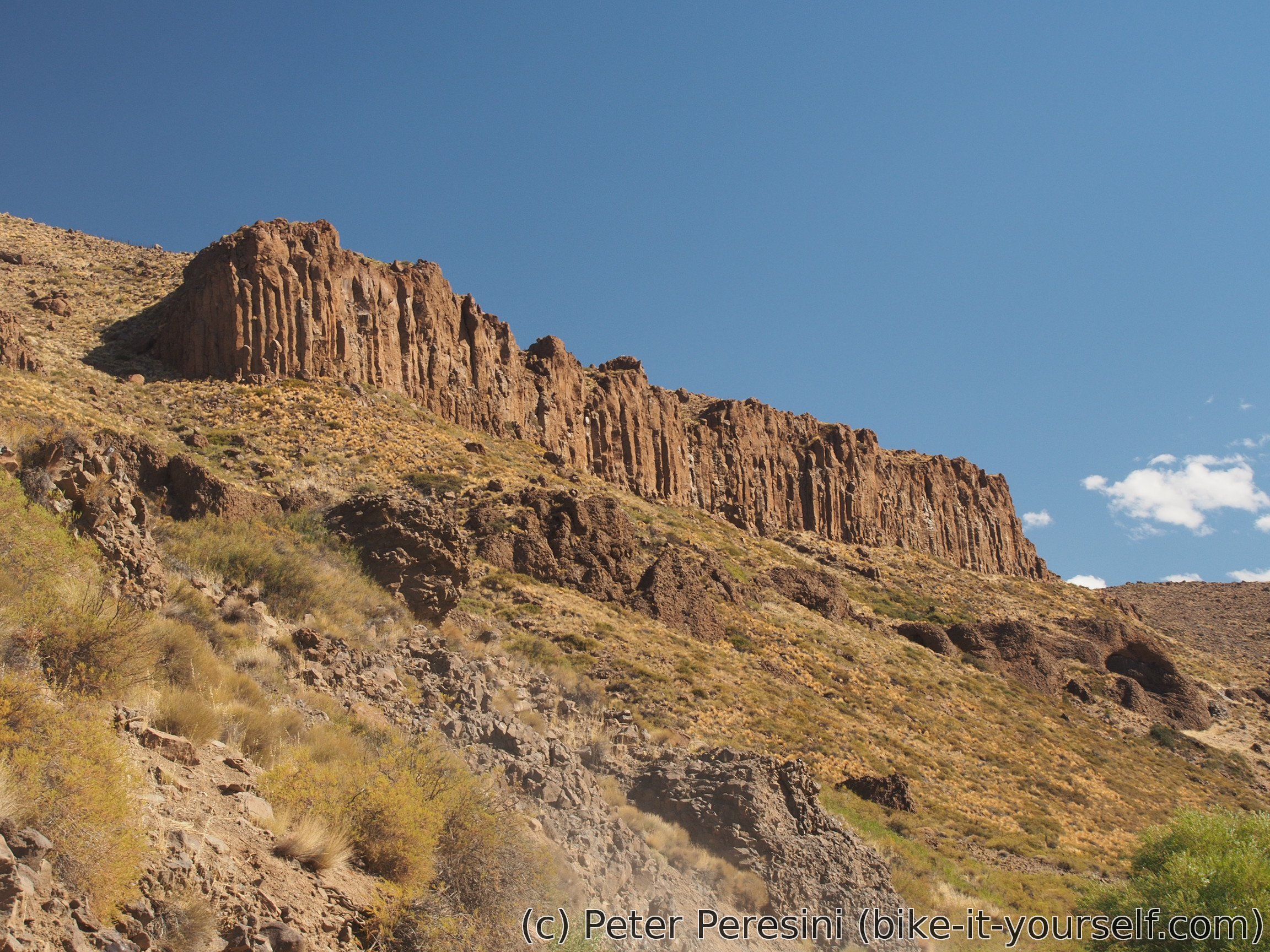
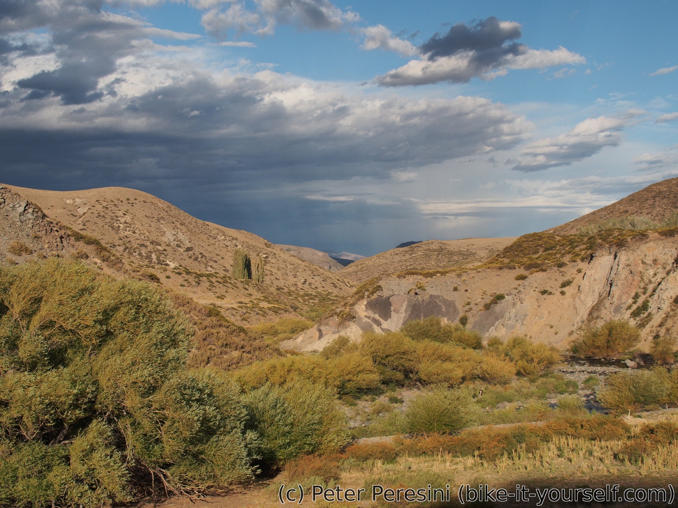
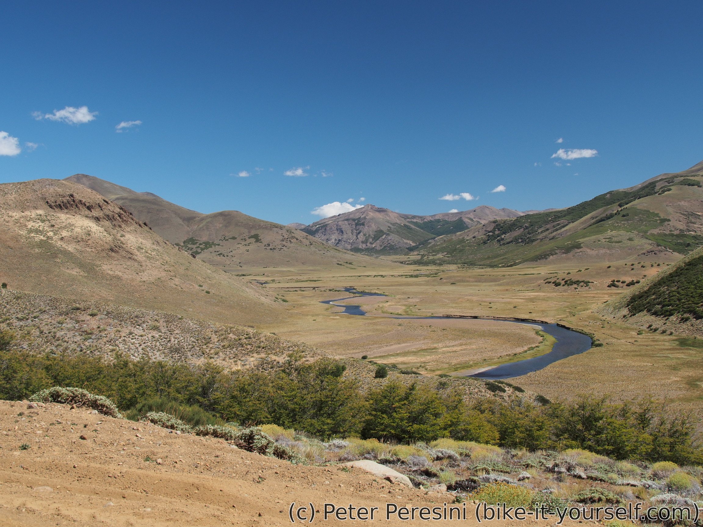
However, after another few kilometers of going down the river the situation changes to better. The big brown river turns right into a canyon and is instead replaced by a smaller but very clear river. And the views also get better -- now I am slowly but steadily progressing upstream in big canyons carved by the rivers. Of course, as soon as I see water, I am refilling my bottle although this will turn out unnecessary as the road will go along this river for a looong time.
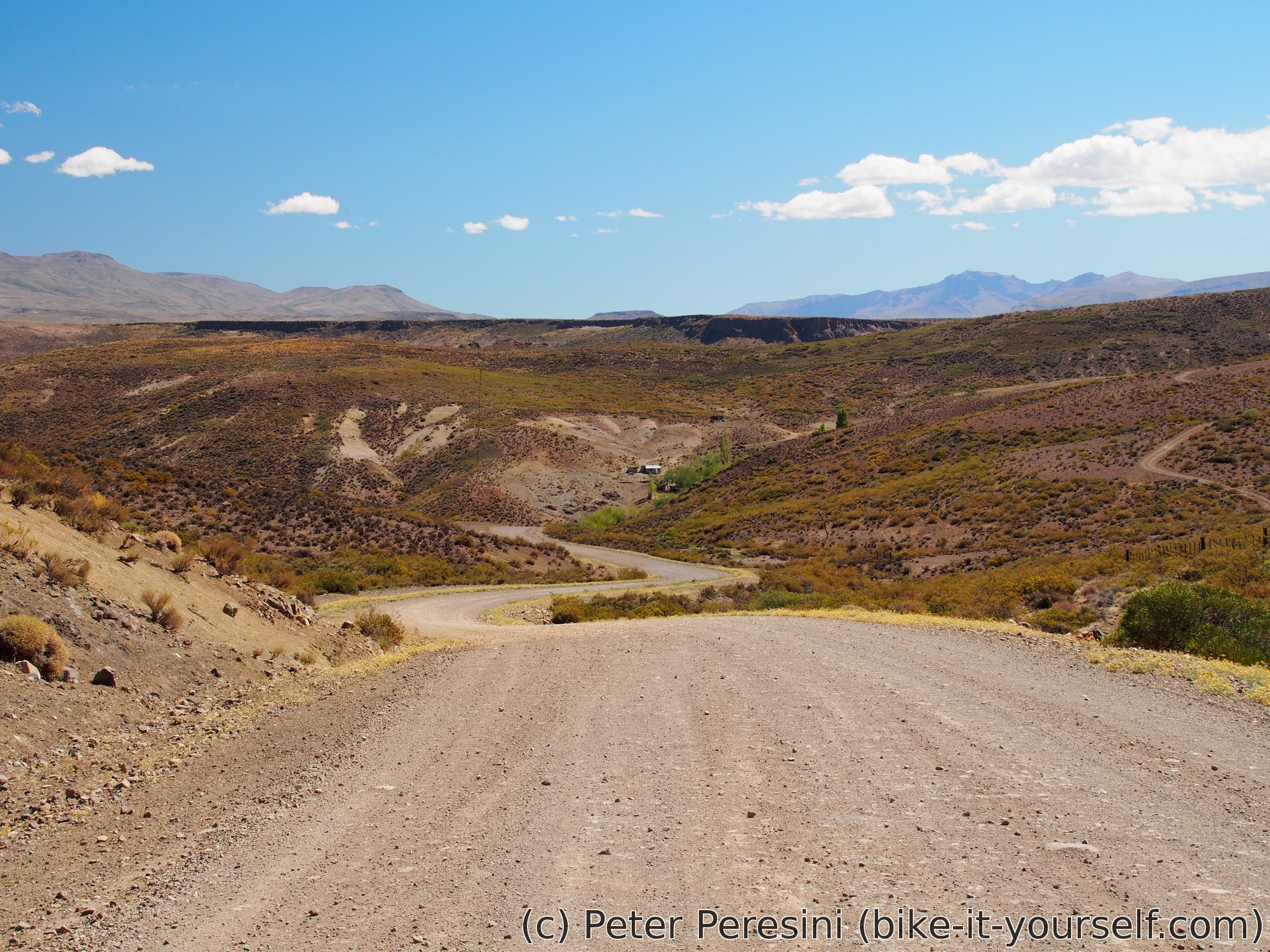

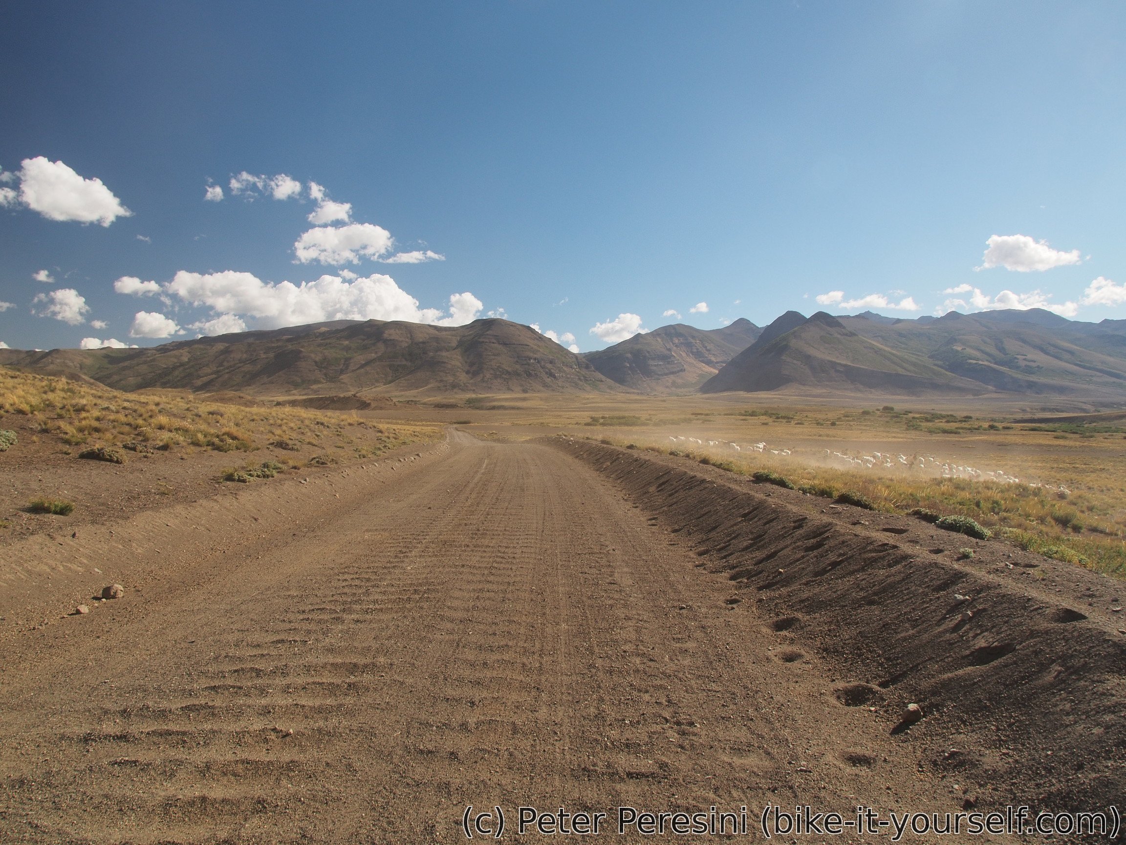
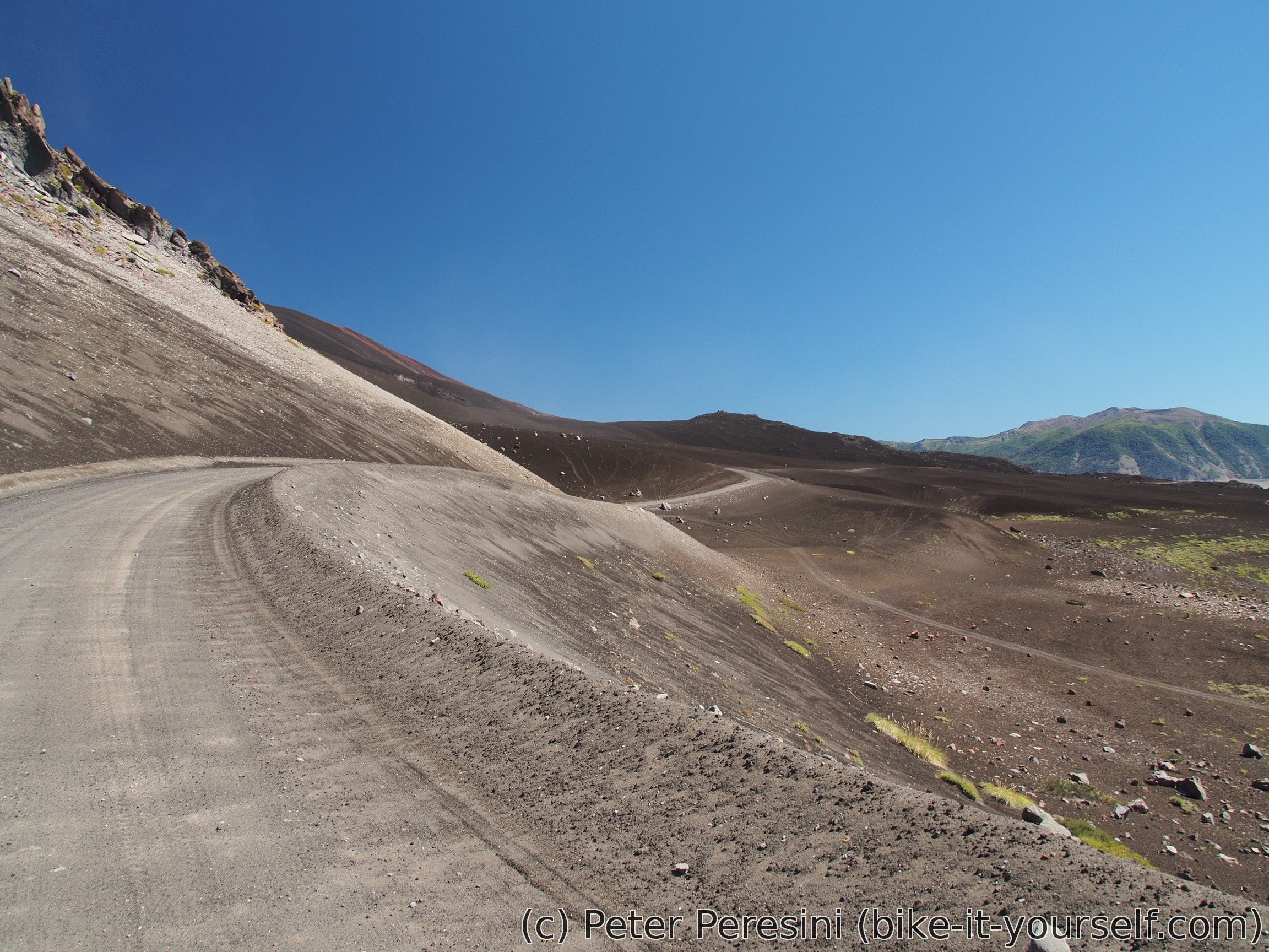
The only problem I have is the, to call it mildly, substandard quality of the road. Too much rocks and bumps makes for a very slow going.
In the evening I am looking back at the places I came from. And I am surprised to see storm clouds heavy of rain. I guess I am very lucky because only a few raindrops reach the place I am camping at (which is just besides a road).
March 4
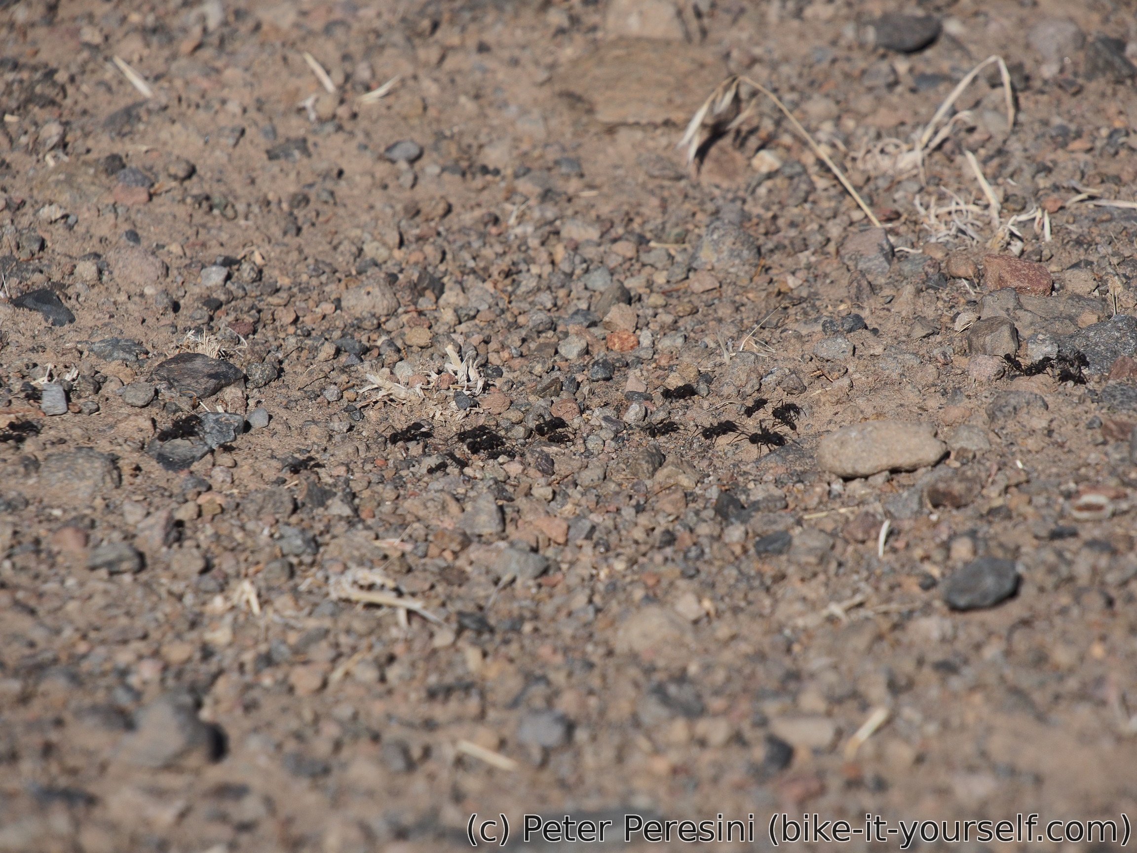
As if there was no storm yesterday, the sky is all clear in the morning. The most interesting novelty of this part of the road are ant highways which pretty frequently cross through the road. But ants aren't the only animals around -- I manage to scare at least two or three rabbits which then scurried quickly away into the bush.
Then I reach the gendarmeria and it is time for immigration paperwork. Or, actually, for a lunch because I am in a queue after a band of motorcyclists. It takes about an hour until they can stamp me out of the country.
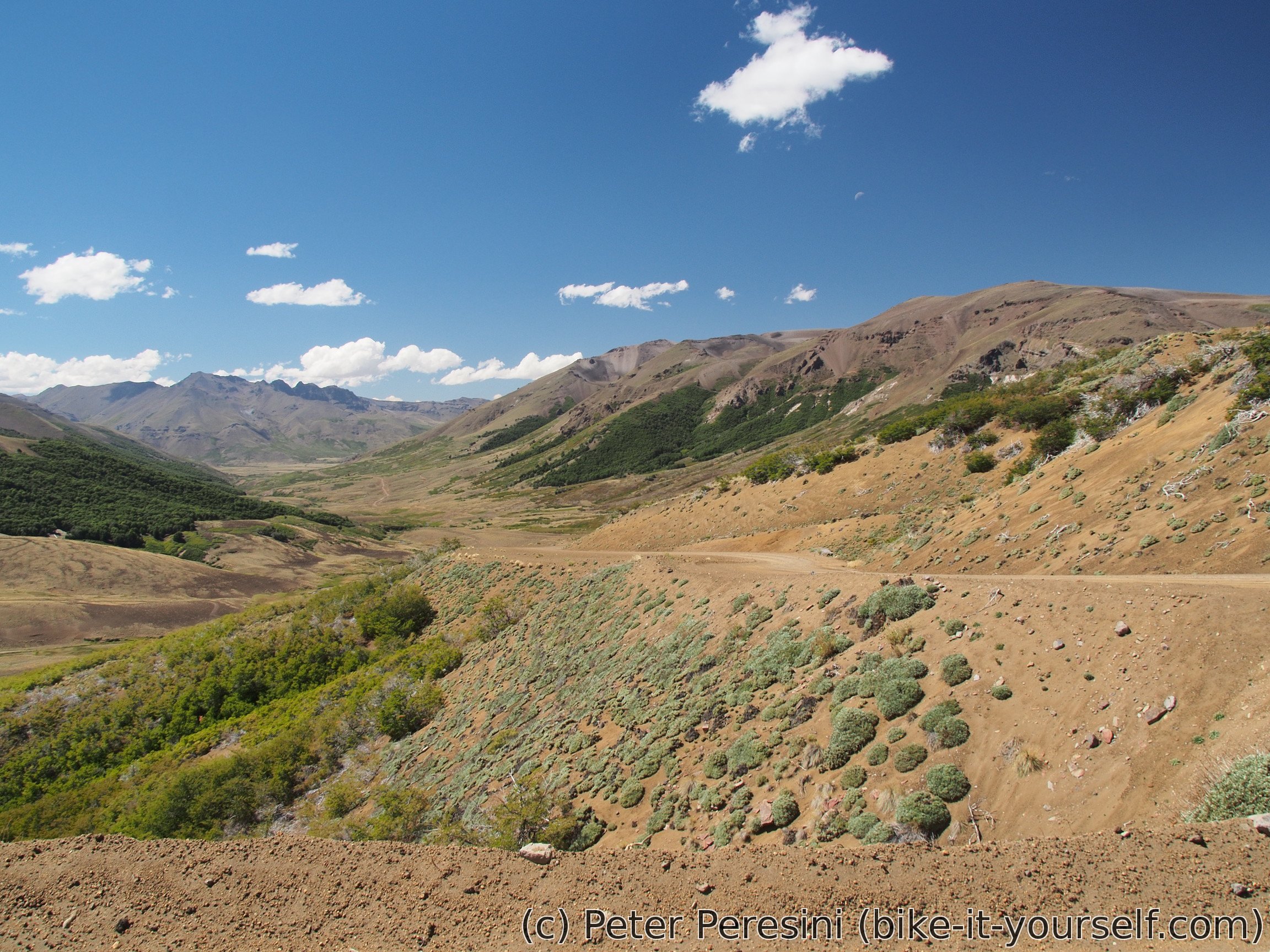
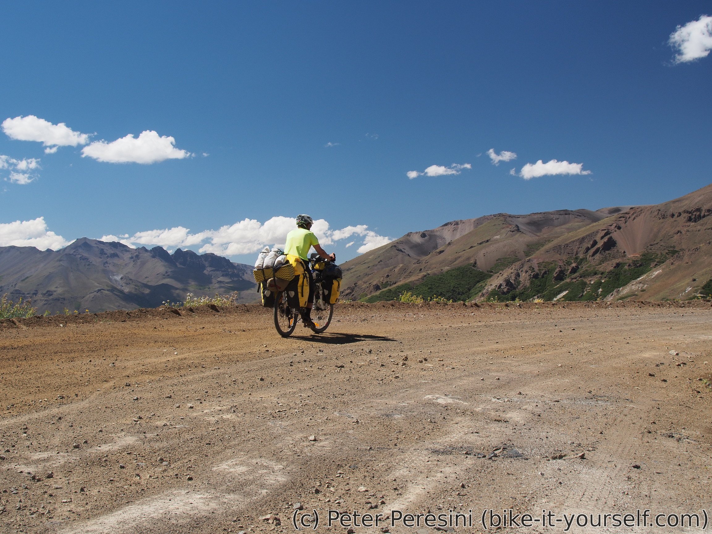
At half past twelve I am ready for the pass. It is 20 kilometers away and around 600 meters of elevation. First I cannot see it but about 12 kilometers before the pass the views open and I can ponder whether I really want to do this -- the last 500 elevation meters are at a stable climb of 5-8% grade. Basically, hard but doable.
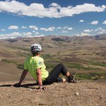
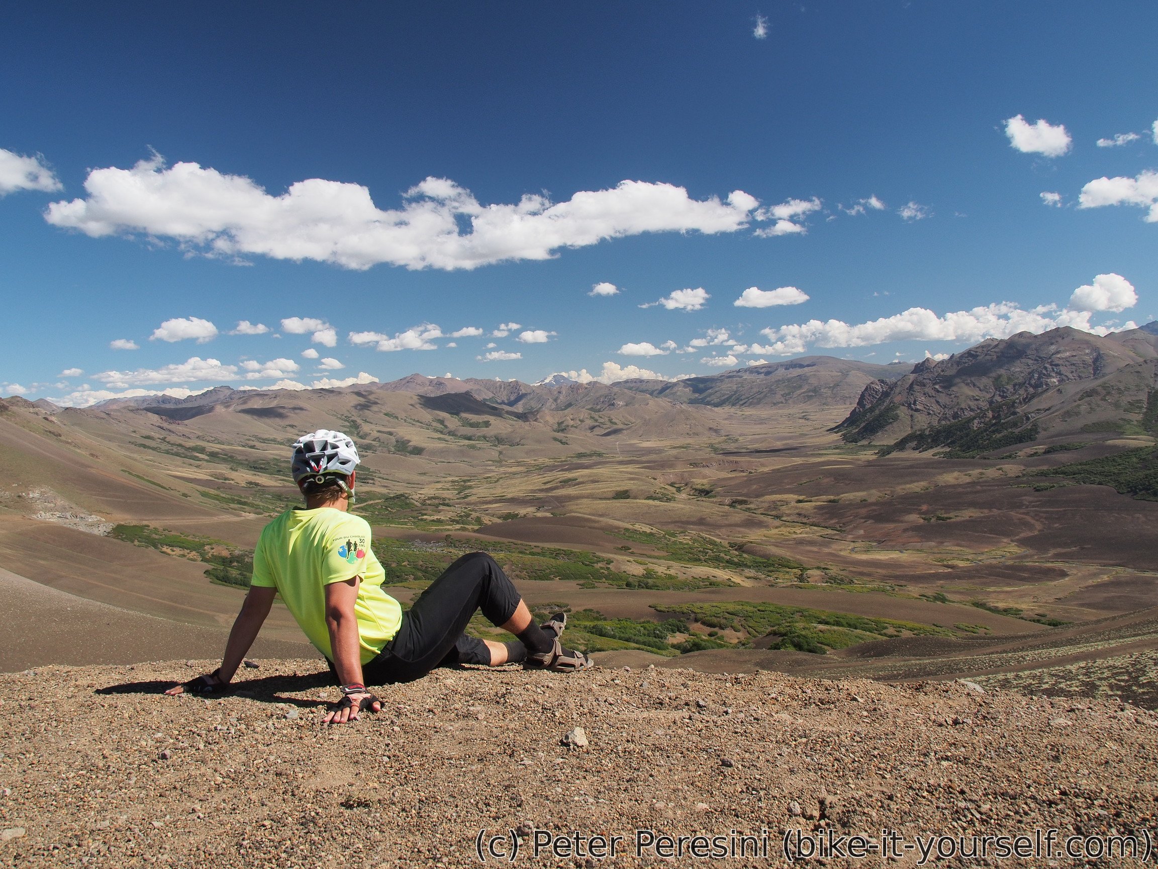
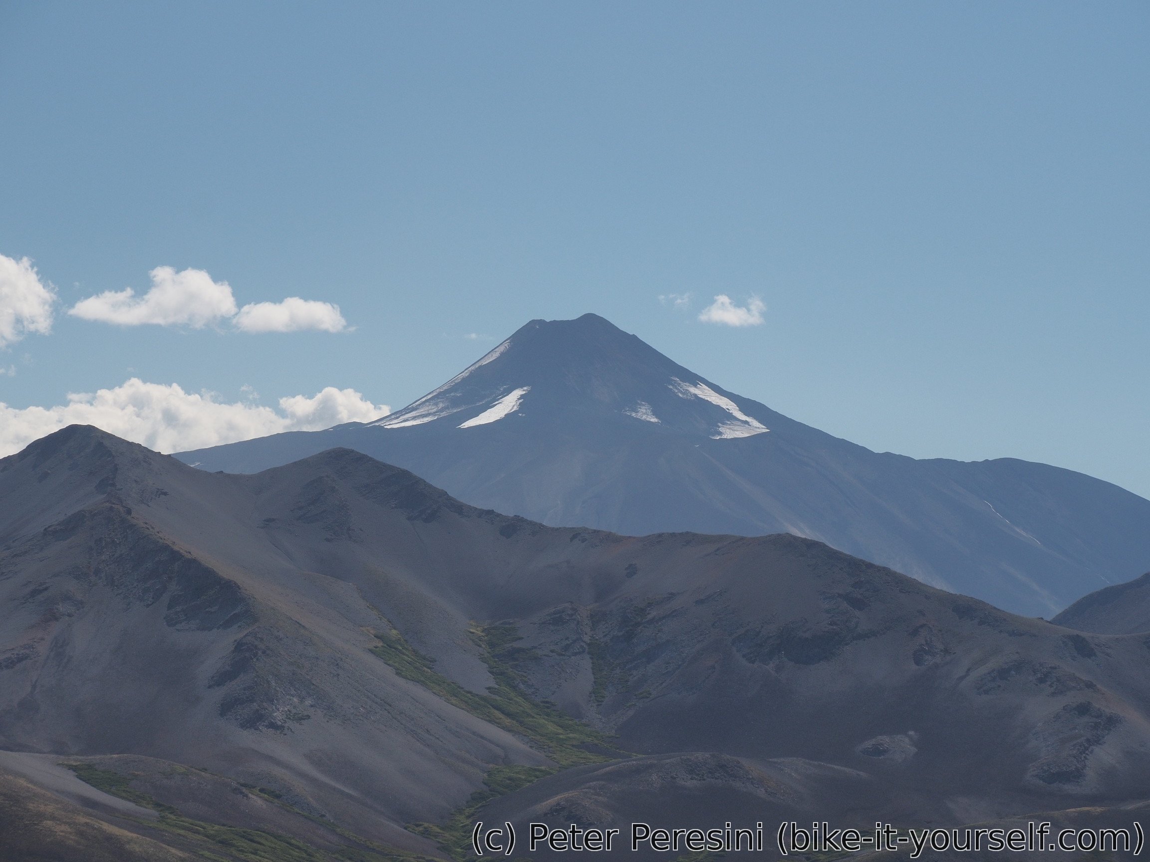
It takes me quite some time to finish the climb. I reach the top only at 4 pm. But the view is worth it. I can see Volcán Antuco and glacier-covered Sierra Velluda. And a huge valley below me.
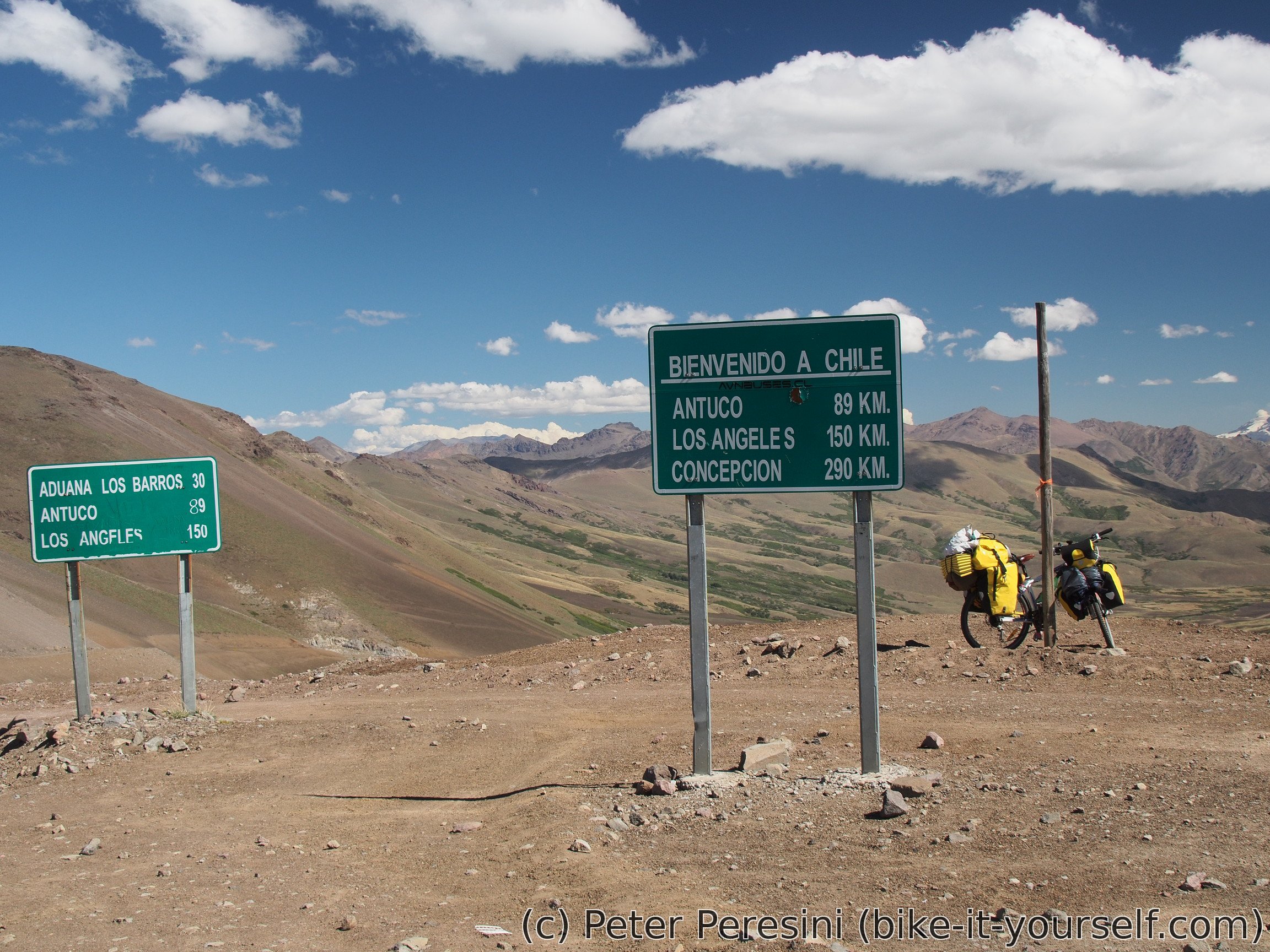
The sign at the top mentions that the Chilean immigration is 30 kilometers but this is fluke, it is a bit less. In any case, there is at least 40 kilometers inbetween the immigrations.
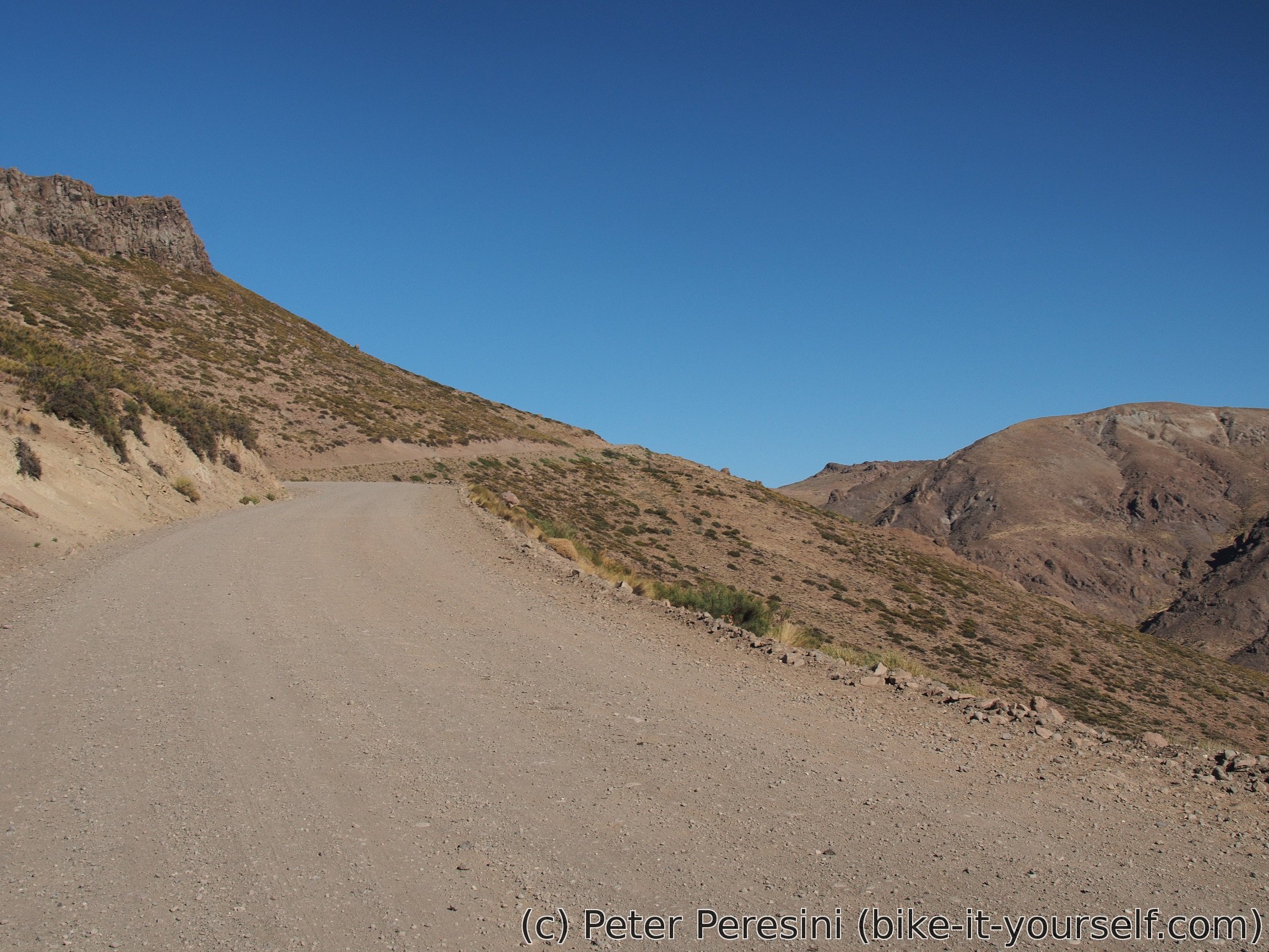
The way down is first very steep. In fact, it is so steep that I cannot enjoy riding it fast. This changes when I reach the bottom of the valley. The road flattens and gets a bit on a sandy side. Always rideable but not very pleasant.
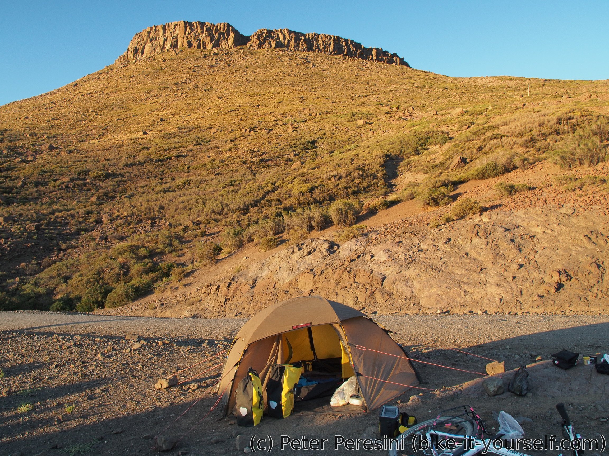
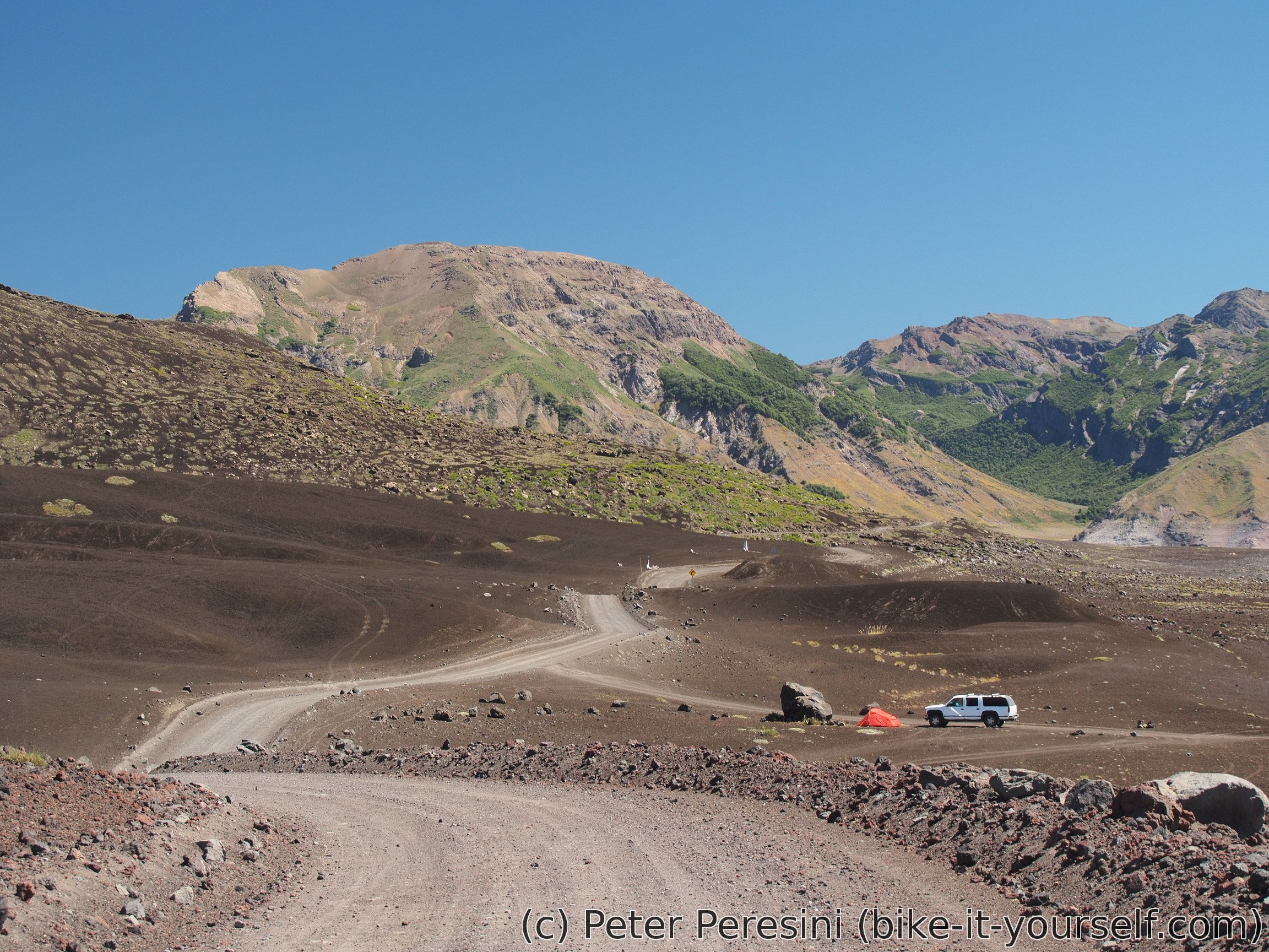
As I reached the pass quite late, it looks like I would need to camp around carabineros. Which isn't exactly a good place -- either I would camp just before, getting some weird looks, or just after but that would be too late considering that it would take some time to pass through. In the end I decide to camp 3 kilometers before on a place which would get perfect morning views.
March 5
I am surprised by the coldness of the night. Just before the dawn it was freezing so this is a second time my tent is frozen. But the view from the tent melts away any coldness in my heart.


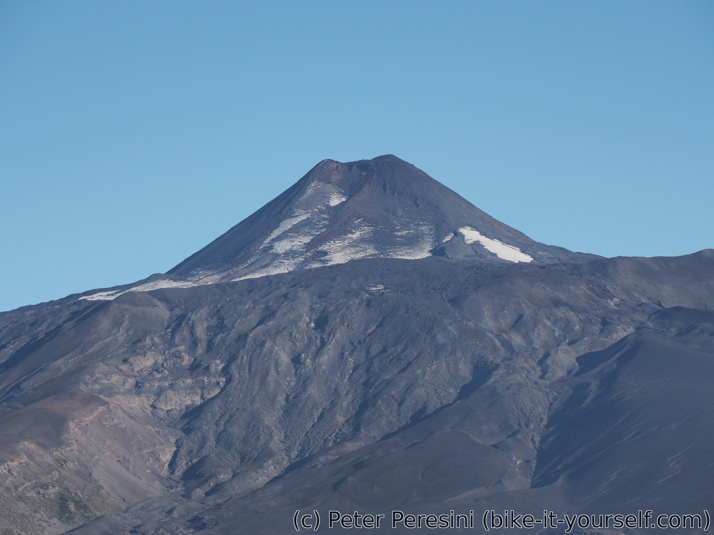
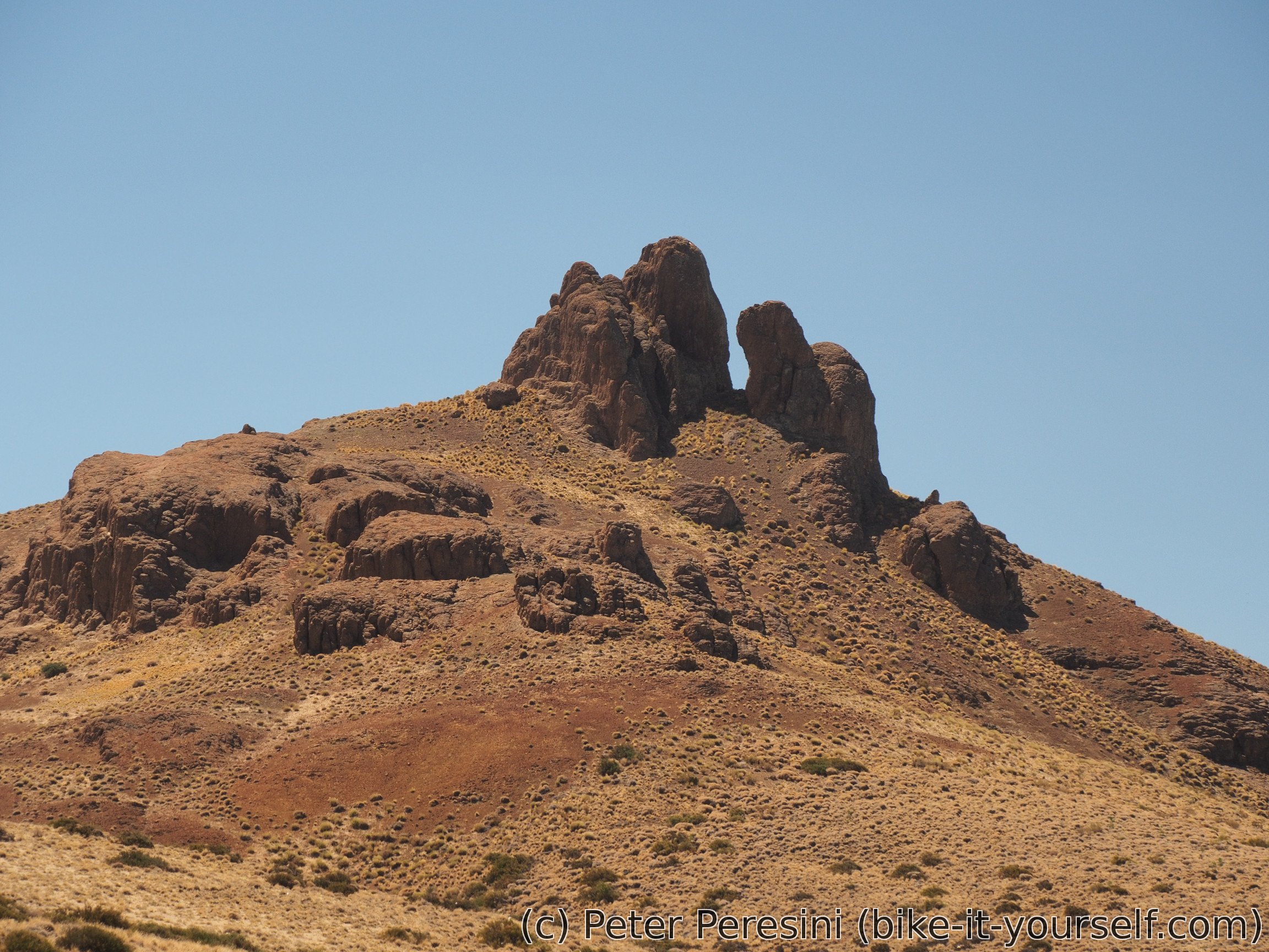
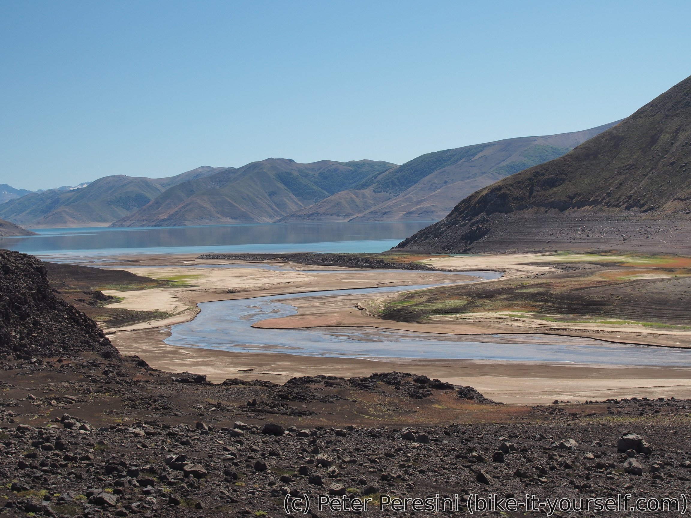
I am quickly clearing the immigration (and it looks like they knew I was camping out there) and then I am ready for an unwordly ride through Laguna del Laja. This national park around Volcán Antuco is just hard to describe -- kilometers of black sandy-like volcanic rock and a huge lagoon. Or maybe not so huge. There definitely isn't water around the places my GPS indicates. When I finally see the lagoon it is obvious that this year must have been super dry. The water is extremely low compared to tide marks. Still, the lagoon is quite big.
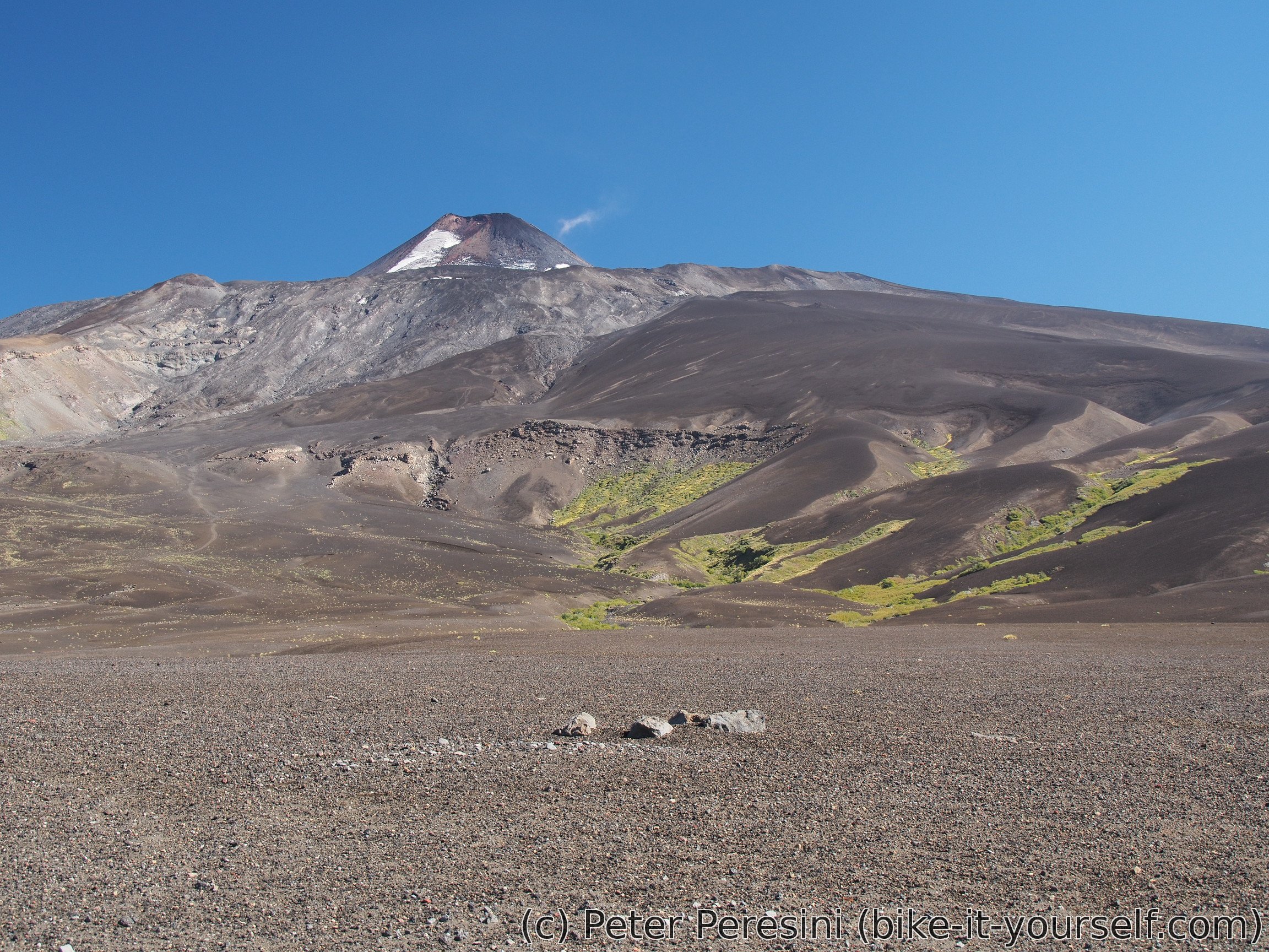
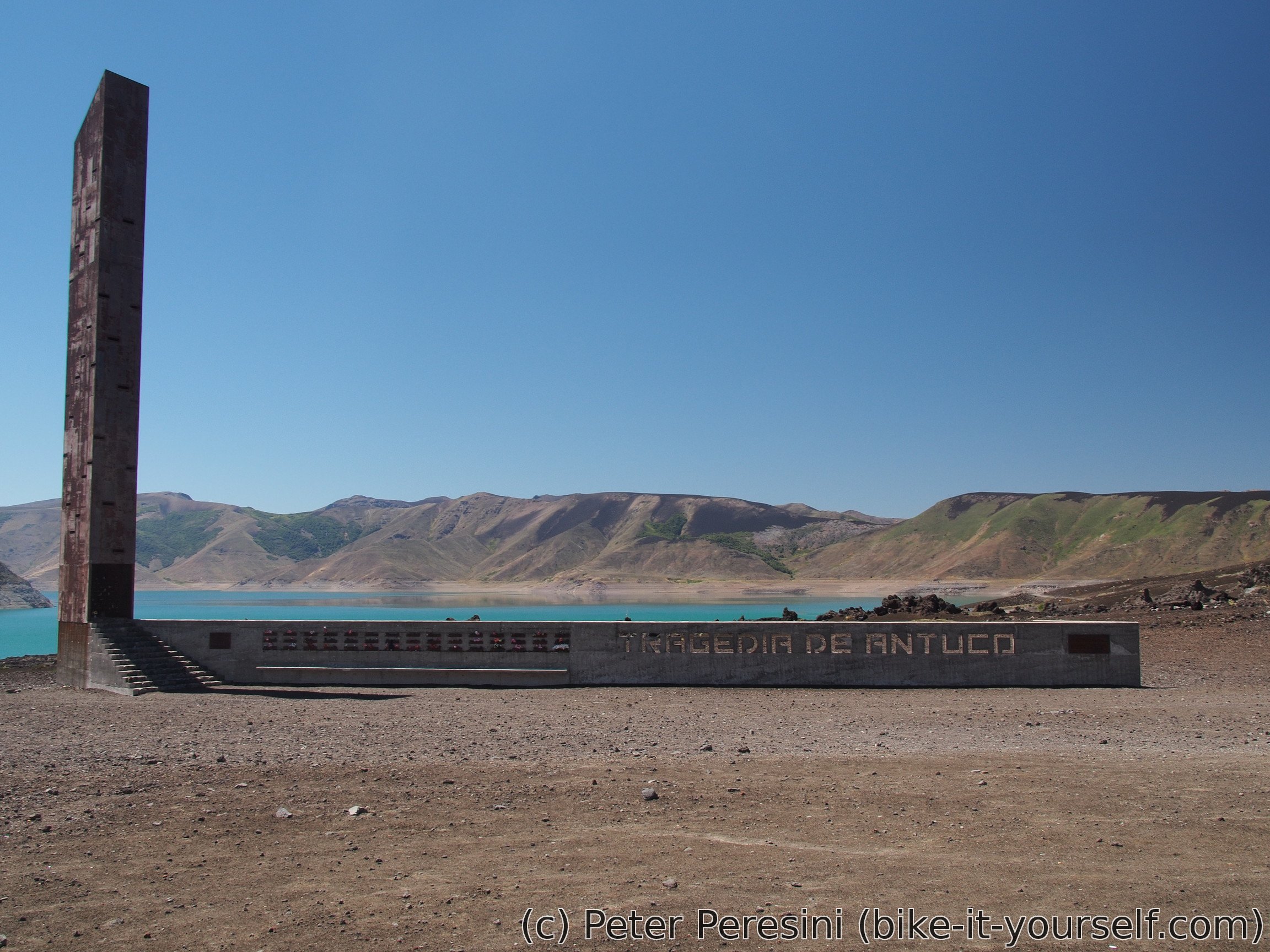
Then I am passing by a monument "Antuco Tragedy" devoted to around 40 Chilean soldiers who died here when they were taken on a routine training but unexpectedly a snowstorm arrived and deposited more than meter of snow. This is also my final goodbye to Laguna del Laja.
What follows can be described as steep, slow and crappy descent. The road is full of loose gravel and my hands are starting to hurt from all the braking. Which is why I am finally glad to see a paved road starting from Abanico. But first I need to restock my depleted food which I promptly do in what is apparently the only opened kiosco here (the whole village is just a few houses and several closed shops). There isn't even a mobile coverage here -- I am learning that it will be around 10 kilometers later.

I am asking also about directions to Polcura. While Polcura and Antuco seem to be close, there are on different sides of a river and my maps just cannot agree on whether there is a road there or not. Asking locals it seems that there isn't one (although, I think later in Polcura I saw Antuco sign) so I am forced to exit the paved road to Antuco and get 20 kilometers of ripio. Not the best one but definitely not very bad as well.
From Polcura, there is a nice paved road and I am quickly making last kilometers of this day. My plan is to finish in Chillan tomorrow and it is still quite far. Unfortunately, being down from mountains has certain disadvantages. The most pressing one is finding a spot for the night. There is always some village around or some fence or some other problem. In the end I am finding a sort-of-a-spot on a parallel trail in woods. While I am just few meters from the road, the spot is at least a bit covered and not likely to cause trouble.
March 6
In the morning I have a rather early "alarm clock". The road is much more busy than in the previous evening and the cars make a rather huge ruckus. Otherwise the weather is nice. As I want to get moving soon I am packing my tent wet -- the Sun wouldn't reach this place anyway because of trees.
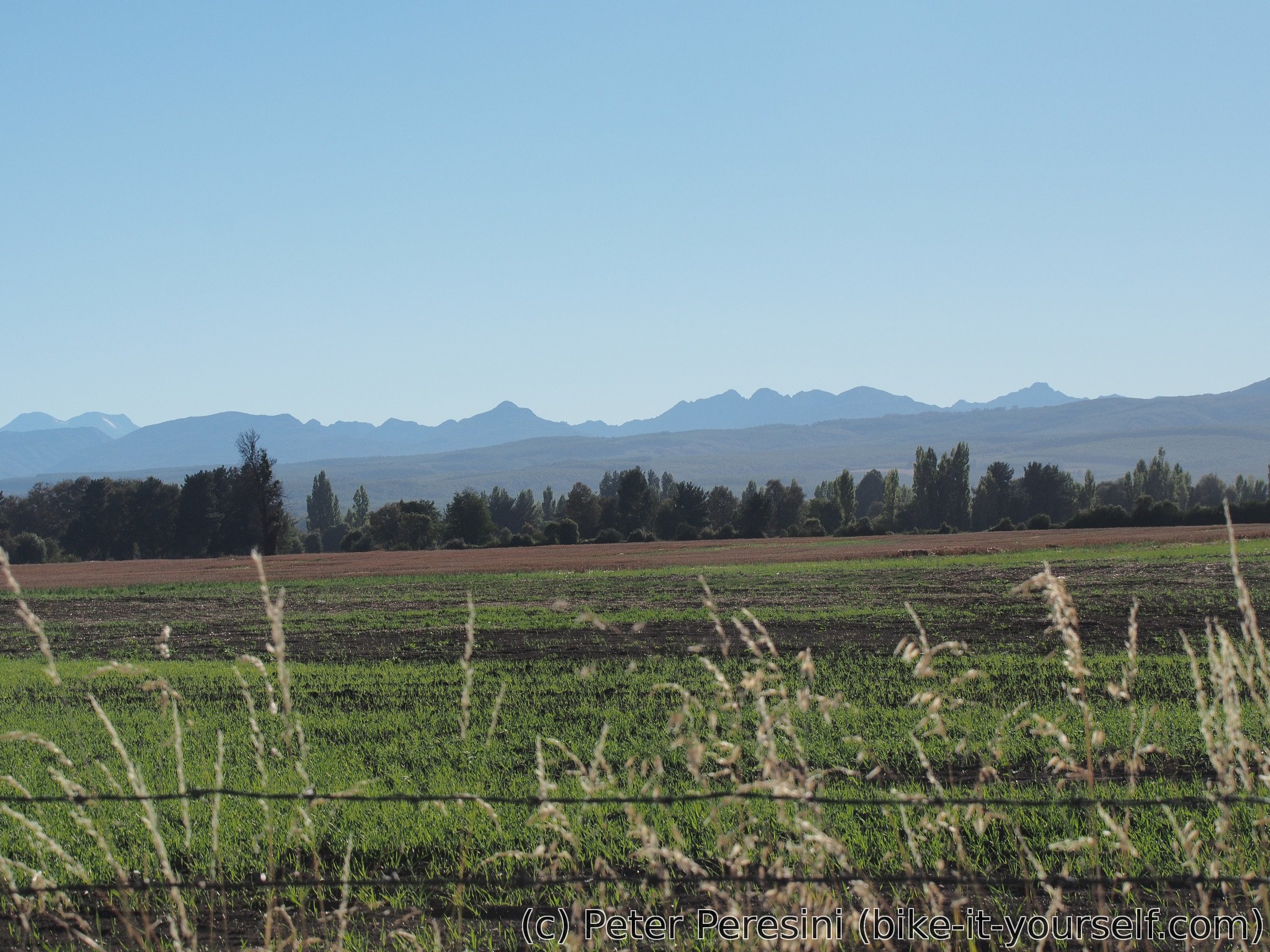
Today's road is almost completely flat. Yesterday's hills covered with forests are replaced by fields. On the east I can still see outlines of Andes -- they are pretty far but nice anyway. Otherwise it isn't too interesting around. And as I close on Chillán the traffic just gets heavier.
Chillán is a big city. It therefore takes me quite a while to figure out a tourist office. The guy there doesn't know anything I want to know but apparently he is quite good consulting with the Internet as in the end I am getting all the information I need.
Packed with a map of the city I am buying new gas canister for my stove. Unfortunately the only place which sells them (Chillán isn't too outdoor-oriented city) doesn't have a big one so I am getting only a small one. The only problem is that it doesn't fit my "storage" space on bike very well.
Next I want to buy a new bike lock. And when I ask at the bike shop if the brakes can handle a bit more, the owner just says he will replace them for free. And he does. An extremely nice guy, he even gives me some discount on the lock. So if you need to fix bike in Chillán, head to All Bikes.
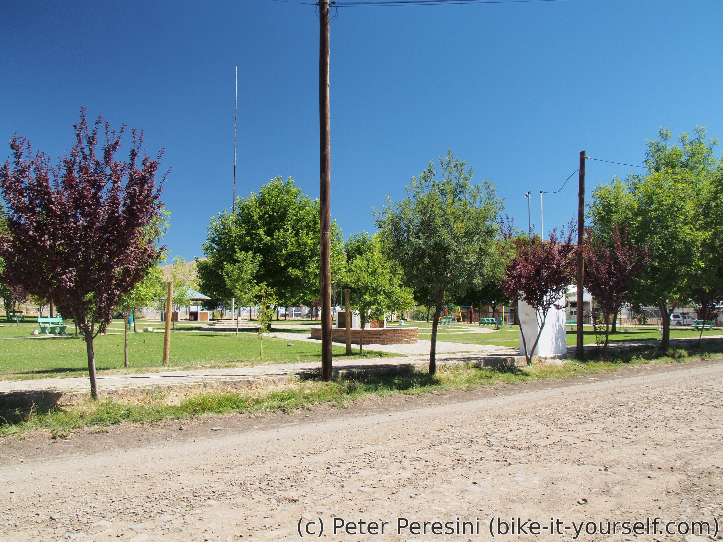
The final plan is to cycle another 7 kilometers to a camping. Which turns out to be a rather good spot -- it is inside a swimming pool complex and because the season is over, they just let me camp in a picknic area. I am getting a shower, a quick swim in the swimming pool and even buy a dinner. All in all a very good place. The only problem is a broken Internet but I just switch to my mobile data.
Notes for cyclists
- The pass is better to cycle from the Argentinian side which averages over 5-8% of grade on the last 600 elevation meters. Before that the gradient is generally negligible. The Chilean side features nontrivial amount of ≥10% grade.
- Get water in El Cholar for 20+ kilometers. Afterwards regular sources. No easy water access around the gendarmeria so get water there. Some water on the Argentinian side of the pass. No water on the descent until the flat section. A few streams there but I would advise filtering as I saw livestock. No water between carabineros and downhill from Laguna del Laja.
- The last chance to stock up food in Argentina is El Cholar, the first chance on the Chilean side is kiosco at Abanico but you can probably wait until Antuco.
| Distance | Elevation | Place | Comment |
|---|---|---|---|
| 0 km | 1250 | El Cholar | Small town. Basic supplies and water |
| 22 km | 990 | Road joins Rio Renileuvu | Water and good camping spots regularly from here |
| 24 km | 1020 | Turnoff to RP57 | Bad state of the road around here |
| 50 km | 1480 | Gendarmeria | No water access around here |
| 62 km | 1600 | Start of the final climb | |
| 70 km | 2060 | Top of the pass | |
| 76 km | 1580 | End of steep downhill. Sometimes a bit sandy track onwards | |
| 95 km | 1420 | Los Barros | Aduana Chile. No water from this point until the descent from Laguna del Laja |
| 113 km | 1420 | Antuco tragedy monument | |
| 116 km | 1420 | Start of a downhill | |
| 129 km | 830 | Turnoff to Abanico | 1 km to the village. Basic supplies |
| ~146km | 550 | Antuco | Bigger town |
Route
Download simplified GPX of a route here
Stats by activity:
| Activity | Distance (km) |
Ascent (km) |
Pedal rotations (thousands) |
|---|---|---|---|
| bike | 303 | 2.6 | 66 |
| Date | Distance (km) |
Ascent (km) |
Avg. temp (moving, C) |
|---|---|---|---|
| March 3, 2017 | 63.6 | 0.72 | 23.1 |
| March 4, 2017 | 56.8 | 1.22 | 20.5 |
| March 5, 2017 | 79.7 | 0.25 | 28.4 |
| March 6, 2017 | 102.6 | 0.36 | 25.3 |
Elevation data
The next table is only for cycling activity.
| Grade(%) | Ascent (km) | Descent(km) |
|---|---|---|
| < 2 | 151.6 | |
| < 4 | 17.0 | 32.2 |
| < 6 | 9.4 | 9.6 |
| < 8 | 5.1 | 7.4 |
| < 10 | 4.1 | 3.4 |
| ≥ 10 | 2.8 | 6.4 |
<a href=http://gcialisk.com/>order cialis online
<a href=https://clomidset.com>clomid next day delivery
<a href=http://gcialisk.com/>cialis for sale online</a>
<a href=https://cialiswwshop.com/>cialis online cheap</a>